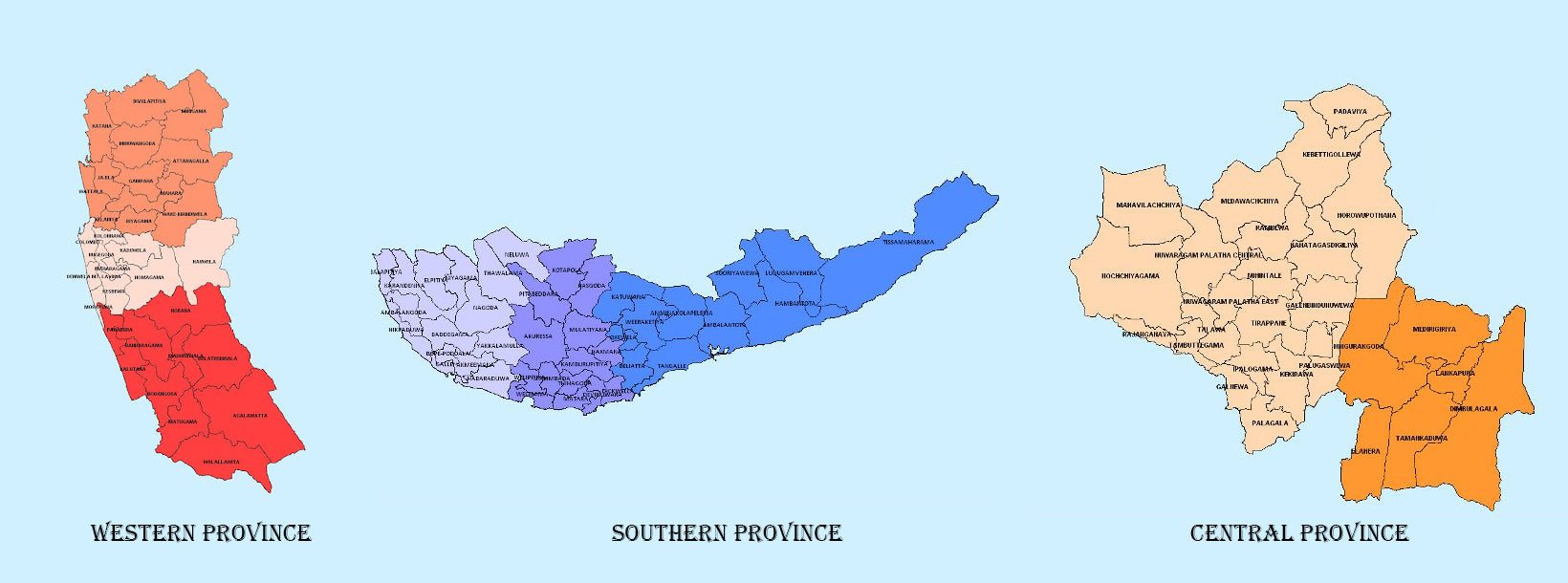
Eastern Province

Another province of Sri Lanka mostly known for its golden beaches and the natural harbour, the Eastern Province which is 9,996 km2 in extent consists of three administrative districts namely Trincomalee, Batticaloa and Ampara. Between 1988 and 2006 the province was temporarily merged with the Northern Province to form the North-East Province. However, the North-East Province North-East Province was formally de-merged into the Northern and Eastern provinces on 1? January 2007 according to a ruling of the Supreme Court.

The province is surrounded by the Northern Province on the north, the Bay of Bengal on the east, the Southern Province on the south, and the Uva, Central and North Central provinces on the west. The province’s coast is dominated by lagoons, the largest being Batticaloa Lagoon, Kokkilai lagoon, Upaar Lagoon and Ullackalie Lagoon.

Trincomalee is the capital of the Eastern Province lying on the east coast of the island, about 113 miles south of Jaffna. Trincomalee is world famous for the natural deep water harbour. The city is built on a peninsula, which divides the inner and outer harbours. The city is home to the famous ancient Koneswaram temple alluded to in its historic Tamil name Thirukonamalai from which its anglicized name is derived, and has been a sea port that has played a major role in the maritime and international trading history of Sri Lanka. It is referred to as Gokanna in Pali or Gokarna in Sanskrit.

The Bay of Trincomalee harbour is renowned for its large size and security; unlike every other in the Indian Sea, it is accessible to all types of craft in all weathers. The beaches are used for urfing, scuba diving, fishing and whale watching. The city lso has the largest Dutch fort in Sri Lanka. It is home to major Sri Lankan naval bases and a Sri Lankan Air Force base. The town is situated on a hill at the end of a natural land formation that resembles an arc; the temple is built on Swami Rock, historically referred to as Kona-ma-Malai, a cliff on the peninsula that drops 400 feet directly into the sea.

Trincomalee, a natural deep-water harbour, has attracted seafarers like Marco Polo, Ptolemy and sea traders from China and East Asia since ancient times. Trinco, as it is commonly called, has been a sea port since the days of the ancient Sri Lankan kings. The earliest known reference to the port of Gokanna is found in the Mahavamsa stating that in 5th century BC, when King Vijaya who having failed to convince his brother to come to Sri Lanka as his successor, got down his youngest son Panduvasdeva, who landed at Gokanna and was subsequently enthroned at Upatissagama.

Trincomalee has many places of worship. Among them is the Konesvaram shrine which was demolished in 1622 by the Portuguese (who called it the Temple of a Thousand Columns), and who fortified the heights with the materials derived from its destruction. Some of the artefacts from the demolished temple were kept in the Lisbon Museum including the stone inscriptions.

The entrance to the roadway leading to Koneswaram is actually the entrance to what used to be Fort Fredrick. The fort was built in 1623 by the Portuguese and captured in 1639 by the Dutch. It then went through a phase of dismantling and reconstruction and was attacked and captured by the French in 1672.

Trincomalee strategic importance has shaped

  • La province de l'Ouest, la plus densément peuplée du Sri Lanka avec ses 3 593 km², abrite la capitale législative du pays, Sri Jayewardenepura, ainsi que Colombo, son centre économique.
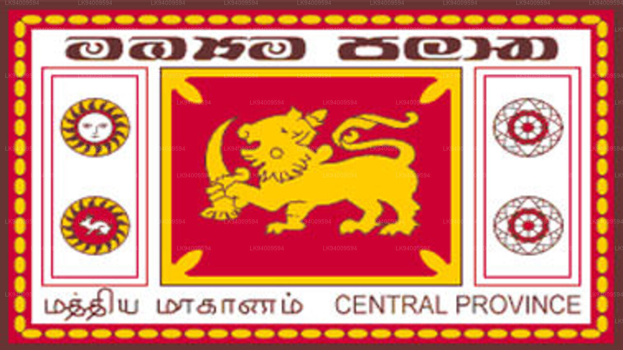
    Province de l'Ouest 
  • La province centrale est située dans les collines centrales du Sri Lanka et comprend trois districts administratifs : Kandy, Matale et Nuwara Eliya. Sa superficie est de 5 575 km², soit 8,6 % de la superficie totale du Sri Lanka.

    Province du Centre 
  • La province du Sud du Sri Lanka est une petite région géographique composée de trois districts : Galle, Matara et Hambantota. L’agriculture et la pêche constituent les principales sources de revenus pour la grande majorité des habitants de cette région.
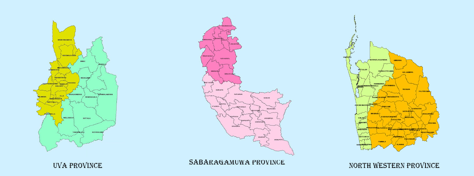
    Province du Sud 
  • La province d'Uva comprend deux districts : Badulla et Moneragala, et sa capitale est Badulla. Uva est bordée par les provinces de l'Est, du Sud et du Centre.

    Province d'Uva 
  • Sabaragamuwa est une autre province du Sri Lanka, située dans la région centre-sud de l'île et composée de deux districts administratifs : Ratnapura et Kegalle.

    Province de Sabaragamuwa 
  • La province du Nord-Ouest comprend deux districts administratifs : Kurunegala et Puttalam. Sa capitale, Kurunegala, compte 28 571 habitants. La province est réputée pour ses cocoteraies.

    Province du Nord-Ouest 
  • La province du Centre-Nord, la plus grande du Sri Lanka, située dans la zone aride et d'une superficie de 10 714 km², comprend deux districts administratifs : Anuradhapura et Polonnaruwa.

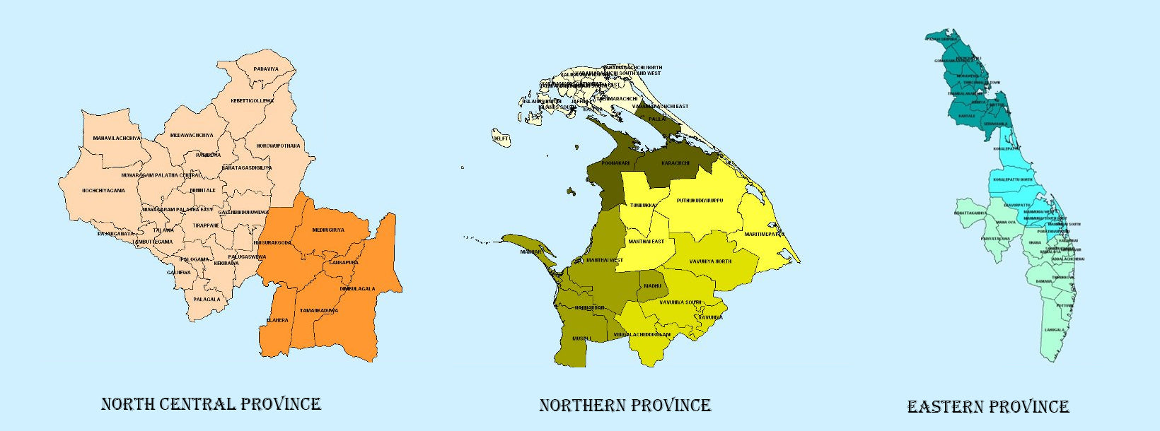
    Province du Centre-Nord 
  • La province du Nord est située au nord du Sri Lanka, à seulement 35 km de l'Inde. Elle couvre une superficie de 8 884 km². Elle est bordée par le golfe de Mannar et la baie de Palk à l'ouest, le détroit de Palk au nord-ouest, le golfe du Bengale au nord et à l'est, et les provinces de l'Est, du Centre-Nord et du Nord-Ouest au sud.

    Province du Nord 
  • Une autre province du Sri Lanka surtout connue pour ses plages dorées et son port naturel, la province orientale, d'une superficie de 9 996 km², se compose de trois districts administratifs : Trincomalee, Batticaloa et Ampara.

    Province de l'Est