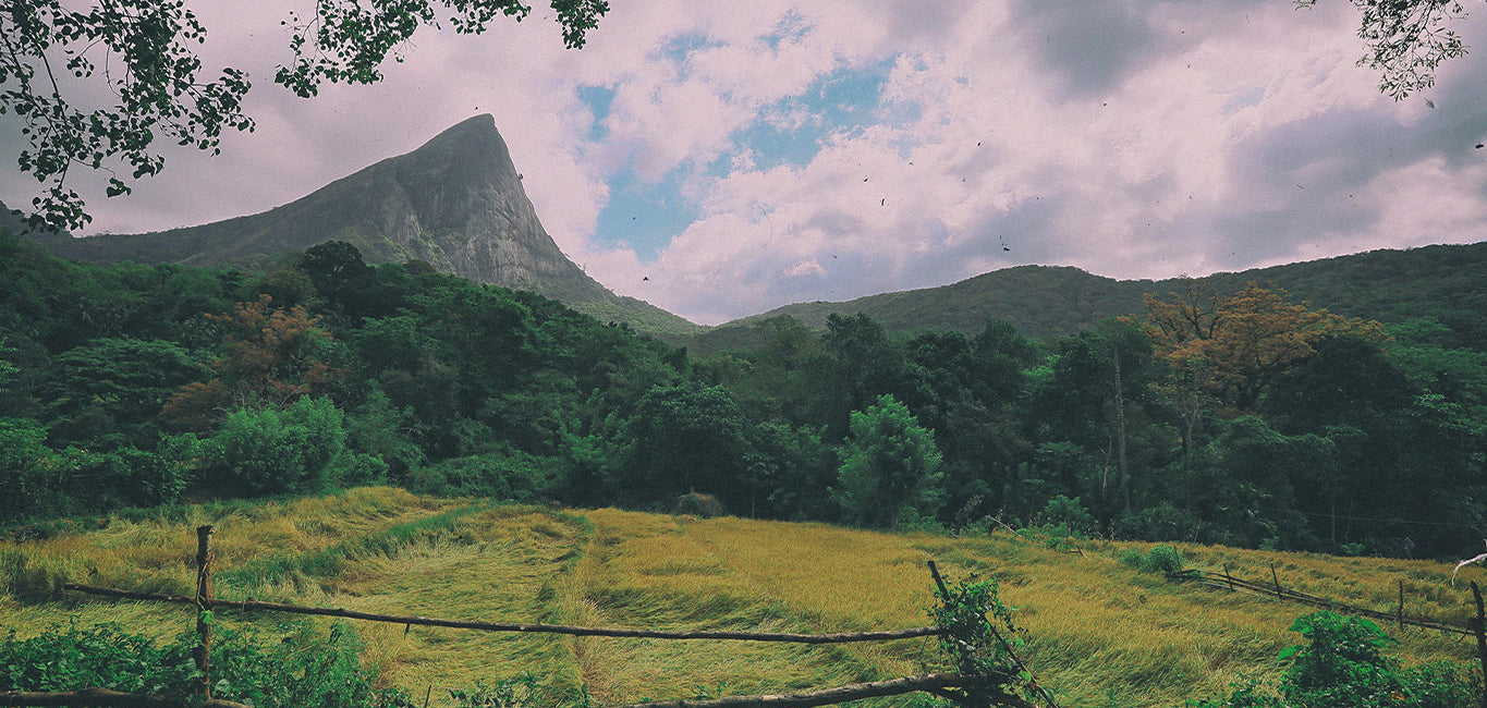
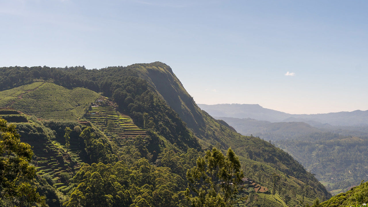
Kirigalpotta


Kirigalpoththa mountain in Sri Lanka – The Second Tallest Mountain on the Island. Reaching upto 2388m (7835 feet) above mean sea level, Kirigalpoththa Mountain in Sri Lanka looms in the district of Nuwara Eliya casting its shadow over the main city.The name Kirigalpoththa literally translates to Milk (Tree) Bark Rock (Kiri – milk, gal – rock and poththa- tree bark), possibly because the mountain has many tall trees with mottled white bark. Reached by a nature trail in the Horton Plains National Park; this mountain is the second tallest of the island paradise Sri Lanka, and the tallest of the mountains in the island whose summits are are open to access to the general public.
Kirigalpoththa mountain in Sri Lanka: Some Things to Know
- Location : Nuwara Eliya District
- Nearest Village : Pattipola
- Nearest Town : Nanuoya
- Trail to climb Kirigalpoththa is located at : Horton Plains National Park
- Trail Head : Horton Plains Visitor Centre
- Trail End : Kirigalpoththa Summit
- Length of Trail : 5.6 km
- Elevation Gain : 252m (Elevation at Trail Head: 2139m – Elevation at Trail End: 2392m)
- Climb Difficulty Level : Moderate
- Climb Time : 3 – 4 hours
- Weather Conditions : The Nuwara Eliya area is usually cold and rainy in general. But it is more so in the monsoon months. The dryest months comparatively speaking are February to April and July to September. Strong winds and cold weather are almost guaranteed higher up on the trail.
- Permit Required : Yes. Can be obtained at the entrance of Hortons Plains National Park
- Things to take on your climb: Water bottle, light sweater, raincoat, bug spray and salt for leeches, first aid equipment such as plaster, disinfectant, and bandages. (Some strong climbing rope may also be advantageous)
- Clothes to be worn : Thick clothes that will protect your skin from brambles and such and tall skidproof boots to avoid slipping in mud.
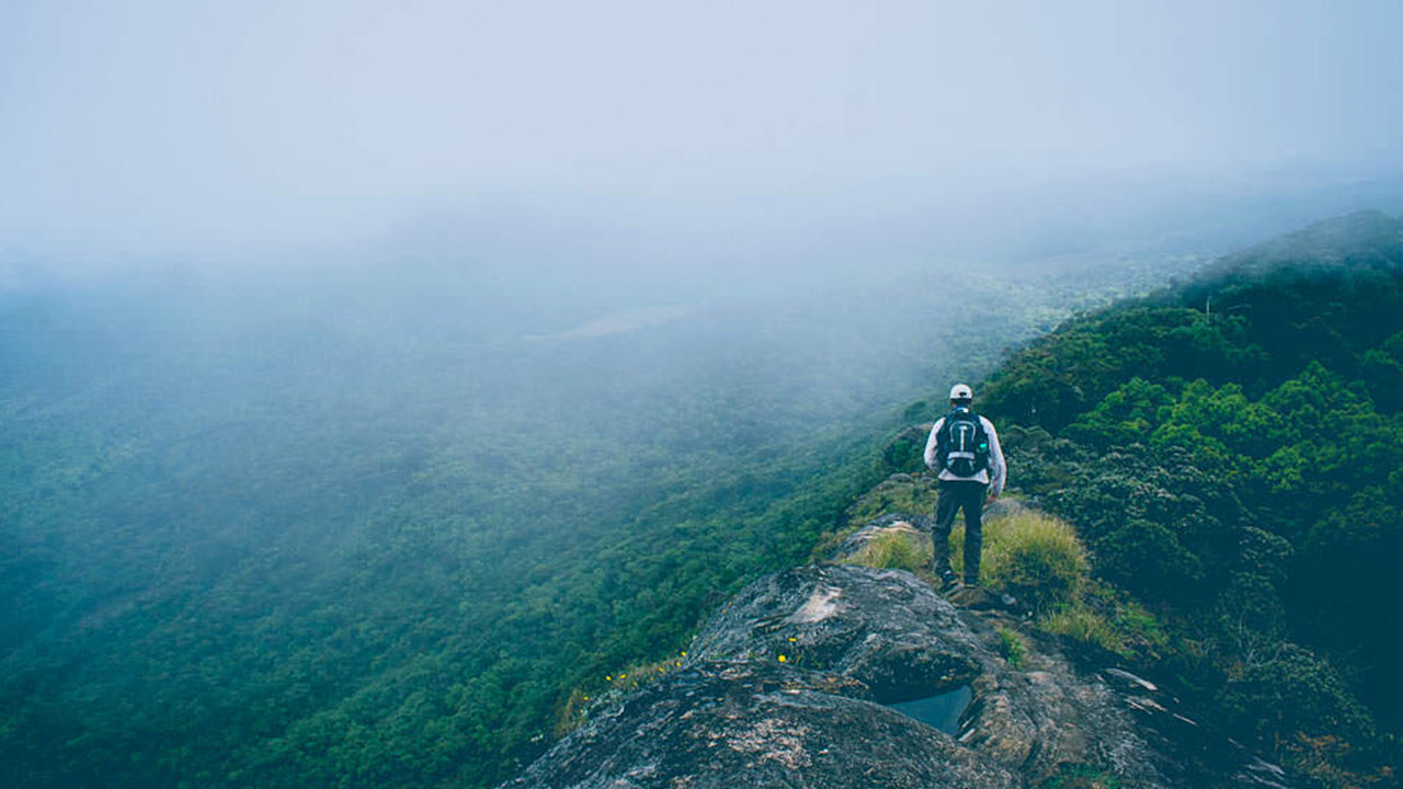
- Other tips: Do not stray from the established trail as the plain is marshy. Do not attempt as a solo climber.


-
 키리가르포타
스리랑카 누와라엘리야 지역에 위치한 키리갈포타 산은 해발 2,388m(7,835피트)에 달하며, 도시 전체에 웅장한 그림자를 드리우고 있습니다. 이 산은 스리랑카에서 두 번째로 높은 산이자, 섬나라 내에서는 가장 높은 산입니다.
-
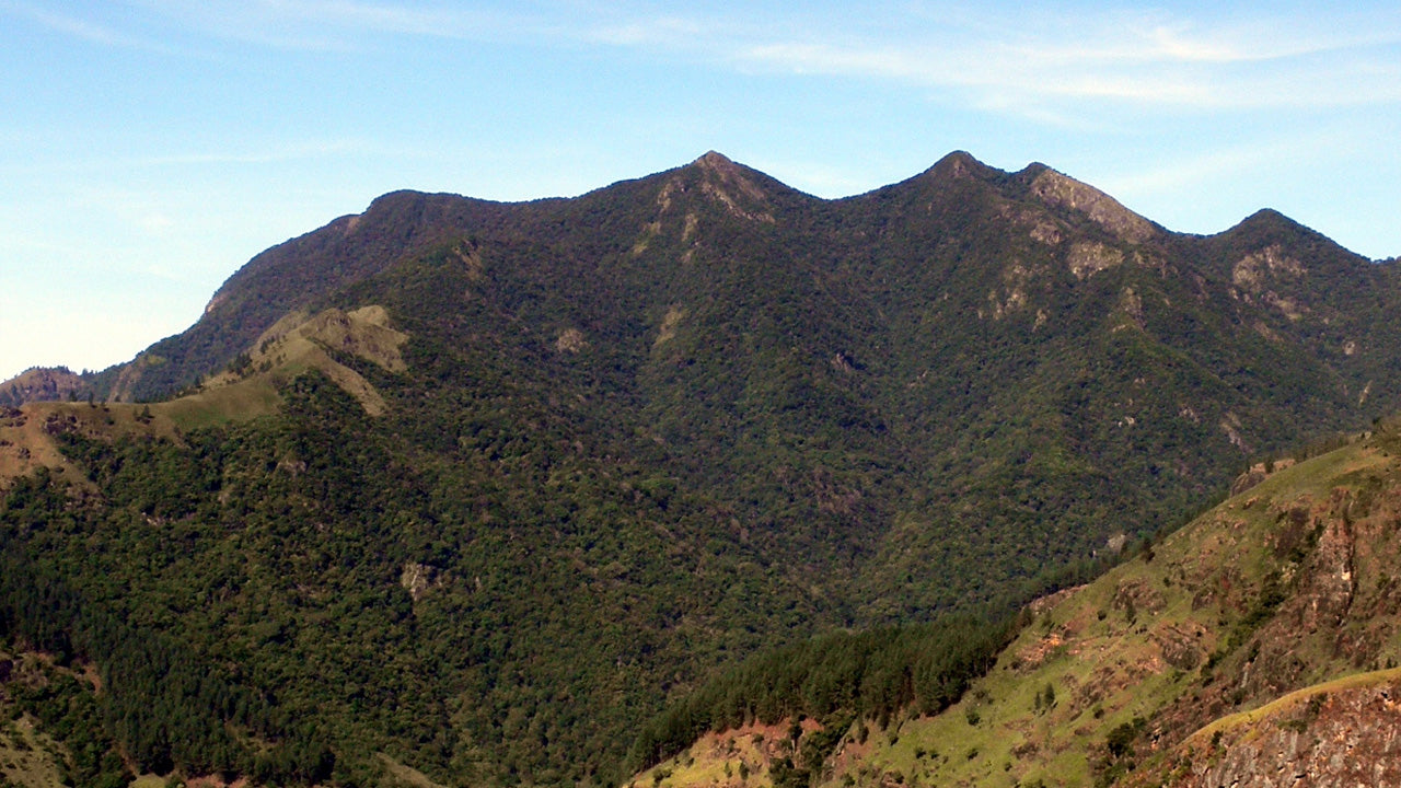
 토투폴라 칸다
토타폴라칸다는 스리랑카에서 세 번째로 높은 산으로, 누와라엘리야 지구에 위치하며 해발 2,357m입니다. 이 산은 호튼 플레인스 국립공원 내에 자리하고 있습니다. 정상까지 이어지는 약 2km 길이의 등산로는 호튼 플레인스 국립공원의 파티폴라 입구에서 몇 미터 떨어진 곳에서 시작됩니다.
-
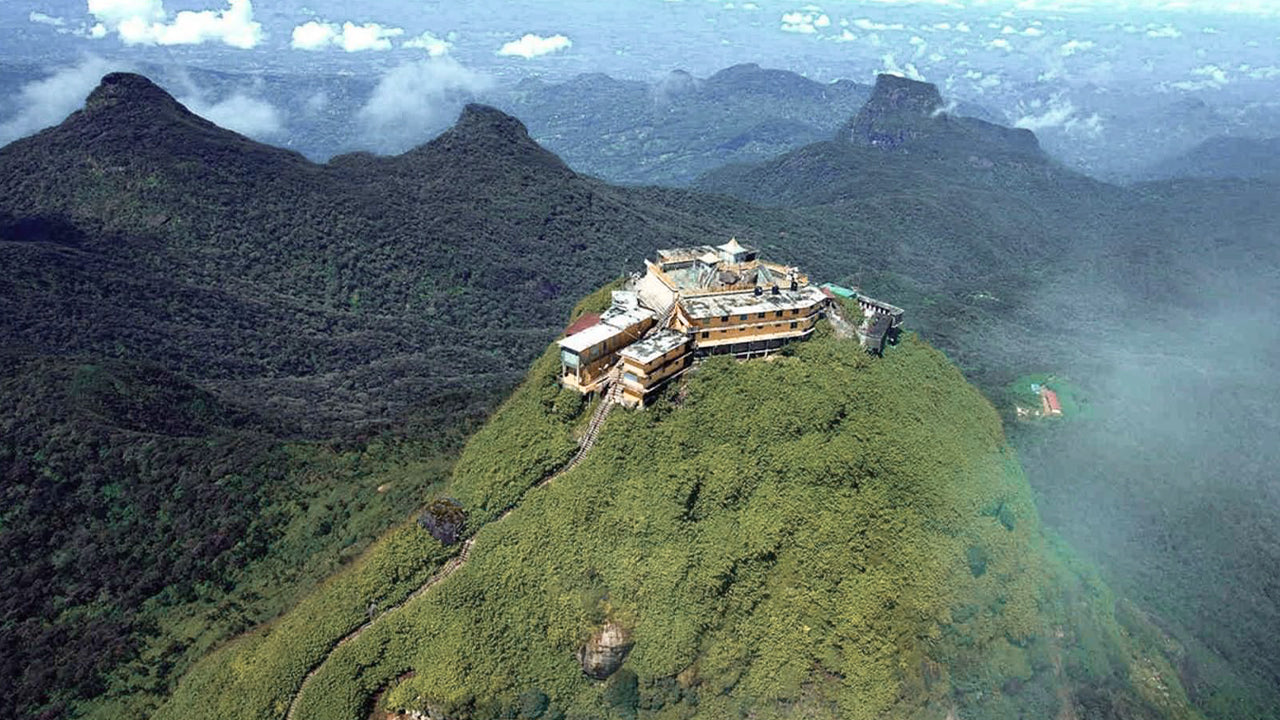 아담스 피크(스리 파다 산)
스리랑카에서 가장 유명한 지형은 라트나푸라 지역에 위치한 아담스 피크입니다. 중앙 산맥의 가장자리에 자리 잡고 있으며, 주변 산맥은 피크의 황야(Wilderness of the Peak)라고 불립니다. 높이는 약 7,500피트(약 2,287m)로, 스리랑카에서 두 번째로 높은 봉우리입니다.
-
 하크갈라 봉우리
하크갈라 봉우리는 스리랑카 중부 고원 지대에 위치한 하크갈라 엄격 자연 보호 구역 내에 자리하고 있습니다. 누와라엘리야 마을 근처에 있으며, 아름다운 경관과 서늘한 기후로 유명한 중부 고원 지대에 속합니다.
-
 곰몰리야
곰몰리야곰몰리야 봉우리는 스리랑카 중부에 위치한 유네스코 세계문화유산인 너클스 산맥의 일부로, 풍부한 생물 다양성과 아름다운 경관으로 유명합니다. 이 봉우리는 스리랑카 중부 고원지대인 캔디 지구에 자리하고 있습니다.
-
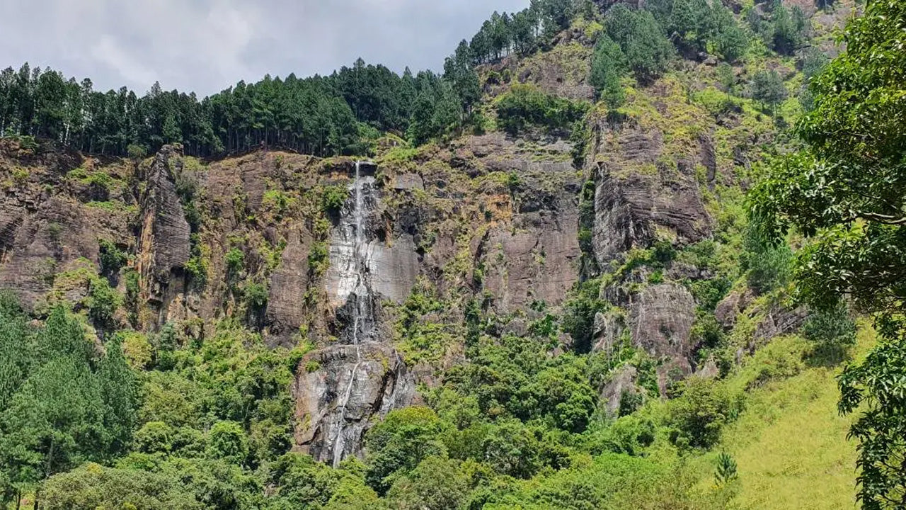 밤바라칸다 봉우리
밤바라칸다 봉우리는 스리랑카 우바 주 바둘라 지구에 위치해 있습니다. 중부 고원 지대에 속하며 스리랑카에서 가장 높은 폭포인 유명한 밤바라칸다 폭포 근처에 자리하고 있습니다. 이 지역은 울창한 녹음, 시원한 기후, 그리고 아름다운 자연 경관으로 유명합니다.
-
 리버스톤 피크
스리랑카의 리버톤 봉우리는 마탈레 마을에서 약 30km 떨어진 마탈레-기란두루코테 도로를 따라가면 도착할 수 있습니다. 구불구불하고 날카로운 헤어핀 커브가 있는 이 비밀스러운 도로는 주변 시골 풍경의 절경을 선사하여 '미니 월드 엔드'라는 별명을 얻었습니다.