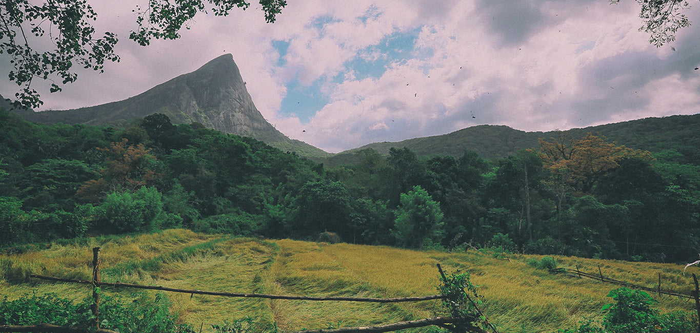
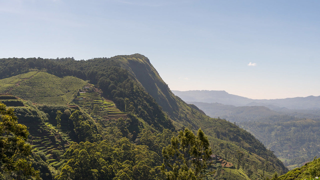
Riverston Peak


The Riverston Peak in Sri Lanka can be reached by travelling, about 30km away from the Matale town, down the Matale – Girandurukotte Road. This secretive windy road, with its sharp hairpin turns, offers some of the best views to the surrounding countryside; to the extent that it is called the Mini World’s End. Though it is very popular among locals, the area is comparatively unknown amongst mainstream tourists. Therefore the area offers up the natural beauty of Sri Lanka; fresh, green and unpolluted by vendors, tourists, garbage and unsightly buildings.
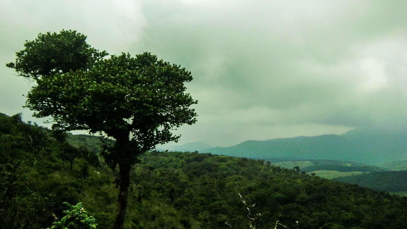
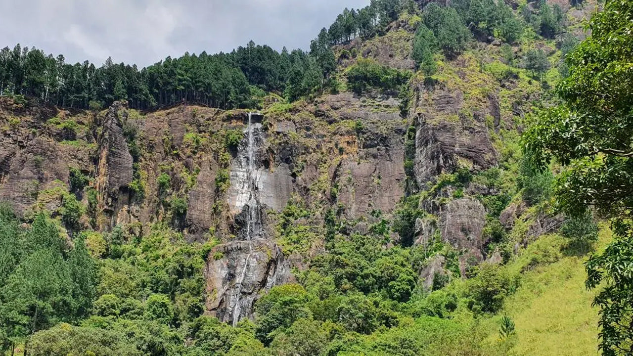
With climates very similar to the Hortons Plains, where the World’s End is located, Riverston trek also offers two graceful waterfalls Sera Ella and Bambarakiri Ella. Sera Ella also has some conveniently located rock seats from which a visitor can enjoy the refreshing cold spray of misty droplets. The nearby freshwater river, Thelgamu Oya, can be used for quick cooling dip or even just a refreshing splash before or after a long arduous trek.
The trek is about two and a half kilometres one way, and shouldn’t take more than a healthy hour or two at most. It runs a section known as the Pittawala Paththana and leads to the Riverston Peak. The countryside along the trek has views of the terraced paddy fields, unique to some mountainous regions around the world, and that of the beautiful green Central Highlands.
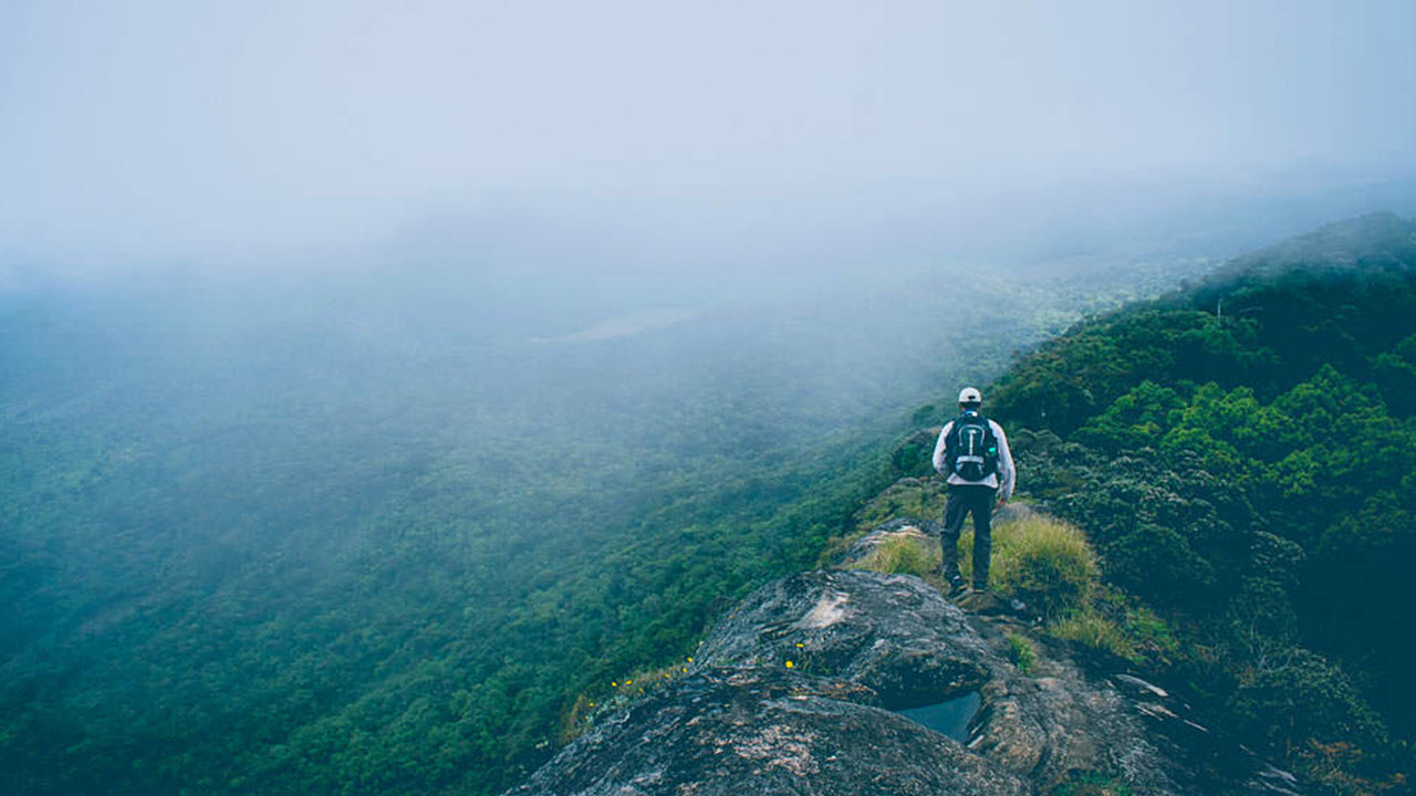
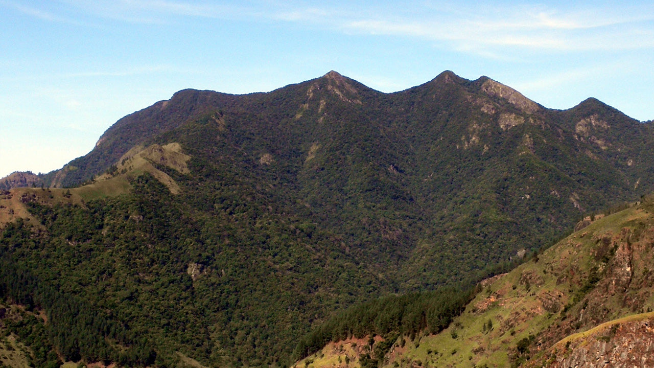
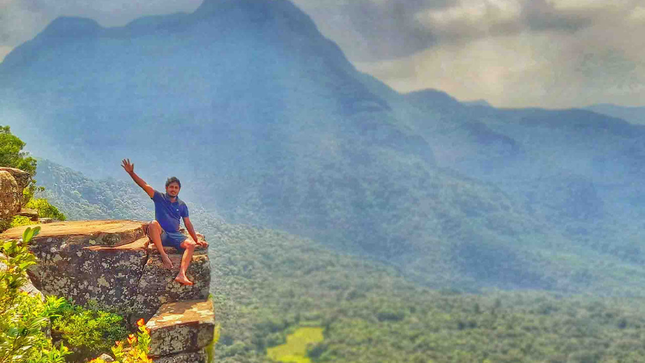
The Riverston Peak features a sheer 300m drop to stunning misty views of the nearby Knuckles Mountain Range and Thelgamu river valley. The peak, with its peaceful and beautiful surroundings, is also a great place to meditate and relax on your holiday to Sri Lanka. The Riverston trek is a great opportunity for nature lovers and photographers who want a few jaw-dropping clicks.
-
 키리가르포타
스리랑카 누와라엘리야 지역에 위치한 키리갈포타 산은 해발 2,388m(7,835피트)에 달하며, 도시 전체에 웅장한 그림자를 드리우고 있습니다. 이 산은 스리랑카에서 두 번째로 높은 산이자, 섬나라 내에서는 가장 높은 산입니다.
-
 토투폴라 칸다
토타폴라칸다는 스리랑카에서 세 번째로 높은 산으로, 누와라엘리야 지구에 위치하며 해발 2,357m입니다. 이 산은 호튼 플레인스 국립공원 내에 자리하고 있습니다. 정상까지 이어지는 약 2km 길이의 등산로는 호튼 플레인스 국립공원의 파티폴라 입구에서 몇 미터 떨어진 곳에서 시작됩니다.
-
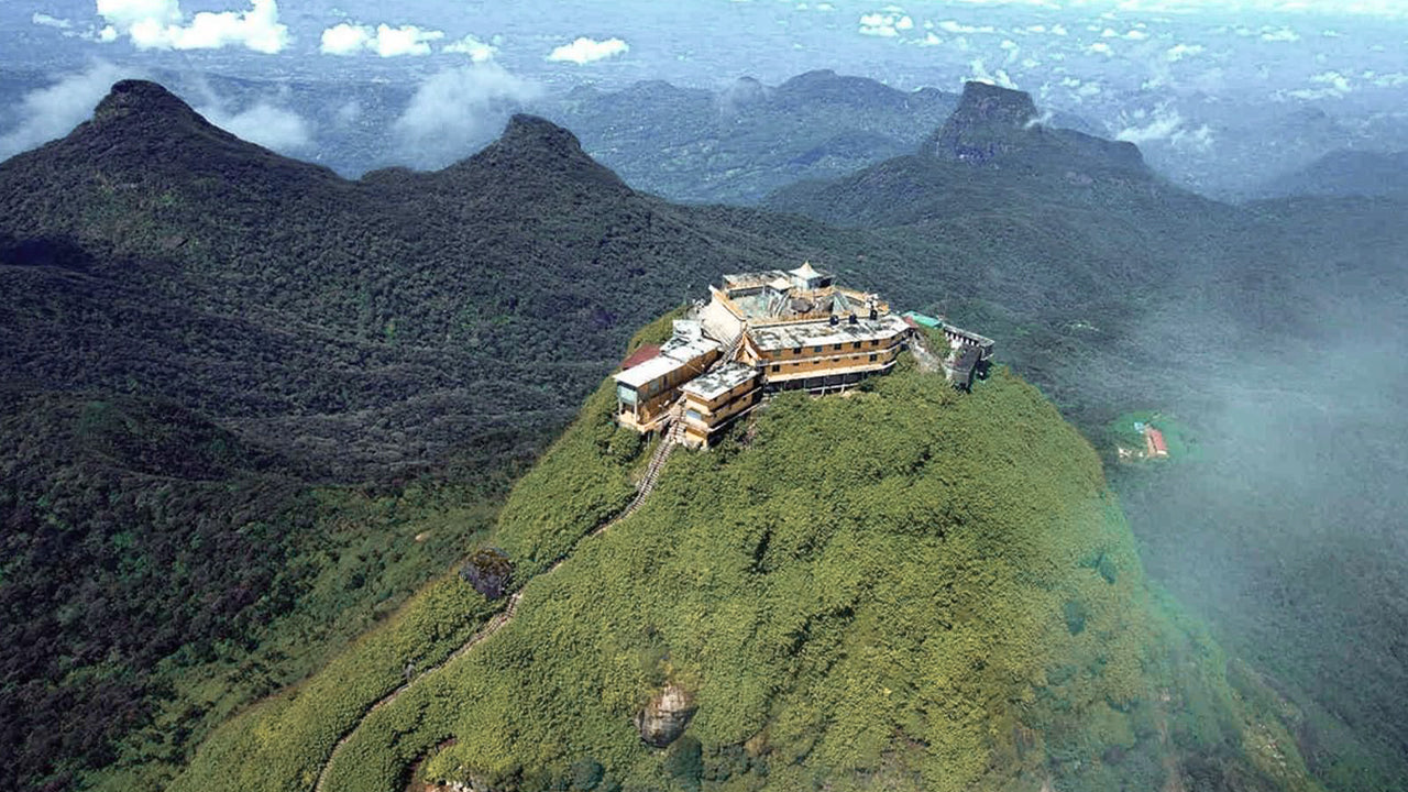 아담스 피크(스리 파다 산)
스리랑카에서 가장 유명한 지형은 라트나푸라 지역에 위치한 아담스 피크입니다. 중앙 산맥의 가장자리에 자리 잡고 있으며, 주변 산맥은 피크의 황야(Wilderness of the Peak)라고 불립니다. 높이는 약 7,500피트(약 2,287m)로, 스리랑카에서 두 번째로 높은 봉우리입니다.
-
 하크갈라 봉우리
하크갈라 봉우리는 스리랑카 중부 고원 지대에 위치한 하크갈라 엄격 자연 보호 구역 내에 자리하고 있습니다. 누와라엘리야 마을 근처에 있으며, 아름다운 경관과 서늘한 기후로 유명한 중부 고원 지대에 속합니다.
-
 곰몰리야
곰몰리야곰몰리야 봉우리는 스리랑카 중부에 위치한 유네스코 세계문화유산인 너클스 산맥의 일부로, 풍부한 생물 다양성과 아름다운 경관으로 유명합니다. 이 봉우리는 스리랑카 중부 고원지대인 캔디 지구에 자리하고 있습니다.
-
 밤바라칸다 봉우리
밤바라칸다 봉우리는 스리랑카 우바 주 바둘라 지구에 위치해 있습니다. 중부 고원 지대에 속하며 스리랑카에서 가장 높은 폭포인 유명한 밤바라칸다 폭포 근처에 자리하고 있습니다. 이 지역은 울창한 녹음, 시원한 기후, 그리고 아름다운 자연 경관으로 유명합니다.
-
 리버스톤 피크
스리랑카의 리버톤 봉우리는 마탈레 마을에서 약 30km 떨어진 마탈레-기란두루코테 도로를 따라가면 도착할 수 있습니다. 구불구불하고 날카로운 헤어핀 커브가 있는 이 비밀스러운 도로는 주변 시골 풍경의 절경을 선사하여 '미니 월드 엔드'라는 별명을 얻었습니다.