Bambarakanda Peak
Location:
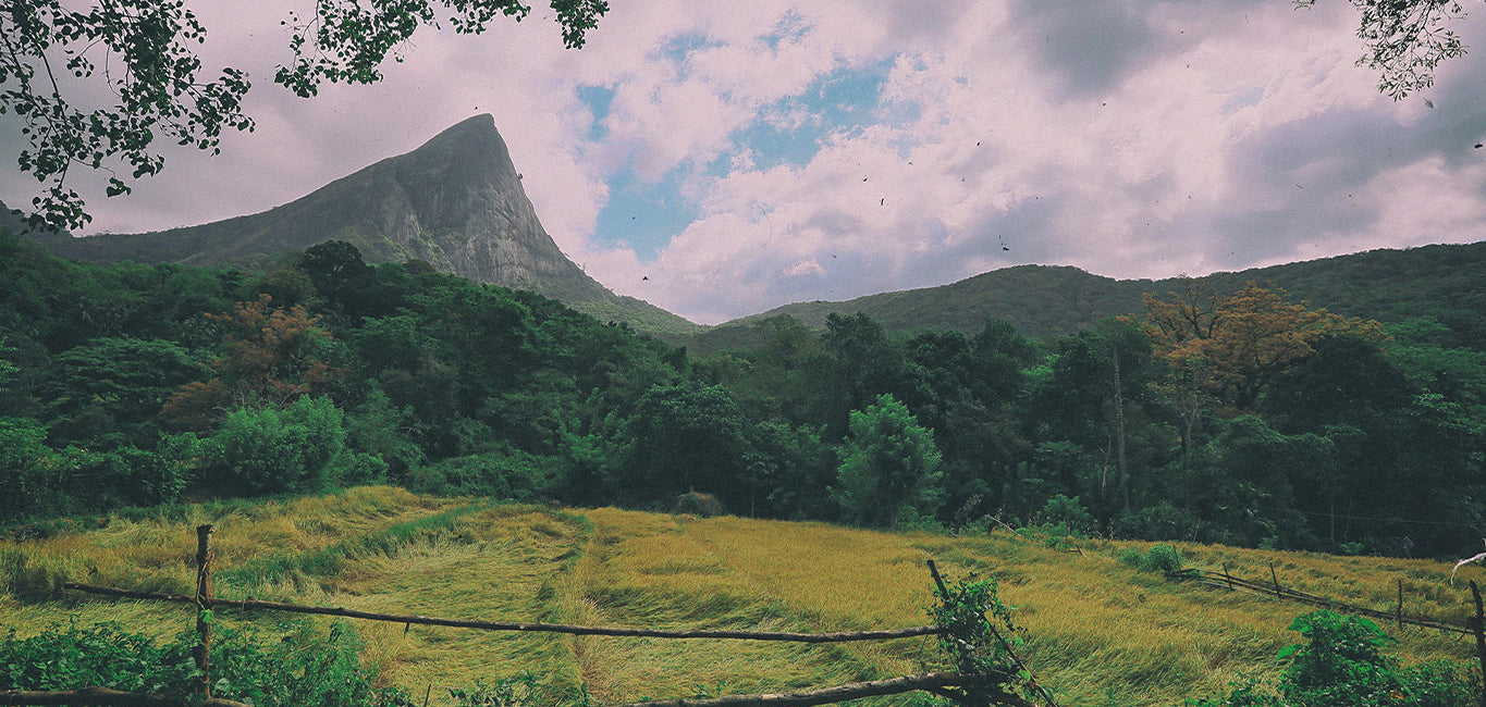
Bambarakanda Peak is located in the Badulla District of Sri Lanka, within the Uva Province. It is part of the central highlands and is situated near the famous Bambarakanda Falls, the tallest waterfall in Sri Lanka. The area is renowned for its lush greenery, cool climate, and stunning natural beauty.
Height:
Bambarakanda Peak stands at an elevation of approximately 2,259 meters (7,411 feet) above sea level. It is one of the higher peaks in Sri Lanka, offering breathtaking views of the surrounding landscape.
Notable Features:
1. Geographical Significance:
Bambarakanda Peak is part of the Bambarakanda Mountain Range, which is known for its steep terrain and scenic beauty. The peak is located near the Bambarakanda Falls, which cascades from a height of 220 meters (722 feet) and is one of Sri Lanka’s most famous waterfalls. The region is rich in natural resources, with several rivers originating from the mountains and flowing through the valleys below.
2. Flora and Fauna:
The surrounding area of Bambarakanda Peak is home to a variety of flora and fauna. The forests are lush and green, with several species of trees, shrubs, and plants, some of which are endemic to Sri Lanka. Wildlife in the region includes several species of birds, monkeys, wild boars, and deer, making it a popular destination for nature enthusiasts and wildlife photographers.
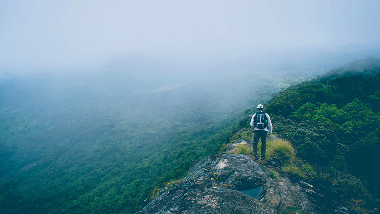
3. Trekking and Hiking:
The hike to Bambarakanda Peak is moderately challenging, involving a trek through dense forests and steep terrain. Trekkers can experience the natural beauty of the area while enjoying the cool mountain air and stunning vistas. There are several trekking routes that take visitors through the surrounding mountains and valleys, offering a chance to witness the unique flora and fauna of the region.
4. Scenic Views:
From the summit of Bambarakanda Peak, visitors are rewarded with panoramic views of the central highlands of Sri Lanka. The surrounding mountains, valleys, and tea plantations provide a picturesque backdrop. The view from the peak also includes distant views of other notable peaks in the region, including Hakgala and Sri Pada (Adam’s Peak).
5. Climate:
Bambarakanda Peak is situated in a cool climate zone, with temperatures that can drop significantly, especially during the night. The weather is typically misty and rainy, particularly during the monsoon season. The region's cool climate contributes to its lush vegetation and makes it a popular destination for those looking to escape the heat of the lowlands.
6. Bambarakanda Falls:
The most famous feature near Bambarakanda Peak is the Bambarakanda Falls. The waterfall is one of the tallest in Sri Lanka and attracts many visitors. It is located about 5 km from the peak and is a popular tourist attraction in the area. The falls are especially beautiful during the rainy season when the water flow is at its peak.
7. Access:
The peak can be accessed through several routes from nearby towns, including Bambarakanda Village. The trail leading to the peak is well-known among trekkers and nature lovers. While the hike is not as challenging as some of Sri Lanka's higher peaks, it is recommended to visit with a guide due to the sometimes difficult terrain and dense forests.
?LK94008867: Images by Google, copyright(s) reserved by original authors.?

 키리가르포타
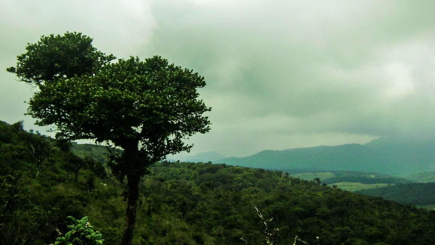 토투폴라 칸다
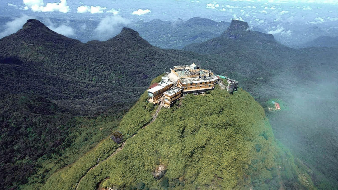 아담스 피크(스리 파다 산)
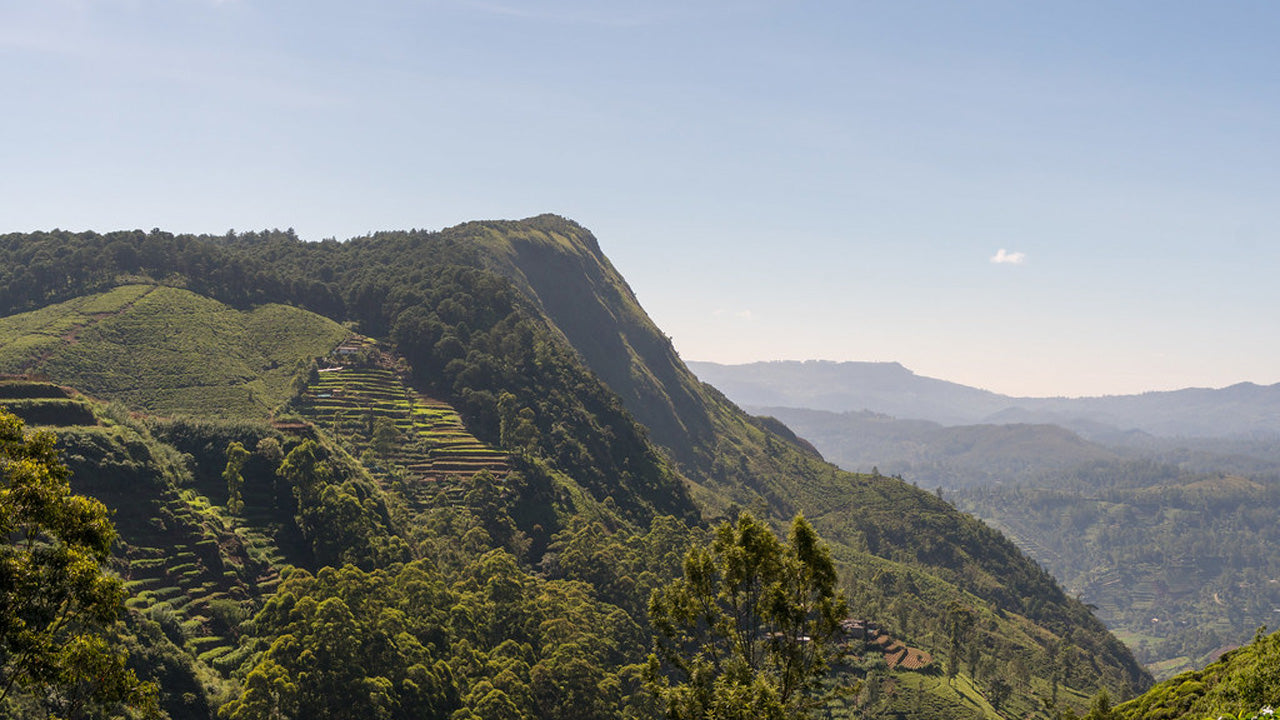 하크갈라 봉우리
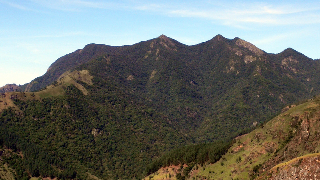 곰몰리야
곰몰리야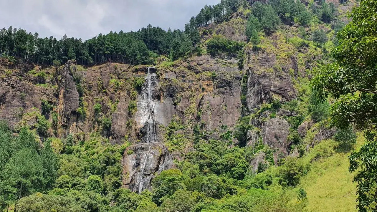 밤바라칸다 봉우리
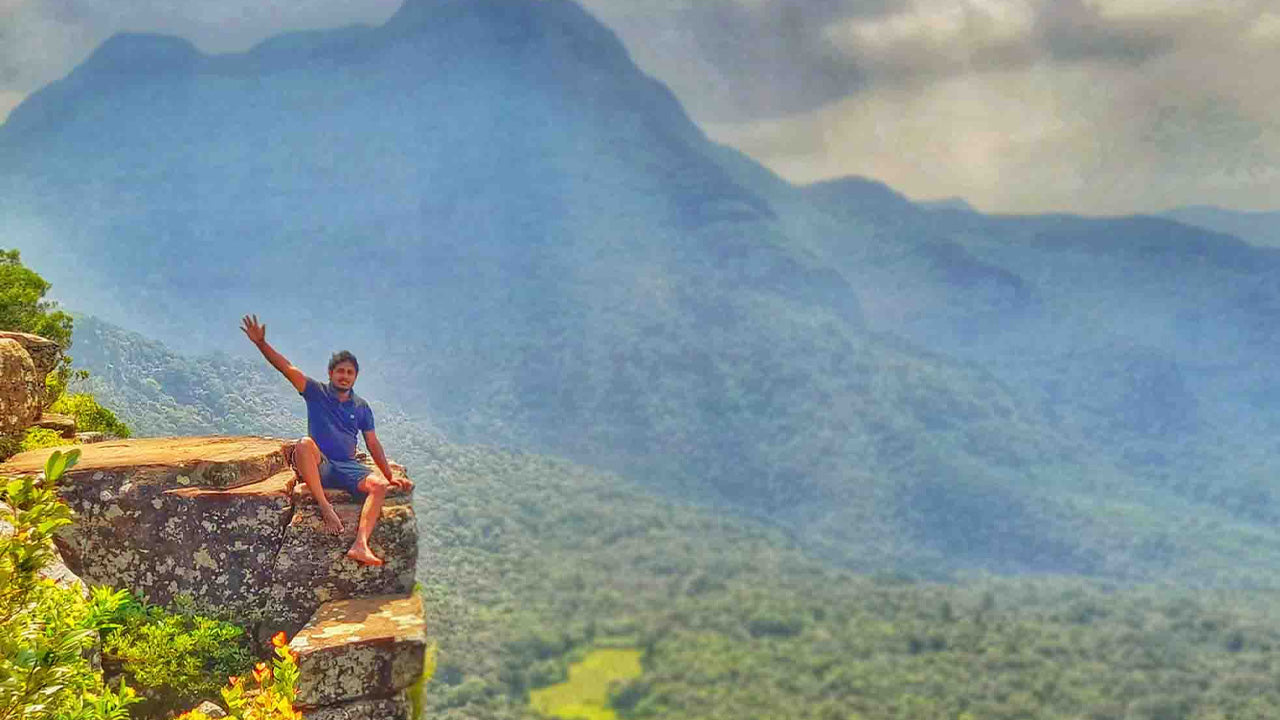 리버스톤 피크