Pidurutalagala

Pidurutalagala Mountain in Sri Lanka (literally translating to Straw Plateau Rock), which is also called Mount Pedro in English is the tallest mountain on the island and situated in the Central Province, north – northeast to the town of Nuwara Eliya. It is also the only ultra prominent peak on the island, and one of only 1515 ultra prominent peaks around the world. An ultra prominent peak is a mountain that has topographic prominence (height of the peak’s summit above the lowest contour line encircling it up to the highest summit) above 1500 meters. Mount Pedro has prominence and elevation of 2524m (8281 feet) (8292 feet according to the Survey Department).

The mountain of Pidurutalagala has a forest reserve surrounding it. The forest underwent damage five years ago in a forest fire, causing the loss of some 3 acres of forest. However, the damage is being repaired now with the assistance of nature and human intervention. The area of the mountain and forest reserve has been designated an ultra-high security zone due to the summit being used to house the communications array of the Sri Lankan Government and the Armed Forces of the country.

Pidurutalagala Mountain in Sri Lanka: Historical Background

The mountain was famed as a place to visit during the British regimen; and records show that, during the year of 1897, there were paths to climb the mountain by foot using a two and half hour trek or in a shorter time by horseback.

It was so popular that there were sedan chairs available for the ladies who wished to visit the mountaintop. Sedans were a form of wooden litter which was used primarily in Britain and Europe at the time. It was a chair placed on top of two long wooden poles (in the case of the chairs used on Mount Pedro, they were bamboo) and the parallel poles were borne by strong men on their shoulders. Some chairs had additional décor such as carved seats, hoods to keep out the sun, curtains to protect from the draft and etc. They were usually used by highborn ladies of the West. Hence their presence in the rural Sri Lanka of those ages shows the presence and visits of many such ladies to the mountain. The mountain gained its nickname ‘Pedro’ from the British as pronouncing the word ‘Pidurutalagala’ was a difficult feat for them.

Unlike most mountain summits which are rocky, Pidurutalagala Mountain in Sri Lanka had a cap of pale green vegetation on its somewhat flat summit as per eyewitness accounts of the 1940s. During the summer months the vegetation had a tendency to dry to a pale yellow giving it a straw-like appearance, and hence the name ‘Straw Laden Rock’ or ‘Pidurutalagala’ in Sinhala. During the early 20th century the mountain still had only a single human-made path to the summit. The only other trails were from the elephants that frequented the mountain. The rest of the mountain was all untouched vegetation. The forest visibly changed drastically from the lowland forests as the height increased. Most notably, the trees were shorter and the tops flattened higher up on the mountain; primarily due to the strong winds. They were also more gnarled and branched out and had lichen and moss clinging to them, displaying characteristics of cloud forests. The single man-made path had way stones with the height from sea level marked on them in feet.

Pidurutalagala Mountain in Sri Lanka: The Geology

  • Pidurutalagala eller Mount Pedro på dansk er en ultrafremtrædende top og det højeste bjerg i Sri Lanka med sine 2.524 m. Mount Pedro ligger tæt på byen Nuwara Eliya og er let synlig fra de fleste områder af Centralprovinsen. Det ligger nord-nordøst fra byen Nuwara Eliya.
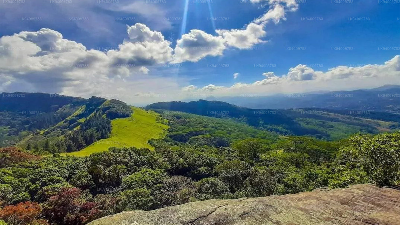
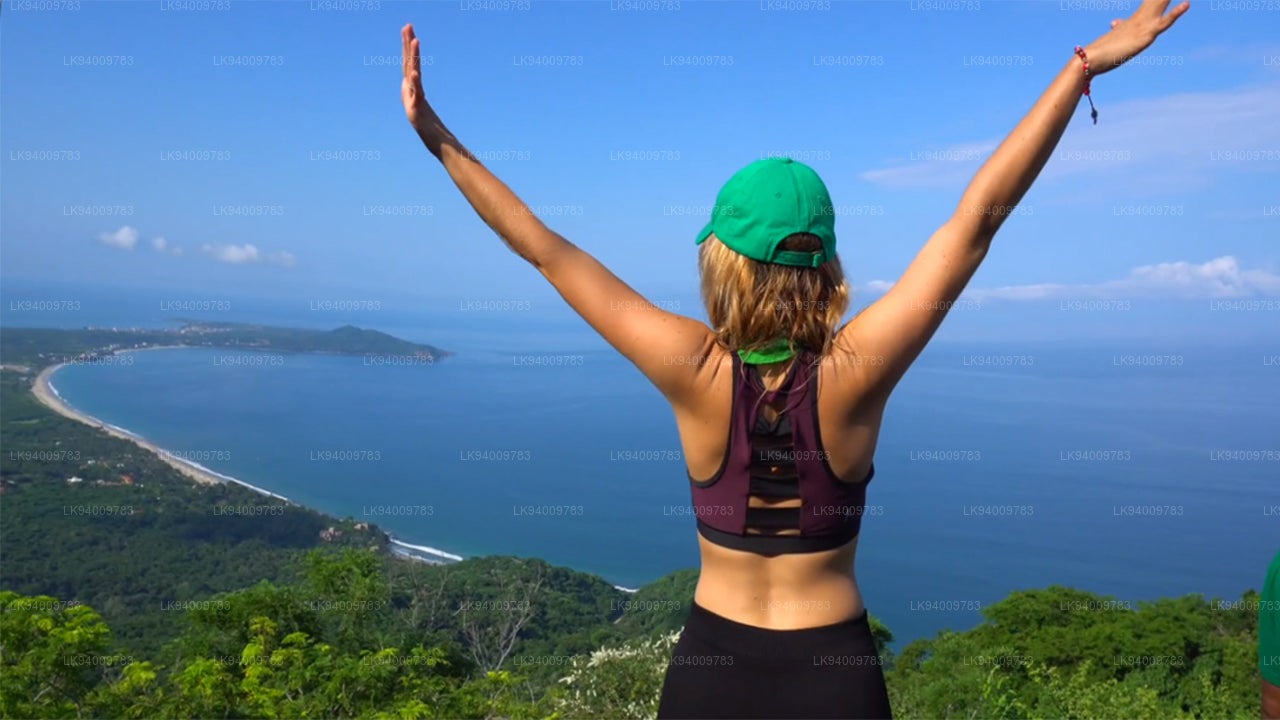
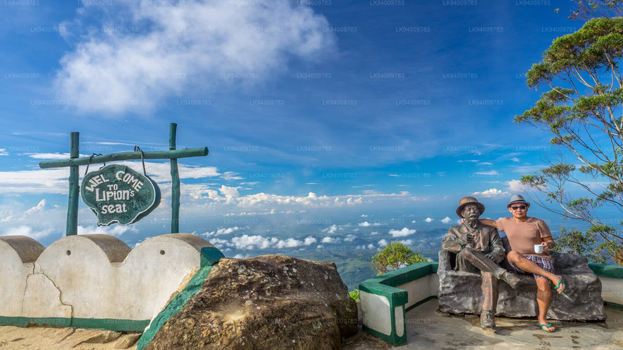
    Pidurutalagala 
  • Lipton’s Seat er et højt udsigtspunkt i bakkerne i Poonagala. Det ligger på toppen af ​​byens navnebror, Poonagala Hill, og er også i nærheden af ​​Dambatenne Tea Factory. Lipton’s Seat er opkaldt efter den berømte skotske baron og teplanter Sir Thomas Lipton, der brugte det som sæde til at beskue sit imperium i en tid, der for længst er svunden, men ikke glemt.
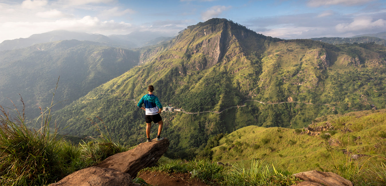
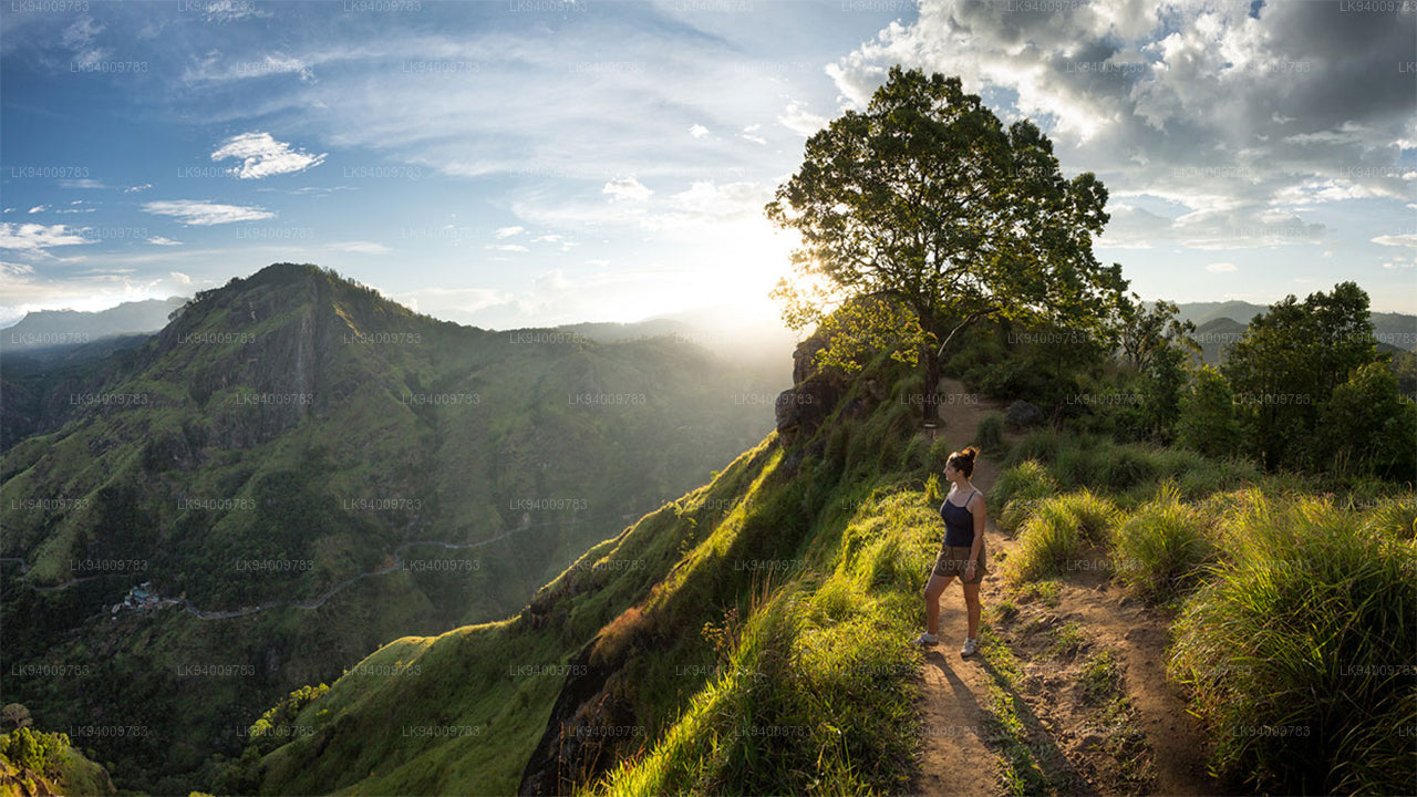
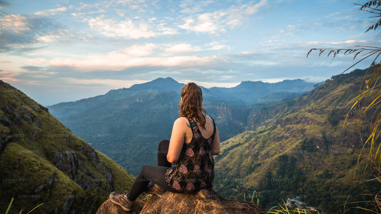
    Liptons sæde 
  • Trods ikke det smukke turistmål i Sri Lanka, Little Adams Peak, uanset om det kommer af ordet 'lille'. Det er opkaldt efter den hellige Adams Peak (Sri Pada - hvor Buddhas fodaftryk er bevaret) på grund af ligheden mellem de to bjerge.

    Little Adams Peak 
  • Ritigala kan nås fra afkørslen fra Habarana-Anuradhapura Road i en afstand af 12 km fra Habarana. Yderligere 5 km langs en grusvej, der er tilgængelig for biler, fører til foden af ​​bjerget.

    Ritigala 
  • Ethagala (Elefantklippen) er en af ​​syv klipper, der skuer ud over byen Kurunegala i Sri Lanka. Klippevæggen når 316 meter over byen og ligner i sin form en elefant, der sidder på hug, hvilket forklarer klippens navn.

    Ethagala (Elefantklippen) 
  • Rumassala-bjerget. Tidligere var Rumassala kendt som Buona Vista, et navn der stammer fra kolonitiden og højst sandsynligt er en forvanskning.

    Rumassala-bjerget 
  • Knuckles-bjergkæden, også kaldet Dumbara-bjergkæden, ligger ud for Kandy i den nordlige ende af det centrale højland i Sri Lanka. Syd og øst for bjergkæden ligger Mahaweli-flodbassinet, mens Matale-sletten ligger mod vest.

    Knuckles-området 
  • Alagalla-bjergkæden. Alagalla-bjergkæden eller "kartoffelkæden" ligger på grænsen mellem Central- og Sabaragamuwa-provinserne i Sri Lanka.

    Alagalla-bjergkæden 
  • Bibelklippen er et bjerg nær Aranayake i Kegalle-distriktet i det centrale Sri Lanka. Det er kendt som "Bibelklippen", da dets overflade ligner.

    Bibelsk rock 
  • Ura Kanda. Urakanda-bjergkæden ligger i Kegalle-distriktet. Et smukt bjerg med betagende omgivelser.

    Ura Kanda 
  • Abebjerget. Gal Oya-området er prægtigt af skov og frodigt vegetation. Området var fuldstændig uden for alfarvej og forbudt under krigen, men har undgået megen udvikling, og landskabet er for det meste uspoleret.

    Abebjerget 
  • Den store Kong Ravanas lig blev efter hans død opbevaret på denne klippe kaldet Yahangala (grundklippen), for at hans landsmænd kunne vise deres sidste respekt for deres kære, afdøde konge.

    Yahangala