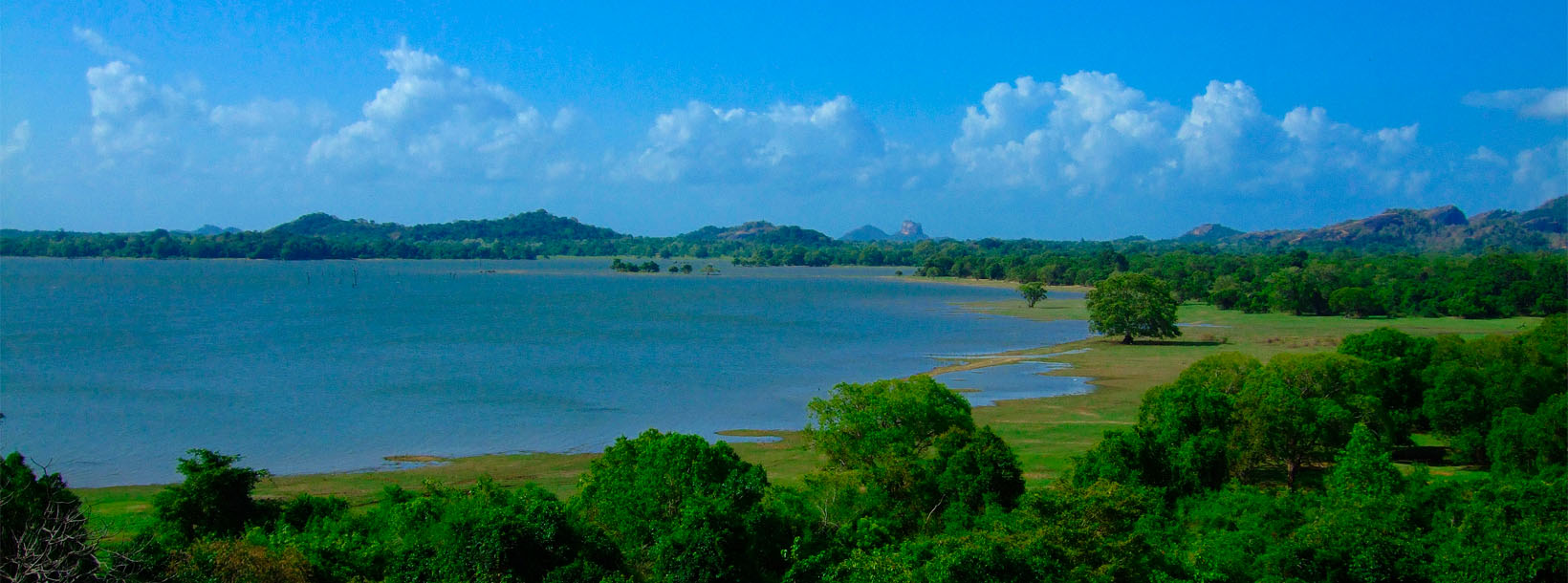
Kandalama: Malerisches Dorf in Sri Lanka in der Nähe von Dambulla, bekannt für seine malerischen Landschaften, alten Höhlentempel und das legendäre Kandalama Hotel.
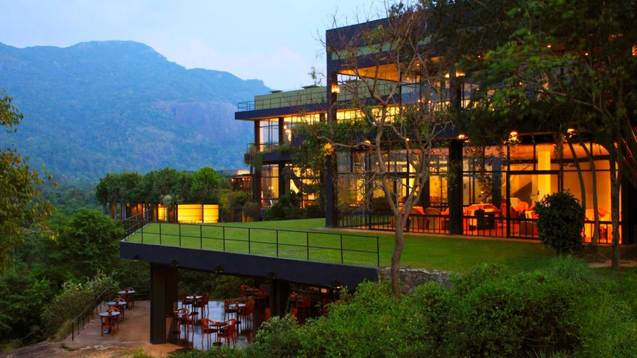
Kandalama ist ein Dorf in Sri Lanka. Es liegt in der Zentralprovinz. Kandalama ist Heimat eines der ersten Fünf-Sterne-Hotels Sri Lankas, dem Heritance Kandalama und dem Kaludiya Pokuna Archäologischen Wald.
Kandalama wird von zwei UNESCO-Weltkulturerbestätten umgeben - dem Dambulla-Höhlen-Tempel aus dem 1. Jahrhundert v. Chr. Dambulla und der Sigiriya-Felsenfestung aus dem 5. Jahrhundert n. Chr. Sigiriya.
Der alte Bewässerungstank, der vor 1700 Jahren von König Vasabha gebaut wurde, befindet sich in Kandalama. Das Dorf liegt am Fuße von Ereulagala 696 m (über dem Meeresspiegel) und Dikkandahena 618 m (über dem Meeresspiegel) und liegt am nördlichen Ende der Matale-Berge und dem Beginn der trockenen Ebenen. Das Dorf liegt an der Grenze zwischen der mittleren und der trockenen Zone.
Matale ist eine Stadt im Bergland von Sri Lanka. Die Knuckles-Bergkette ist ein besonderes Wahrzeichen von Matale. Der Verwaltungsbezirk Matale umfasst auch das historische Sigiriya-Felsen, den Aluwihare-Tempel und den Dambulla-Höhlen-Tempel. Um die Stadt herum befinden sich die Knuckles-Vorberge, die Wiltshire genannt werden. Es ist hauptsächlich eine landwirtschaftlich geprägte Gegend, in der Teeanbau, Gummi, Gemüse und Gewürze dominieren.
Der Aluwihare-Tempel im Norden der Stadt ist der historische Ort, an dem der Pali-Kanon zum ersten Mal vollständig auf Palmblättern niedergeschrieben wurde. In der Nähe von Aluwihare befinden sich zahlreiche Klosterhöhlen, von denen einige schöne Fresken zeigen.
Die Zentralprovinz Sri Lankas besteht größtenteils aus Bergland. Sie umfasst eine Fläche von 5.674 km² und hat 2.421.148 Einwohner. Zu den wichtigsten Städten zählen Kandy, Gampola (24.730 Einwohner), Nuwara Eliya und Bandarawela. Die Bevölkerung setzt sich aus Singhalesen, Tamilen und Moors zusammen.
Sowohl die Hauptstadt Kandy als auch die Stadt Nuwara Eliya und Sri Pada liegen in der Zentralprovinz. Die Provinz produziert einen Großteil des berühmten Ceylon-Tees, der in den 1860er Jahren von den Briten angepflanzt wurde, nachdem eine verheerende Krankheit alle Kaffeeplantagen der Provinz vernichtet hatte. Die Zentralprovinz ist ein beliebtes Touristenziel mit Bergkurorten wie Kandy, Gampola, Hatton und Nuwara Eliya. Der Zahntempel (Dalada Maligawa) ist die wichtigste heilige Stätte der Zentralprovinz.
Das Klima ist kühl, und in vielen Gebieten um 1500 Meter Höhe sind die Nächte oft kalt. Die Westhänge sind sehr feucht, stellenweise fallen dort fast 7000 mm Niederschlag pro Jahr. Die Osthänge gehören zur mittleren Trockenzone, da sie nur vom Nordostmonsun Regen erhalten. Die Temperaturen reichen von 24 °C in Kandy bis zu nur 16 °C in Nuwara Eliya, das auf 1889 m Höhe liegt. Die höchsten Berge Sri Lankas befinden sich in der Zentralprovinz. Das Gelände ist überwiegend gebirgig und von tiefen Tälern durchzogen. Die beiden wichtigsten Gebirgszüge sind das zentrale Massiv und die Knuckles-Kette östlich von Kandy.