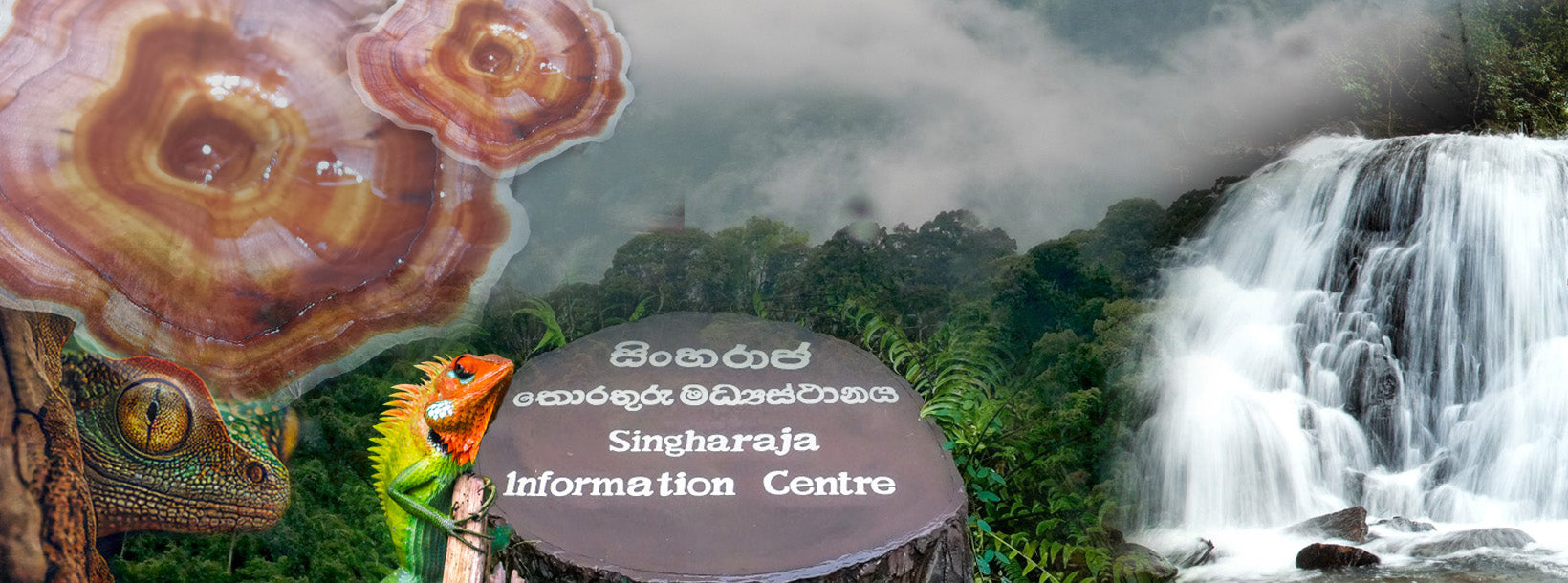
Het Sinharaja Regenwoud, een UNESCO Werelderfgoed, is het laatste levensvatbare overblijfsel van het tropische laaglandregenwoud van Sri Lanka, en beslaat een gebied van 18.900 acres. Het bevindt zich in de provincies Sabaragamuwa en Southern in de zuidwestelijke laagland vochtige zone van Sri Lanka. Sinharaja wordt aan drie zijden begrensd door rivieren: de Napola Dola en de Koskulana Ganga in het noorden, de Maha Dola en de Gin Ganga in het zuiden en zuidwesten, en de Kalukandawa Ela en de Kudawa Ganga in het westen. In het oosten wordt het begrensd door een oude voetweg nabij de Beverley theeplantage en Denuwa Kanda.
Hoe Sinharaja Regenwoud te bereiken
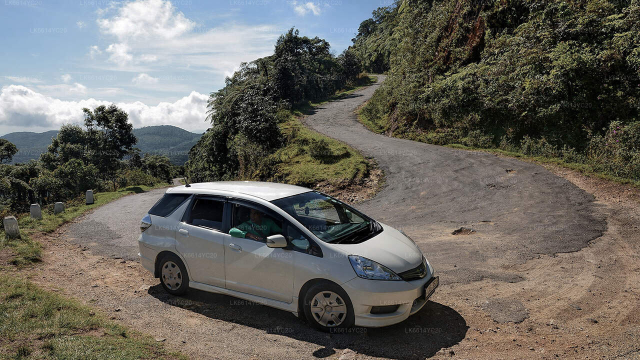
Vanuit het noorden of westen van het land kun je het Sinharaja Forest Reserve bereiken via Ratnapura, Kiriella, Kalawana en Weddala. Vanuit het zuiden kun je het Sinharaja Regenwoud bereiken via Deniyaya. Vanuit Hambantota en Udawalawe kun je Sinharaja vanuit de Rakwana-zijde betreden.
Oppervlakte van het Sinharaja Regenwoud
De totale oppervlakte van het Sinharaja Forest Reserve is 18.900 acres (7.648 hectare). Het varieert in hoogte van 300 m tot 1.170 m.
Het Belang van het Sinharaja Woud
Het Sinharaja Forest Reserve herbergt meer dan 50% van de Sri Lankaanse endemische zoogdieren en vlinders, evenals veel insecten, reptielen en zeldzame amfibieën.
Oprichting van het Sinharaja Forest Reserve
Het grootste deel van het Sinharaja Woud werd oorspronkelijk in 1875 als bosreservaat verklaard onder de Waste Lands Ordinance. In 1978 werd het Sinharaja Regenwoud opgenomen in het internationale netwerk van biosfeerreservaten als onderdeel van UNESCO's "Man and the Biosphere" (MAB) programma. In oktober 1988 werd het reservaat, samen met een noordoostelijke uitbreiding, uitgeroepen tot het eerste Nationale Wilderness Heritage Area van Sri Lanka. In december 1988 werd het Sinharaja Biosphere Reserve de eerste natuurlijke site van Sri Lanka die werd toegevoegd aan de UNESCO Werelderfgoedlijst.
Klimaat in het Sinharaja Regenwoud
Meteorologische gegevens van de afgelopen 60 jaar tonen aan dat de jaarlijkse neerslag in het Sinharaja Woud varieert van 3.614 mm tot 5.006 mm, met temperaturen tussen 19°C en 34°C. De grootste neerslag valt tijdens de zuidwestmoesson (mei-juli) en de noordoostmoesson (november–januari).
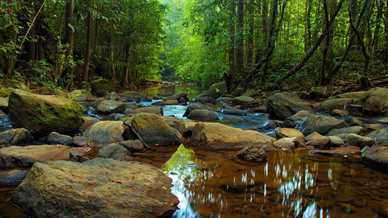
Fysieke Kenmerken
Het Sinharaja Regenwoud is een smalle strook van golvend terrein bestaande uit een reeks bergen en valleien, die wordt afgewaterd door een complex netwerk van beken die via de Napola Dola, Koskulana Ganga en Kudawa Ganga in de Gin Ganga aan de zuidelijke grens en de Kalu Ganga aan de noordelijke grens vloeien.
De Natuurpaden van het Sinharaja Regenwoud
De twee belangrijkste natuurpaden van het Sinharaja Regenwoud leiden naar de toppen van Moulawella en Sinhagala. Beide paden, die beginnen bij het Kudawa Conservation Centre (KCC), zijn even plezierig en verhelderend. Het bos is dicht begroeid met hoge bomen, maar de kronkelende paden maken het wandelen aangenaam. Kleine, kristalheldere beken, die een verscheidenheid aan vissen, kikkers en krabben herbergen, kruisen de paden. Mengsels van vogels kunnen in het bladerdak boven worden gezien.
Het Sinhagala Natuurpad
Start van het pad: Ingang van het beschermde gebied, Kudawa Conservation Centre, Weddagala, Kalawana
Einde van het pad: Sinhagala Peak
Lengte van het pad: 2,4 km
Hoogtewinst: 300 m (Start van het pad: 473 m, Einde van het pad: 773 m)
Geschatte tijd: 5-7 uur
Beste maanden voor wandelen: De beste maanden zijn december tot april
Het Mulawella Natuurpad
Start van het pad: Ingang van het beschermde gebied, Kudawa Conservation Centre, Weddagala, Kalawana
Einde van het pad: Mulawella Peak
Lengte van het pad: 2,4 km
Hoogtewinst: 457 m (Start van het pad: 301 m, Einde van het pad: 758 m)
Geschatte tijd: 1-2 uur
Beste maanden voor wandelen: De beste maanden zijn december tot april
Vogels in het Sinharaja Regenwoud
Het Sinharaja Regenwoud herbergt vele endemische vogels, zoals de Ceylon Hanging Parrot (Loriculus beryllinus), de Ceylon Grey Hornbill (Ocyceros gingalensis), de Ashy-headed Laughing Thrush (Garrulax cinereifrons), de Layard's Parakeet (Psittacula calthripae), de Jungle Fowl (Gallus lafayetii), de Spur Fowl (Galloperdix bicalcarata), de Ceylon Wood Pigeon (Columba torringtonii), de Brown-capped Babbler (Pellorneum fuscocapillum), de Red-faced Malkoha (Phaenicophaeus pyrrhocephalus) en de Ceylon Blue Magpie (Urocissa ornata), onder andere.
Negentien van de twintig endemische vogelsoorten van Sri Lanka komen voor in het Sinharaja Reservaat. Onder de bedreigde vogels bevinden zich de Ceylon Wood Pigeon, de Green-Billed Coucal, de Sri Lankan White-headed Starling, de Red-faced Malkoha, de Green-billed Coucal, de Sri Lanka Spur Fowl, de Sri Lankan Blue Magpie en de Ashy-headed Babbler, die allemaal endemisch zijn.
Zoogdieren, Reptielen, Amfibieën en Vlinders
Van de 12 endemische zoogdiersoorten in het land, komen er 8 voor in dit reservaat. De Giant Squirrel, de Dusky-stripped Jungle Squirrel, de Badger Mongoose, de Endemic Purple-faced Leaf Monkey en de Torque Macaque worden vaak gezien.
Veel bedreigde soorten zoogdieren, reptielen, amfibieën en vlinders komen voor in het reservaat, waaronder de luipaard. Endemisme bij zoogdieren en vlinders is groter dan 50%. Reptielen en amfibieën omvatten de Python, de Endemic Green Pit Viper, de Endemic Hump-nosed Lizard (Lyriocephalus scutatus) en de Rough-nose Horned Lizard (Ceratophora aspera).
Conserveringswaarde van Sinharaja
Sinharaja is het laatste uitgebreide primaire tropische regenwoud in Sri Lanka. Het herbergt een groot aantal endemische planten- en diersoorten, waarvan meer dan 60% van de bomen endemisch zijn. Veel van deze soorten zijn zeldzaam. Het natuurreservaat is de thuisbasis van 21 endemische vogelsoorten, en een aantal zeldzame insecten, reptielen en amfibieën (IUCN Technische Evaluatie).
Het langdurige succes van de bescherming van Sinharaja is afhankelijk van de duurzame ontwikkeling van de buffer- en perifere zones via een participatieve benadering die de betrokkenheid van de lokale bevolking benadrukt. De aanleg van hotels en wegen in de perifere zones zou onherstelbare schade aan deze Werelderfgoedlocatie kunnen veroorzaken.
Ingangen van het Sinharaja Regenwoud Reservaat
Sinharaja Forest Kurulugala Ingang
Deze ingang ligt ongeveer 12,8 km van het centrum van Deniyaya. Je kunt verschillende paden volgen. Dit is een van de ideale plekken in Sinharaja voor vogelobservatie en vlinderobservatie vanwege de gemiddelde hoogte van ongeveer 1000 m en de nabijgelegen Rakwana bergen.
Sinharaja Forest Pitadeniya Ingang
Deze ingang ligt ongeveer 15 km van Deniyaya. De belangrijkste attracties hier zijn de Kekuna Ella watervallen, de Pathan Oya watervallen en de hangbrug in het Pitadeniya Conservation Centre. Deze ingang is een van de meest actieve in de afgelopen jaren geweest.
Sinharaja Forest Lankagama Ingang
Deze ingang ligt ongeveer 18,5 km van Deniyaya. Het biedt toegang tot zes watervallen in korte tijd. Deze ingang is vooral populair bij lokale toeristen.
Sinharaja Forest Morningside Ingang
Deze ingang ligt ongeveer 40 km van Deniyaya.
Sinharaja Forest Kudawa Ingang
Deze ingang ligt ongeveer 95 km van Deniyaya.