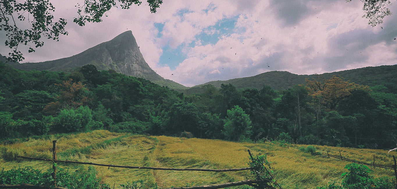
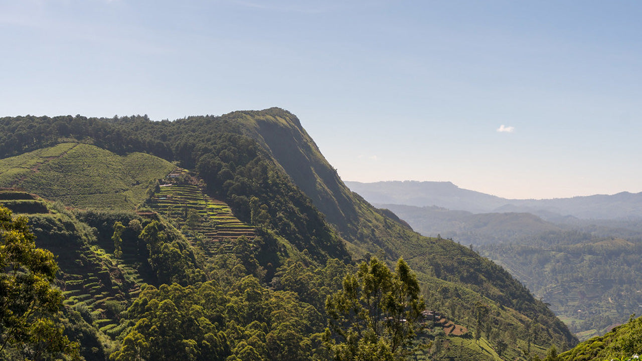
Katusu Konda


Katusu Konda, nestled in the Hanthana Mountain Range near Kandy, is a must-visit destination for hikers and nature enthusiasts. Its name, which translates to "Lizard's Back," comes from its unique shape resembling a lizard's spine. This peak offers an adventurous and rewarding experience, making it a hidden gem in Sri Lanka’s hiking trails.
The journey begins with a picturesque trail through the rolling landscapes of the Hanthana hills, surrounded by lush greenery and a cool, refreshing climate. The initial part of the hike is relatively easy, but as you ascend, the adventure truly begins. The trail becomes narrower, leading to the summit's razor-edge ridge. Strong winds sweep across the peak, adding to the adrenaline-filled experience, while the steep drop-offs on either side provide both thrill and awe.
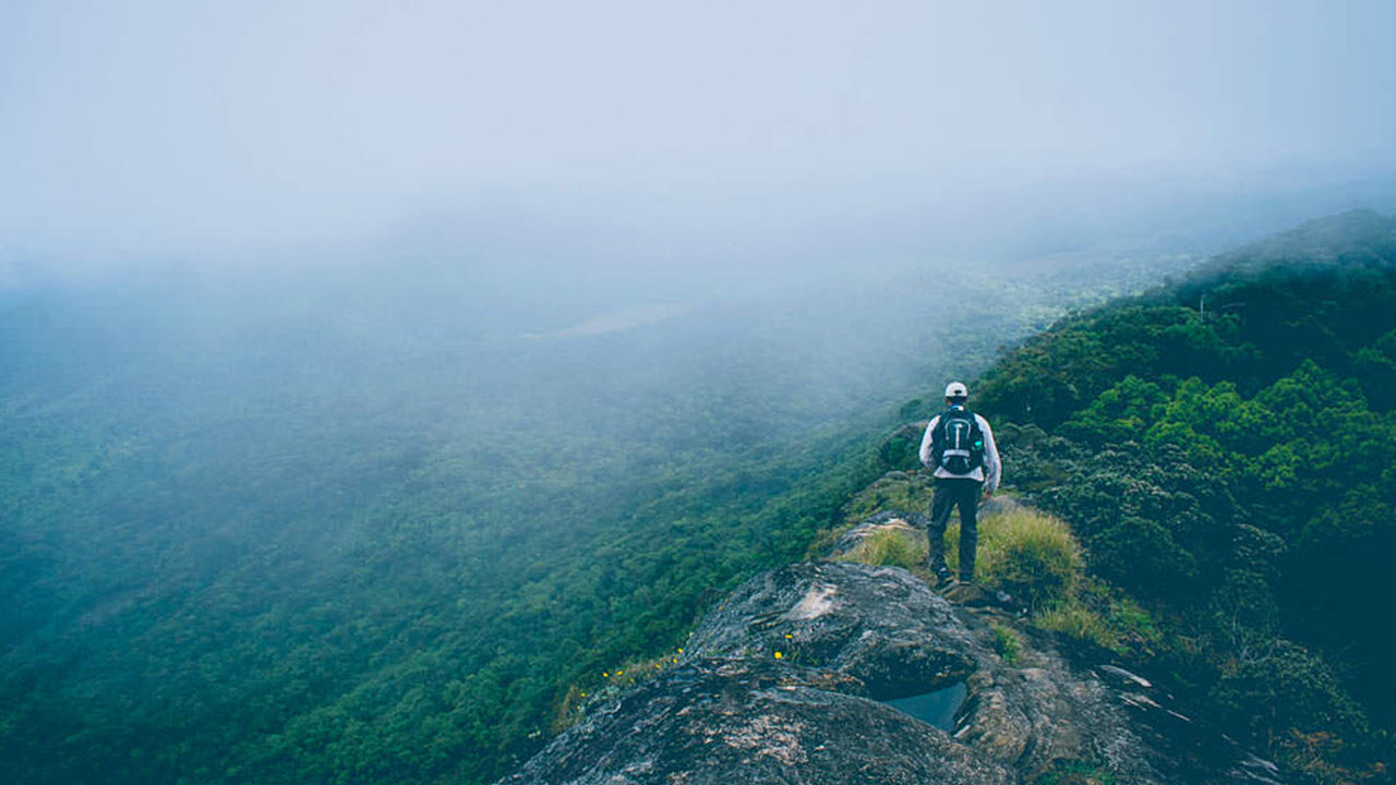
The summit rewards hikers with breathtaking 360-degree views. On a clear day, you can see the majestic Knuckles Mountain Range, the city of Kandy with its iconic landmarks, the sprawling University of Peradeniya campus, and distant landmarks such as Monaragala, Alagalla, and Hunnasgiriya. The interplay of mist, sunlight, and the endless green hills creates a magical and serene atmosphere, ideal for photography or quiet reflection.
Although the trail is not overly challenging, there are precautions hikers should take. The summit can become slippery and dangerous during rainy weather, so it’s best to check the forecast before starting. Sturdy footwear is essential, as is carrying water and light snacks for energy. Beginning the hike early in the morning allows you to enjoy cooler weather and possibly catch the sunrise. First-time hikers are encouraged to hire a local guide, as the terrain can be confusing at certain points.
Katusu Konda is more than just a hike—it’s a blend of adrenaline, natural beauty, and tranquility. Whether you’re an experienced trekker or a curious traveler, this peak offers an experience that lingers long after you descend. After conquering Katusu Konda, nearby attractions like the Hanthana Tea Museum or the tranquil Kandy Lake offer further exploration to round out your adventure.


-
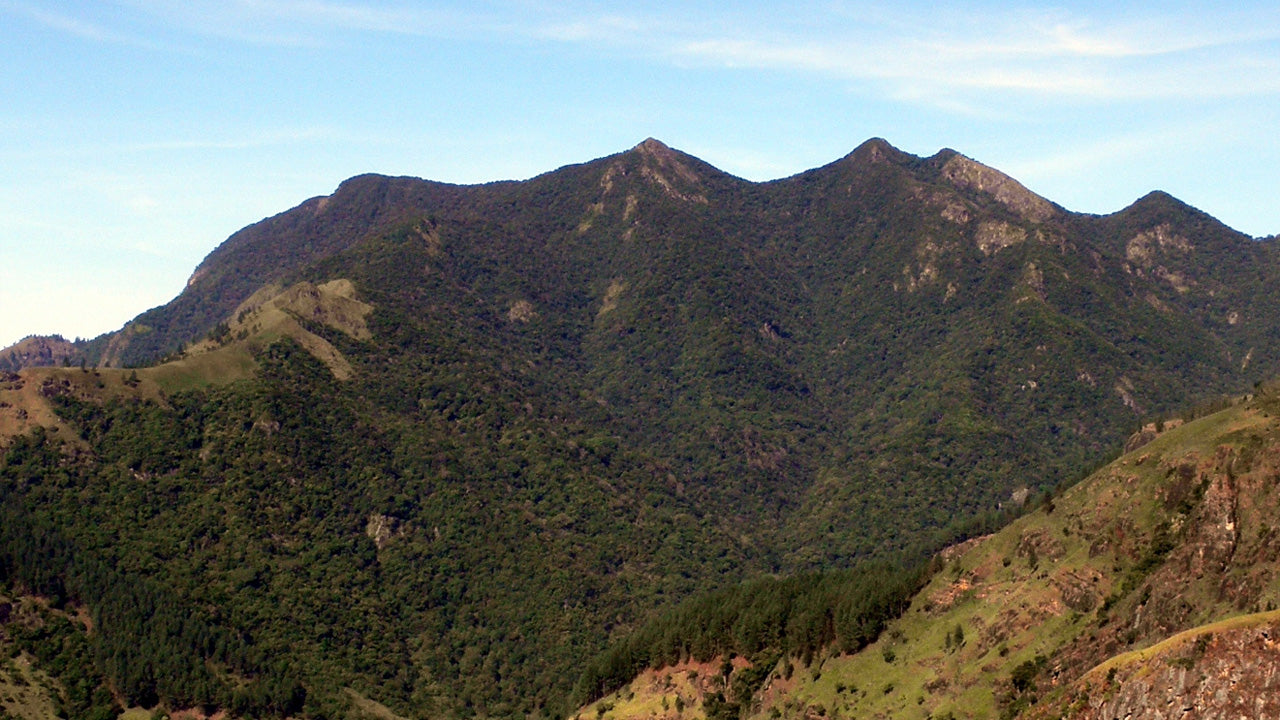
 키리가르포타
스리랑카 누와라엘리야 지역에 위치한 키리갈포타 산은 해발 2,388m(7,835피트)에 달하며, 도시 전체에 웅장한 그림자를 드리우고 있습니다. 이 산은 스리랑카에서 두 번째로 높은 산이자, 섬나라 내에서는 가장 높은 산입니다.
-
 토투폴라 칸다
토타폴라칸다는 스리랑카에서 세 번째로 높은 산으로, 누와라엘리야 지구에 위치하며 해발 2,357m입니다. 이 산은 호튼 플레인스 국립공원 내에 자리하고 있습니다. 정상까지 이어지는 약 2km 길이의 등산로는 호튼 플레인스 국립공원의 파티폴라 입구에서 몇 미터 떨어진 곳에서 시작됩니다.
-
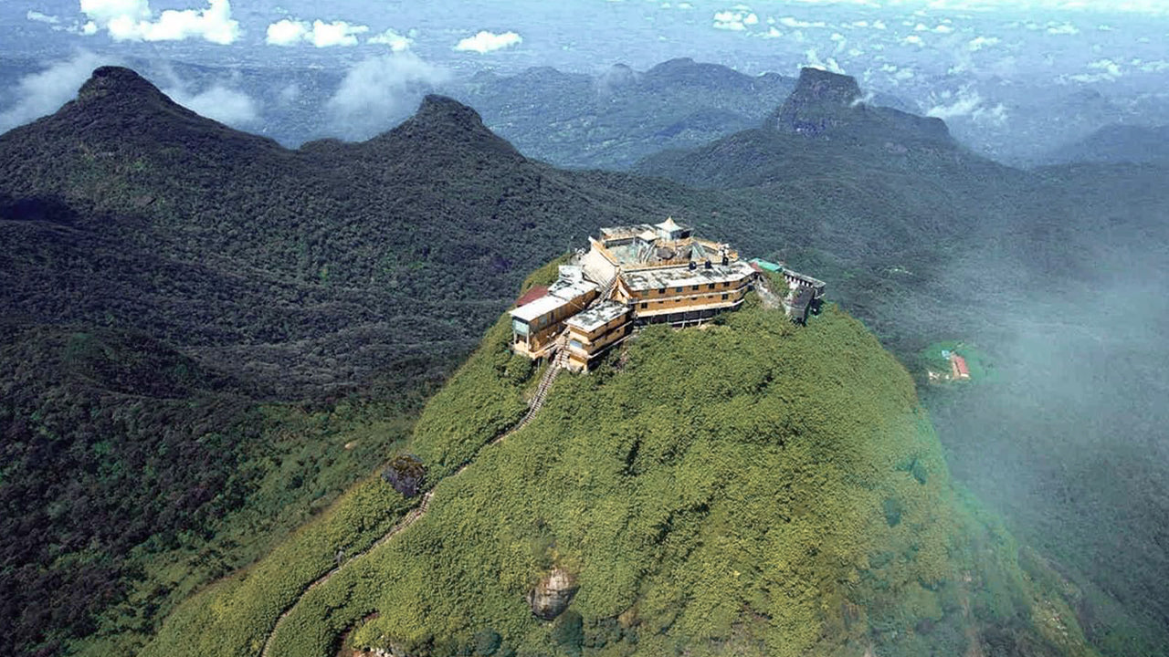 아담스 피크(스리 파다 산)
스리랑카에서 가장 유명한 지형은 라트나푸라 지역에 위치한 아담스 피크입니다. 중앙 산맥의 가장자리에 자리 잡고 있으며, 주변 산맥은 피크의 황야(Wilderness of the Peak)라고 불립니다. 높이는 약 7,500피트(약 2,287m)로, 스리랑카에서 두 번째로 높은 봉우리입니다.
-
 하크갈라 봉우리
하크갈라 봉우리는 스리랑카 중부 고원 지대에 위치한 하크갈라 엄격 자연 보호 구역 내에 자리하고 있습니다. 누와라엘리야 마을 근처에 있으며, 아름다운 경관과 서늘한 기후로 유명한 중부 고원 지대에 속합니다.
-
 곰몰리야
곰몰리야곰몰리야 봉우리는 스리랑카 중부에 위치한 유네스코 세계문화유산인 너클스 산맥의 일부로, 풍부한 생물 다양성과 아름다운 경관으로 유명합니다. 이 봉우리는 스리랑카 중부 고원지대인 캔디 지구에 자리하고 있습니다.
-
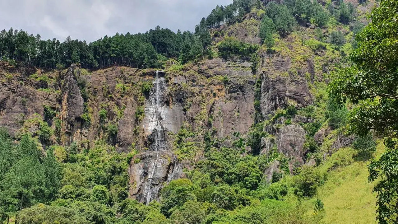 밤바라칸다 봉우리
밤바라칸다 봉우리는 스리랑카 우바 주 바둘라 지구에 위치해 있습니다. 중부 고원 지대에 속하며 스리랑카에서 가장 높은 폭포인 유명한 밤바라칸다 폭포 근처에 자리하고 있습니다. 이 지역은 울창한 녹음, 시원한 기후, 그리고 아름다운 자연 경관으로 유명합니다.
-
 리버스톤 피크
스리랑카의 리버톤 봉우리는 마탈레 마을에서 약 30km 떨어진 마탈레-기란두루코테 도로를 따라가면 도착할 수 있습니다. 구불구불하고 날카로운 헤어핀 커브가 있는 이 비밀스러운 도로는 주변 시골 풍경의 절경을 선사하여 '미니 월드 엔드'라는 별명을 얻었습니다.