Ritigala Archaeological complex
This site is the monastic complex on the lower slopes of Ritigala-kande – the Ritigala Mountain – situated in Sri Lanka’s North Central Province, 25 miles (40 kilometers) southeast of Anuradhapura. These ruins are some of the most distinctive the island has to offer. The Buddhist dagobas (domed relic chambers) and statuary of Anuradhapura and elsewhere are conspicuous by their absence.
The Archeological Site of Ritigala is situated at the eastern slopes of the Ritigala mountain range, the car park and entrance of the excavation site is 20 km to the northwest of Habarana by road. It can be reached from a turn-off at the Habarana-Anuradhapura Road (A11) at a distance of 12 km from Habarana. An 8.5 km along a graveled road leads to the car park of Ritigala at the foot of the mountain range. The distance from Anuradhapura New Town is 55 km, from Polonnaruwa Archeological Site 63 km, from Kandy 113 km, and from Trincomalee 105 km.
Attraction of Ritigala archaeological complex
The reservoir: the perimeter of this huge polygonal reservoir measures 366 meters. it is said to have been dug during the reign of King Pandukabhaya (437-367 BC). Because of its location even before the entrance to the monastery, its use would have been to allow pilgrims and visitors to perform a ritual bath before entering the premises. The reservoir is crossed by a river which supplied it with water. Visitors would walk along it clockwise and reach the other side of the river.
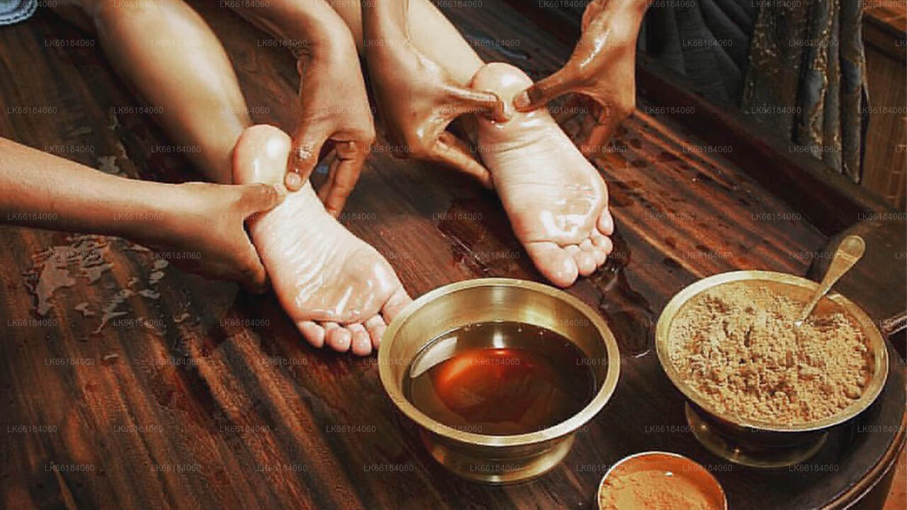
The hospital: among the remains still visible are those of an ancient hospital and facilities for making herbal medicines, a field in which the monks particularly excelled. We can still see a bathtub used for Ayurvedic baths, as well as stones used to reduce roots and herbs to powder.
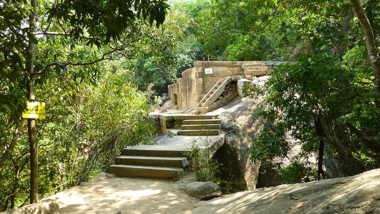
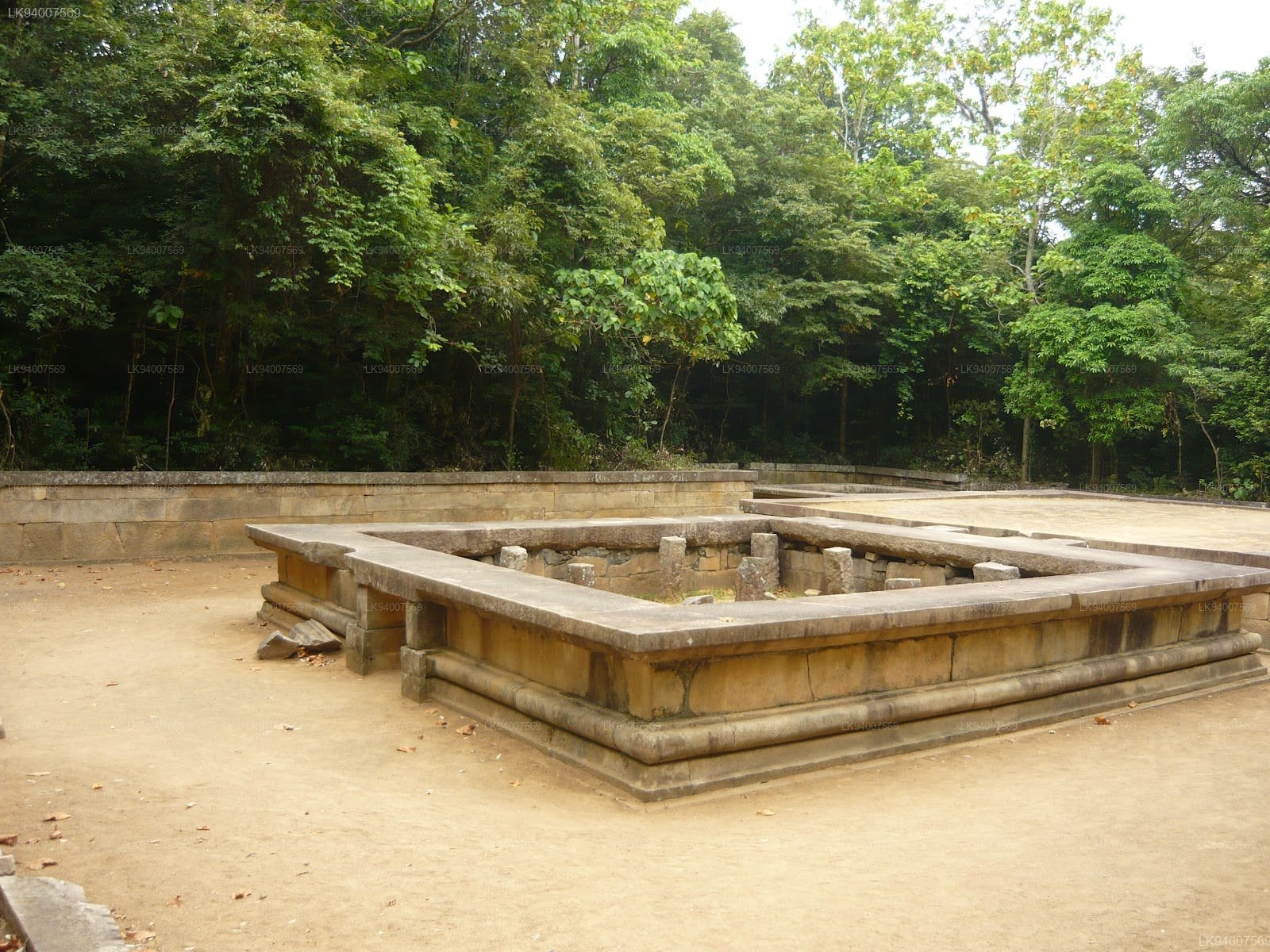
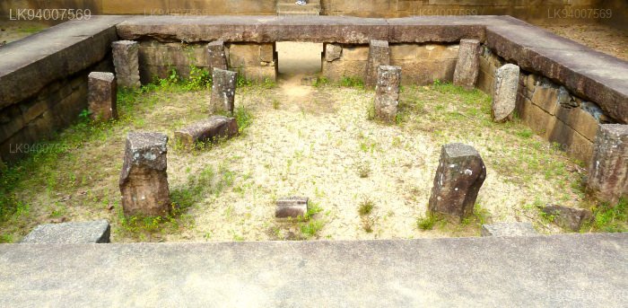
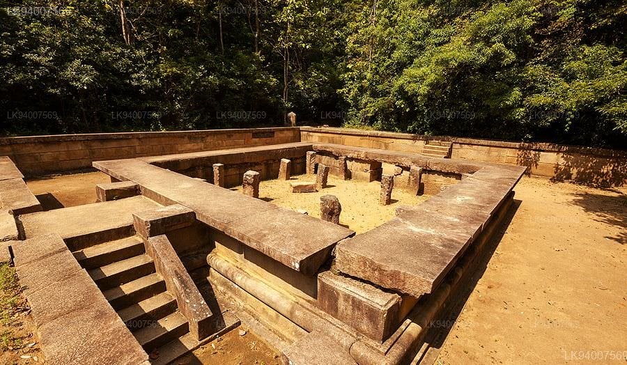
The double platforms: about fifty terraces are visible in Ritigala. On each of them, a double platform was built. They were probably surmounted by buildings housing meditation cells and other spaces devoted to common rites and teachings. Each of these platforms is oriented east-west and a stone bridge connects each pair. These platforms are typical of forest hermitages like that of Ritigala.
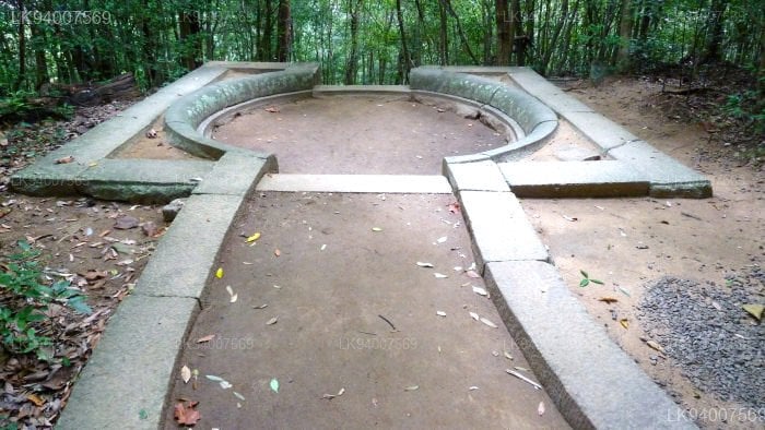
The traffic circles: the paved path is crossed by traffic circles visible at each intersection. These are large slabs forming a circle from which two or more paths start.
-
 سري ماها بوديا
شجرة بودي جايا سري ماها هي شجرة بو مقدسة في حدائق ماهاميونا، أنورادهابورا، سريلانكا. وهي الفرع الجنوبي من شجرة بودي سري ماها التاريخية في معبد بوذا جايا في الهند، والتي بلغ بوذا في ظلها التنوير. زُرعت عام ٢٨٨ قبل الميلاد، وهي أقدم شجرة حية زرعها الإنسان في العالم، ويُعرف تاريخ زراعتها.
-
 روانويليسيياروانويليسييا
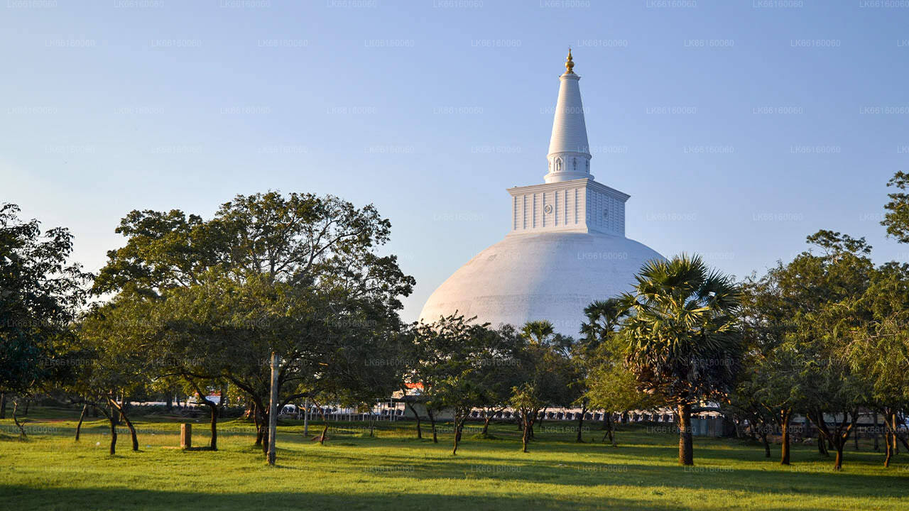
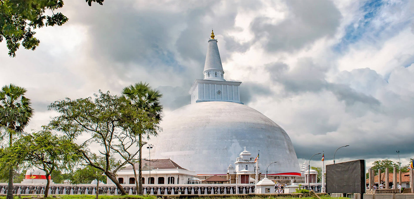
روانويلي ماها سيا، المعروف أيضًا باسم ماهاثوبا (الثوبا الكبرى)، هو ستوبا (هيكل نصف كروي يحتوي على آثار) في أنورادهابورا، سريلانكا. حُفظت في الستوبا ربع جالون أو دونا واحدة من آثار بوذا، مما يجعلها أكبر مجموعة من آثاره في العالم. بناها الملك السنهالي دوتوغيمونو حوالي عام ١٤٠ قبل الميلاد، الذي أصبح ملكًا لسريلانكا بعد حرب هُزم فيها ملك تشولا إيلارا (إلالان).
-
 ثوبارامايا
ثوبارامايا هو أول معبد بوذي بُني بعد وصول ماهيندا ثيرو (ماهينداغامانايا) إلى سريلانكا. يقع ثوبارامايا ستوبا في المنطقة المقدسة بمنتزه ماهاميونا، وهو أقدم داجوبا بُنيت في الجزيرة، ويعود تاريخه إلى عهد الملك ديفانامبيا تيسا (247-207 قبل الميلاد). وقد اعترفت الحكومة رسميًا بالمعبد كموقع أثري في سريلانكا.
-
 لوفاماهابايا
لوفاماهابايا هو مبنى يقع بين روانويليسييا وسري ماهابوديا في مدينة أنورادهابورا القديمة، سريلانكا. يُعرف أيضًا باسم قصر برازين أو لوهابراسادايا لأن سقفه كان مغطى ببلاط برونزي. في العصور القديمة، كان المبنى يضم قاعة الطعام وأوبوساثاغارا (بيت أوبوساثا).
-
 أبهاياجيري داجوبا
كان أبهاياجيري فيهارا موقعًا رئيسيًا لدير الماهايانا والثيرافادا والفاجرايانا البوذي، ويقع في أنورادهابورا، سريلانكا. وهو من أضخم الآثار في العالم، ومن أقدس مدن الحج البوذي في البلاد.
-
 جيتافانارامايا
كان أبهاياجيري فيهارا موقعًا رئيسيًا لدير الماهايانا والثيرافادا والفاجرايانا البوذي، ويقع في أنورادهابورا، سريلانكا. وهو من أضخم الآثار في العالم، ومن أقدس مدن الحج البوذي في البلاد.
-
 ستوبا ميريساوتيا
ستوبا ميريسافيت هي مبنى تذكاري، أو ستوبا، يقع في مدينة أنورادهابورا القديمة، سريلانكا. بنى الملك دوتوغامونو (١٦١-١٣٧ قبل الميلاد) ستوبا ميريسافيت بعد هزيمته للملك إلارا. وبعد وضع رفات بوذا في الصولجان، ذهب إلى تيسا ويوا للاستحمام، تاركًا الصولجان.
-
 لانكارا
لانكاراما ستوبا بناها الملك فالاجامبا، في موقع أثري في غالهيباكادا بمملكة أنورادهابورا القديمة، سريلانكا. لا يُعرف الكثير عن شكلها القديم، وقد جُدّدت لاحقًا. تُظهر الآثار وجود صفوف من الأعمدة الحجرية، ولا شك في وجود منزل بُني حول الستوبا (فاتاداج) لتغطيتها.
-
 Isurumuniya
إيسورومونيا معبد بوذي يقع بالقرب من تيسا ويوا (حوض تيسا) في أنورادهابورا، سريلانكا. يضم هذا الدير أربعة نقوش ذات أهمية خاصة، وهي: عشاق إيسورومونيا، وبركة الفيلة، والعائلة المالكة. يُعرف معبد ميغاجيري فيهارا القديم حاليًا باسم إيسوروموني فيهارا.