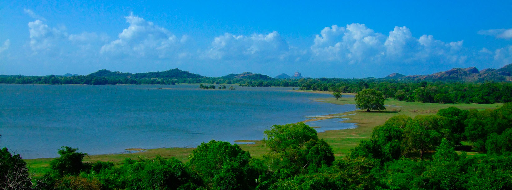
Kandalama Reservoir


Amongst the craggy regions of the Central province of Sri Lanka is a placid and beautiful man-made lake, which is actually the Kandalama Reservoir. Created by kings of long gone times in order to provide water for farming irrigation; the the Kandelle or Candelay reservoir, as it was also known, is located in the town of Kandalama and was made by damming one of the main tributaries of Kala Wewa.
The reservoir measures 4.8 km (3.0 miles) long and 2.3 km (1.4 miles) across at its largest parts; with a catchment area of 102 km2 (39.4 square miles) and a volume of 33,300,000 m3 (1.18×10⁹ cubic ft). The ancient wall of the dam itself has a massive height of 21 m (69 ft) and width of 1,600 m (5,200 ft), making visitors wonder if it was built by giants. The reservoir has water all throughout the year and provides irrigation extending up to the distant Kekirawa region.
Pertaining to the history of the reservoir, not much is known; though it is ancient and lies less than 8 km from the famous Rock Temple of Dambulla. It has also been a famous site of tourism even during the era of the British invasion of Ceylon in the 1800s. Many a olden day foreign adventurer mentioned it during their travels. Here are some of their comments:
“Kandelle is a scattered village, similar to the preceding . It contains about sixteen families, who subsist, on the produce of one large paddy-field. The lake or tank of Kandelle, which is close by, is a great work, and the best example of the kind of work, that I have ever seen. The lake is about three or four miles in circumference, and, like that of Minere, skirted with green plains. The embankment by which the water is confined is a mile and one-third long. It extends nearly in a straight line, from a rocky hillock at one extremity, to a high ledge of rock at the other. Its perpendicular height may be twenty feet; at its base, it may be hundred and fifty or two hundred feet wide. Its face towards the lake is naked, sloped at an angle of about 45 degrees, and composed of stones that rise one above the other like steps. The stones are of the same size nearly; from two to three feet long, about two high, and from one to two wide.
The lake has two outlets: the principal one about a hundred yards from the rocky ledge, through which a river is constantly flowing; and another near the opposite extremity of the embankment, which is commonly dry, and carries off water only when the lake is unusually high.”
John Davy, M. D., F.R.S, F. R. S.E. : An Account of the Interior of Ceylon, and of Its Inhabitants: with Travels in that Island, Year 1821
“The Lake of Kandelle, or as it is commonly termed, the Kandelle waters, is, in the opinion of connoisseurs, the most beautiful lake in Ceylon, and, from its being enveloped on all sides by lofty hills, it will bear inspection from several points. This is more than that can be said of many of the lakes, which are generally tame at the lower extremities. But it is the peculiar beauty of the waters of Kandelle, that in their case the ground ascends everywhere from thei