Gommolliya Peak
-
 Kirigalpotta
Culminant à 2 388 mètres d'altitude, le mont Kirigalpoththa, au Sri Lanka, domine le district de Nuwara Eliya et projette son ombre sur la ville principale. C'est le deuxième plus haut sommet de ce paradis insulaire, et le plus haut de l'île.
-
 Thotupola Kanda
Le Totapolakanda est le troisième plus haut sommet du Sri Lanka. Situé dans le district de Nuwara Eliya, il culmine à 2 357 mètres d'altitude. Il se trouve au cœur du parc national des plaines d'Horton. Un sentier d'environ deux kilomètres mène à son sommet, à quelques mètres de l'entrée de Pattipola du parc.
-
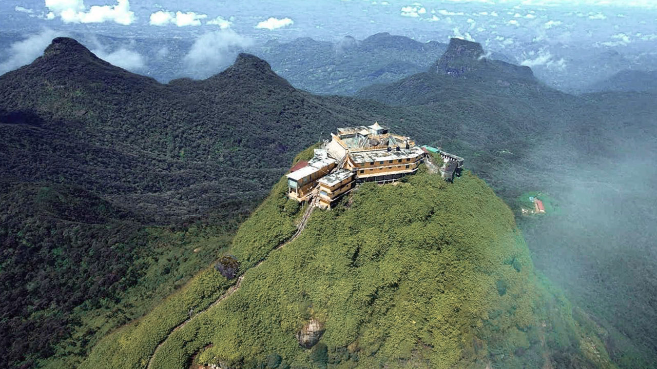 Pic d'Adam (montagne Sri Pada)
Le site naturel le plus emblématique de Ceylan est le pic d'Adam, situé dans le district de Ratnapura. Il se trouve à la lisière du massif central, entouré d'un groupe de montagnes surnommé la « Région sauvage du pic ». Culminant à environ 2 286 mètres (7 500 pieds), il est le deuxième plus haut sommet du pays.
-
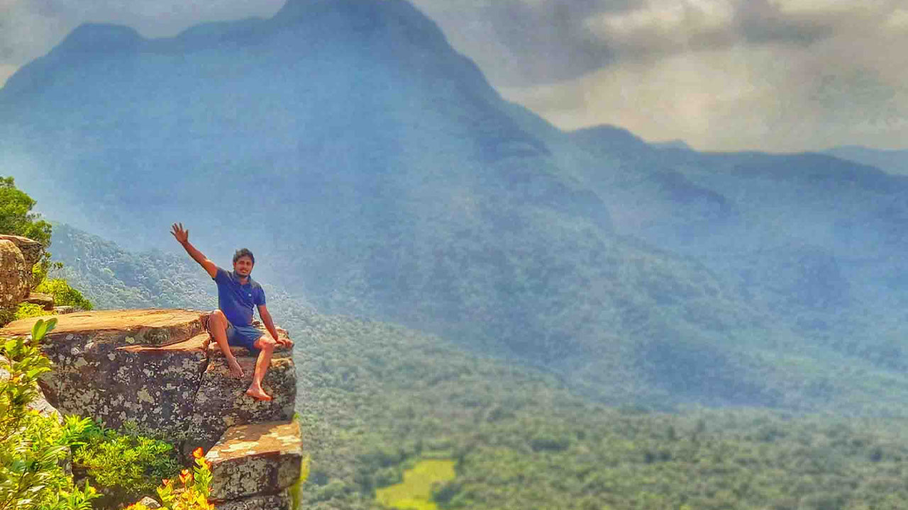
 Pic Hakgala
Le pic Hakgala se situe dans les hauts plateaux du centre du Sri Lanka, au sein de la réserve naturelle intégrale de Hakgala. Il se trouve à proximité de la ville de Nuwara Eliya et fait partie de la région des hauts plateaux centraux, réputée pour ses paysages époustouflants et son climat plus frais.
-
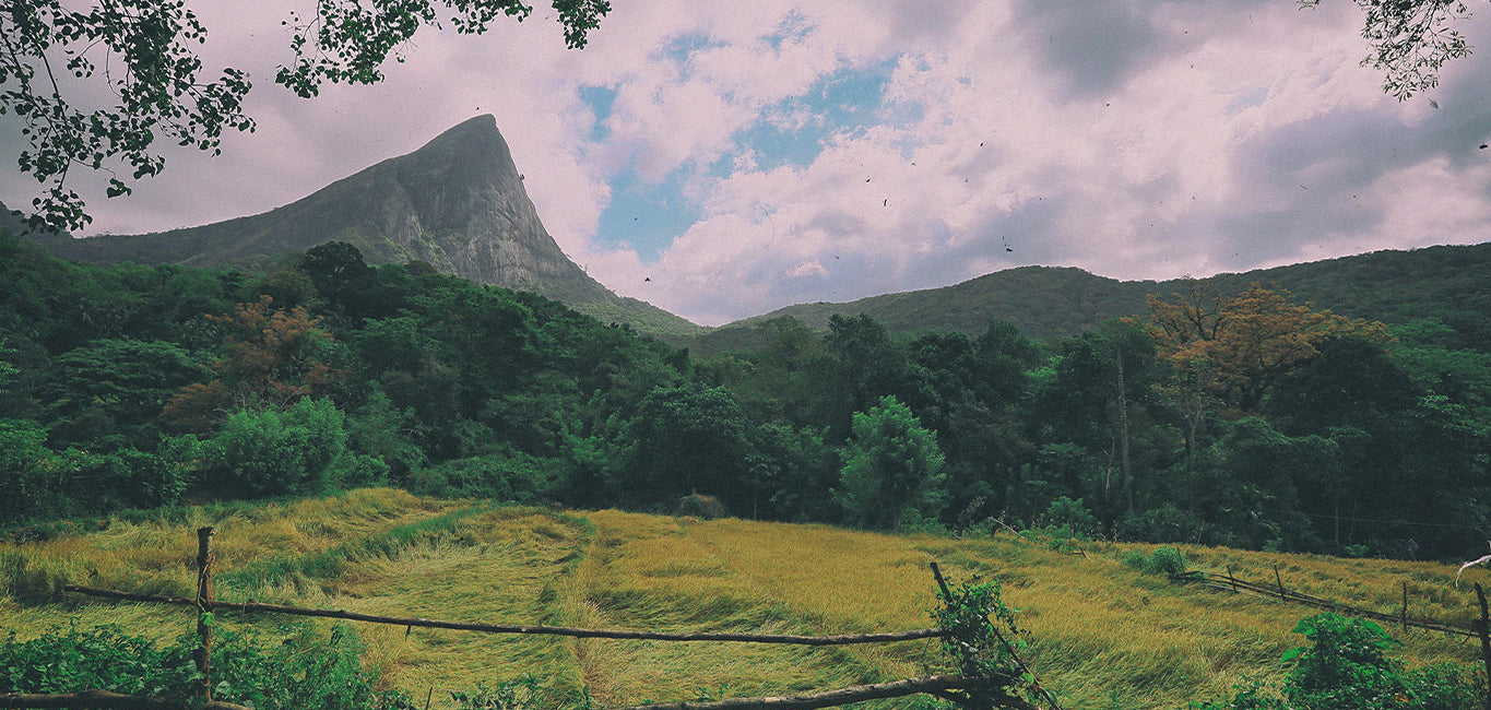
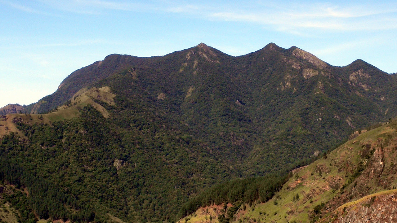 Gommolliya
Le pic Gommolliya fait partie de la chaîne de montagnes des Knuckles, au centre du Sri Lanka, un site inscrit au patrimoine mondial de l'UNESCO, réputé pour sa biodiversité et la beauté de ses paysages. Il est situé dans le district de Kandy, dans les hauts plateaux du centre du Sri Lanka.
-
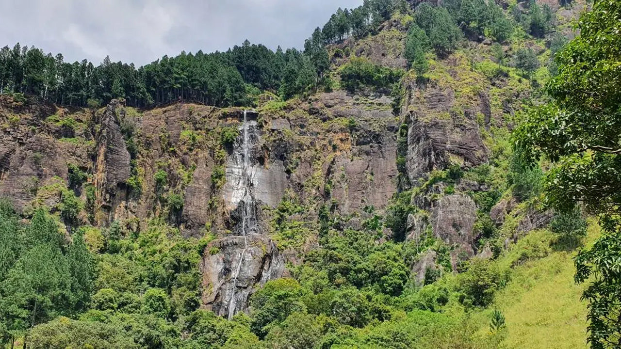 Pic de Bambarakanda
Le pic de Bambarakanda se situe dans le district de Badulla, au Sri Lanka, dans la province d'Uva. Il fait partie des hauts plateaux centraux et se trouve à proximité des célèbres chutes de Bambarakanda, les plus hautes du Sri Lanka. La région est réputée pour sa végétation luxuriante, son climat frais et ses paysages naturels exceptionnels.
-
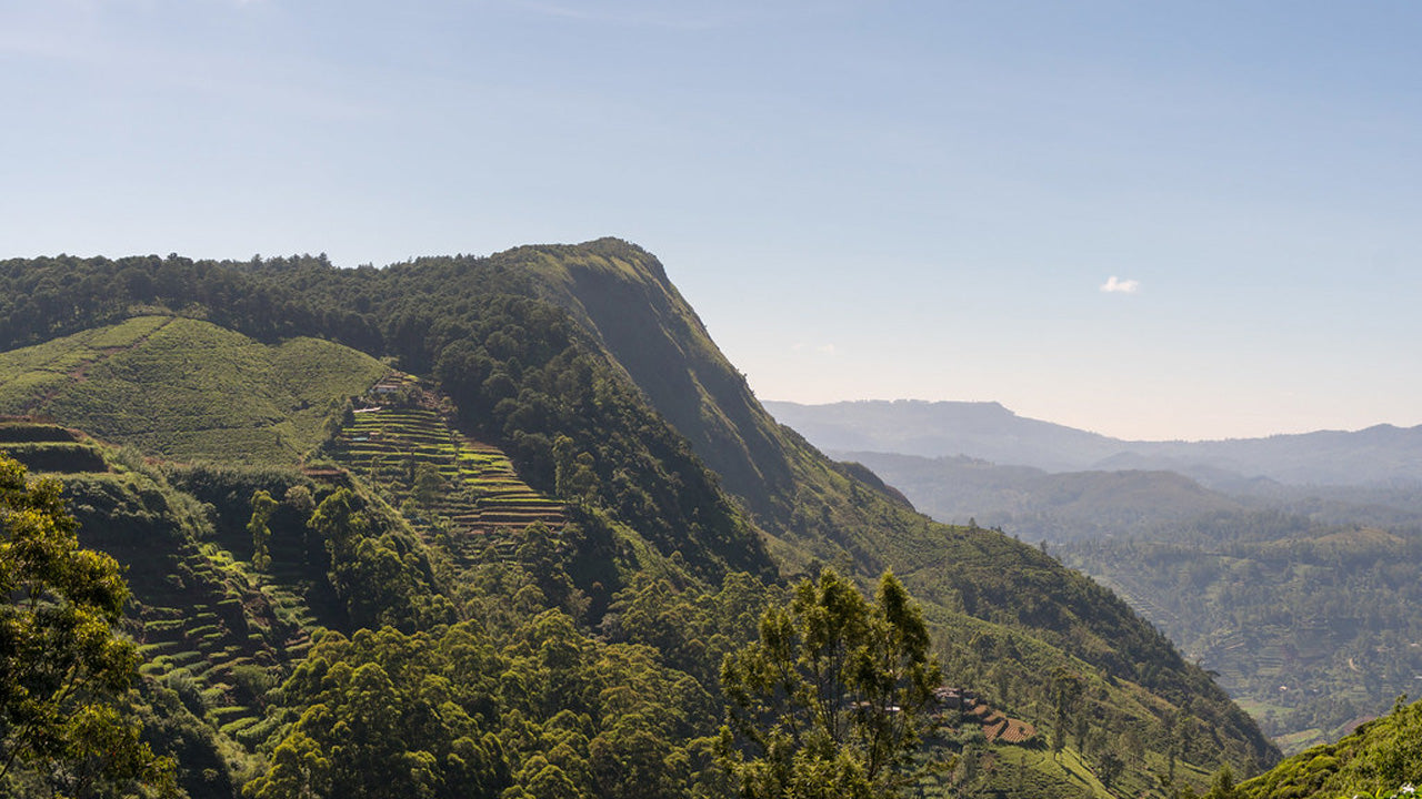
 Pic de Riverston
Le pic Riverston, au Sri Lanka, est accessible en empruntant la route Matale–Girandurukotte, à environ 30 km de la ville de Matale. Cette route sinueuse et isolée, avec ses virages en épingle à cheveux, offre des panoramas exceptionnels sur la campagne environnante, au point qu'on la surnomme le « Mini Bout du Monde ».