Narangala


Narangala es una hermosa colina que se eleva a más de 1500 metros en la provincia de Uva, Sri Lanka. La cima de este segundo monte más alto de Uva ofrece algunas de las mejores vistas en toda la isla tropical. Además, el desafío razonable que representa escalarla la ha convertido en una de las favoritas entre los excursionistas.
Punto de senderismo: Cima de Narangala
Altura: 1527 m
Dificultad: Media
Qué llevar puesto: Botas de senderismo con buen agarre, ropa abrigada
Qué llevar: Botella de agua, barras energéticas, repelente de insectos
Descripción de la ruta:
El sendero comienza en la zona de la plantación Thangamalai. El nombre significa literalmente 'Montaña Dorada' en tamil y proviene de los dorados pastos que cubren las laderas de Narangala. Una de las características más destacadas de Narangala es su pico rectangular, lo que lo hace muy atractivo incluso desde lejos.
Los excursionistas deben estacionar sus vehículos en el templo hindú en la plantación. Si no tienes guía, algunos de los lugareños estarán encantados de ayudarte con las indicaciones. Tendrás que caminar por pequeños senderos en la plantación de té hasta encontrar una gran tubería que suministra agua a la plantación. Luego seguirás la tubería hasta llegar a una carretera que atraviesa la plantación. Habrá muchas vistas hermosas de las laderas cubiertas de los brillantes arbustos de té, que puedes fotografiar. Después de seguir la carretera de la plantación durante un rato, llegarás al punto donde comenzarás a subir la montaña.
La primera parte de la subida será a través de un bosque de árboles de trementina. Las hojas caídas de estos árboles son muy resbaladizas, lo que hace que el terreno sea bastante traicionero, especialmente por la pendiente. Sin embargo, caminar a través de las doradas hierbas de las laderas de Narangala es idílico,
lo que compensa la dificultad para llegar a ellas. Se pueden ver algunos animales salvajes y sus huellas, así que ve con cuidado sin perturbarlos. Cruzarás cuatro de los picos más bajos de Narangala, todos con excelentes vistas, antes de llegar a la cima.
La vista que se extiende ante ti será impresionante. Podrás ver entre los valles de los ríos Uma Oya, Badulu Oya y Loggal Oya, y obtener una vista aérea de las llanuras aluviales de Mahaweli, que se extienden hasta Trincomalee. También se pueden ver las lejanas montañas Kehelpathdoruwa y Yahanagala, la cordillera Nayabedda, Madulsima y Poonagala, la brecha Idalgasinna y el Haputale Gap. Las suaves colinas de Randenigala y los verdes de las Horton Plains también son visibles. El gigante de la cordillera Namunakula está mucho más cerca, con muchos otros lugares que puedes ver e identificar. Estos hermosos paisajes se extienden desde la cima en un panorama colorido, como los que solo se ven en pinturas.
La cima en sí tiene un área plana donde puedes descansar y refrescarte antes de comenzar el descenso. Pero asegúrate de no dejar basura. El recorrido completo tomará entre seis y ocho horas, dependiendo de tu experiencia y ritmo.

Lugares especiales en Badulla
-
 Muthiyangana Raja Maha Vihara
Muthiyanganaya Raja Maha Viharaya se encuentra en el centro de la ciudad de Badulla. La historia de este templo se remonta a la época de Buda, pero la zona alrededor de Badulla se remonta a los siglos XIX y XVIII a. C.
-
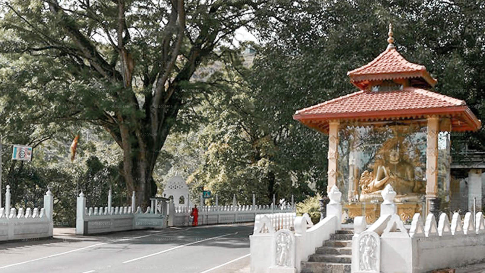 Dowa Raja Maha Viharaya
El Dowa Raja Maha Viharaya (Templo del Cabo Dowa) se encuentra a pocos kilómetros de Bandarawela, en la carretera Bandarawela-Badulla. Se cree que este templo fue construido por el rey Walagamba en el siglo I a. C.
-
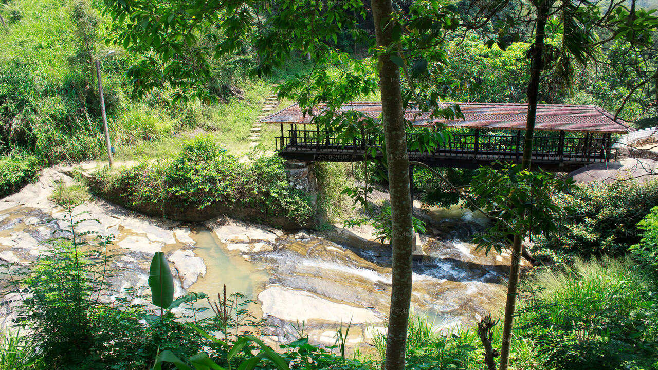 Puente de madera de Bogoda
El puente de madera de Bogoda se construyó en el siglo XVI, durante la era Dambadeniya. Se dice que es el puente de madera más antiguo que se conserva en Sri Lanka. Está situado a 7 kilómetros (4,3 millas) al oeste de Badulla.
-
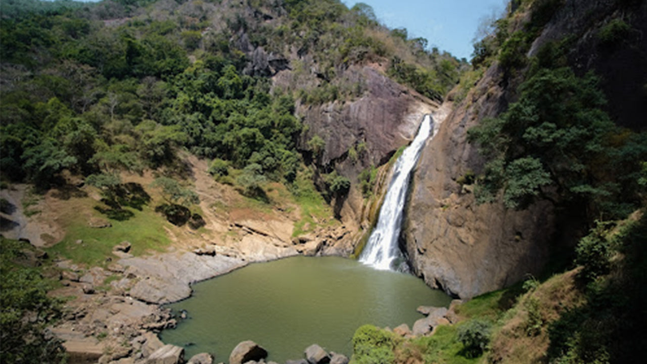 Cataratas de Dunhinda
Las cataratas Dunhinda se encuentran a unos 5 km de la ciudad de Badulla. Tienen 63 metros de altura y se consideran unas de las más hermosas de Sri Lanka. Su nombre se debe a las humeantes gotas de rocío que salpican.