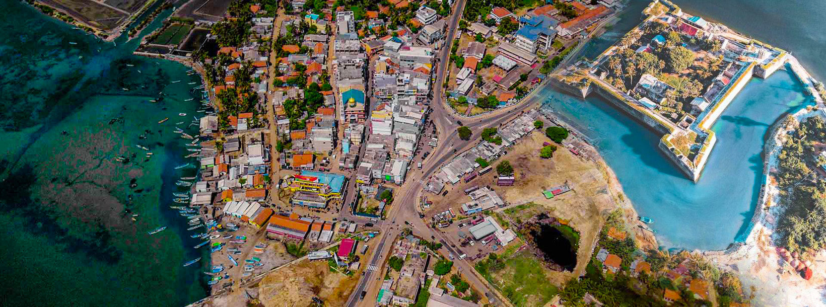
مدينة مانار
مانار هي المدينة الرئيسية في مقاطعة مانار، التابعة للإقليم الشمالي في سريلانكا. وتُدار من قبل مجلس بلدي. تقع المدينة على جزيرة مانار المطلة على خليج مانار، وتضم معبد كيثيسوارام التاريخي.
Mannar Beach
Mannar Beach, located on the northwest coast of Sri Lanka, is known for its unspoiled beauty, extensive sandy shores, and tranquil ambiance. This beach offers a unique and remote coastal experience, ideal for travelers looking to escape the more crowded tourist spots and immerse themselves in natural beauty.
Secluded and Serene
Mannar Beach features long stretches of untouched golden sand and clear, calm waters. The beach’s remote location ensures a peaceful atmosphere, perfect for those seeking solitude and relaxation away from bustling tourist areas.
Fishing and Local Culture
Fishing is an integral part of life in Mannar, and visitors can witness local fishermen at work using traditional methods. The area is rich in local culture and provides opportunities to experience the daily life and customs of the coastal communities.
Historical and Cultural Sites
Nearby Mannar Town offers several historical and cultural attractions:
- Mannar Fort: Built by the Portuguese in the 17th century and later expanded by the Dutch, this fort offers insights into the region’s colonial past and provides panoramic views of the surrounding area.
- Baobab Tree: An unusual and impressive baobab tree located in the Mannar area, which is one of the few of its kind in Sri Lanka. This tree has become a local landmark and provides a unique photo opportunity.
- Adam’s Bridge (Rama's Bridge): Although not directly on the beach, the nearby Adam’s Bridge is a historic site of interest, believed to be a chain of limestone shoals that once connected Sri Lanka to India.
Wildlife and Bird Watching
The region around Mannar Beach is known for its diverse birdlife. Birdwatchers can spot a variety of species, including migratory birds that visit the area during certain times of the year. The nearby Mannar Island is also known for its wildlife and natural beauty.
Local Cuisine
In Mannar, visitors can enjoy traditional Sri Lankan cuisine with a focus on fresh seafood. Local dishes such as fish curry, crab curry, and prawn dishes are commonly available at local eateries, offering a taste of the region’s culinary heritage.
Accommodation
Accommodation options in Mannar are relatively modest compared to more developed tourist areas. Visitors can find a range of guesthouses and small hotels that offer basic amenities and a comfortable stay. Many of these accommodations provide easy access to the beach and local attractions.
Best Time to Visit:
The best time to visit Mannar Beach is from November to April, when the weather is dry and sunny, providing ideal conditions for beach activities and exploring the local area. The monsoon season typically starts in May, bringing rain and rougher sea conditions.
منطقة مانار
مانار هي عاصمة منطقة مانار في سريلانكا. تقع منطقة مانار في الجزء الشمالي الغربي من سريلانكا، وهي واحدة من خمس مناطق إدارية تابعة للإقليم الشمالي. تبلغ مساحة المنطقة 2,002 كيلومتر مربع، أي ما يقارب 3% من إجمالي مساحة اليابسة في سريلانكا.
جغرافيًا، يقع معظم مانار في البر الرئيسي ضمن المنطقة الجافة وشبه القاحلة. يتميز المناخ بدرجات حرارة مرتفعة وقلة هطول الأمطار. تتراوح درجات الحرارة الشهرية بين 26.5 درجة مئوية و30.0 درجة مئوية، مع تسجيل أعلى الدرجات عادة بين شهري مايو وأغسطس. تتلقى مانار نحو 60% من أمطارها خلال موسم الرياح الموسمية الشمالية الشرقية، والذي يمتد من أكتوبر إلى ديسمبر.
تتميز المنطقة بأراضٍ منبسطة نسبيًا وعلى ارتفاعات منخفضة. وفي المناطق الداخلية، يصبح التضاريس متموجة بشكل خفيف، مما يساعد على تخزين مياه الأمطار في الخزانات التي توفر معظم مياه الري للأراضي الزراعية الصالحة للزراعة في المنطقة. وتتمثل الأنشطة الاقتصادية الرئيسية في مانار في زراعة المحاصيل (وخاصة الأرز)، وصيد الأسماك، وتربية الحيوانات. وتعد فرص العمل موسمية إلى حد كبير، ولا توجد مؤسسات للتعليم العالي في المنطقة.
الإقليم الشمالي
الإقليم الشمالي هو واحد من الأقاليم التسعة في سريلانكا. وقد وُجد نظام الأقاليم منذ القرن التاسع عشر، لكنه لم يكتسب صفة قانونية إلا في عام 1987 عندما أنشأ التعديل الثالث عشر لدستور عام 1978 مجالس الأقاليم. وبين عامي 1988 و2006، تم دمج الإقليم مؤقتًا مع الإقليم الشرقي لتشكيل إقليم الشمال الشرقي. عاصمة الإقليم هي جافنا.
يقع الإقليم الشمالي في شمال سريلانكا، ويبعد مسافة 22 ميلًا (35 كيلومترًا) فقط عن الهند. يحده من الغرب خليج مانار وخليج بالك، ومن الشمال مضيق بالك، ومن الشرق خليج البنغال، ومن الجنوب الأقاليم الشرقية والوسطى الشمالية والشمالية الغربية.
يضم الإقليم عددًا من البحيرات الساحلية (اللاجونات)، وأكبرها لاجون جافنا، وننتي كادال، وتشونديكولام لاجون، وفاداماراتشي لاجون، وأوبو آرو لاجون، وكوككلاي لاجون، وناي آرو لاجون، وتشالاي لاجون. كما تقع معظم الجزر المحيطة بسريلانكا إلى الغرب من الإقليم الشمالي. وأكبر هذه الجزر كايتس، وندونتيفو، وكارايتيفو، وبونغودوتيفو، ومانداتيفو.
بلغ عدد سكان الإقليم الشمالي 1,311,776 نسمة في عام 2007. يشكل التاميل السريلانكيون الأغلبية السكانية، مع وجود أقلية من المسلمين السريلانكيين والسنهاليين. وتعد اللغة التاميلية السريلانكية اللغة الرئيسية التي يتحدث بها غالبية السكان، بينما يتحدث حوالي 1% من السكان اللغة السنهالية. كما تُستخدم اللغة الإنجليزية على نطاق واسع ويتم فهمها في المدن.