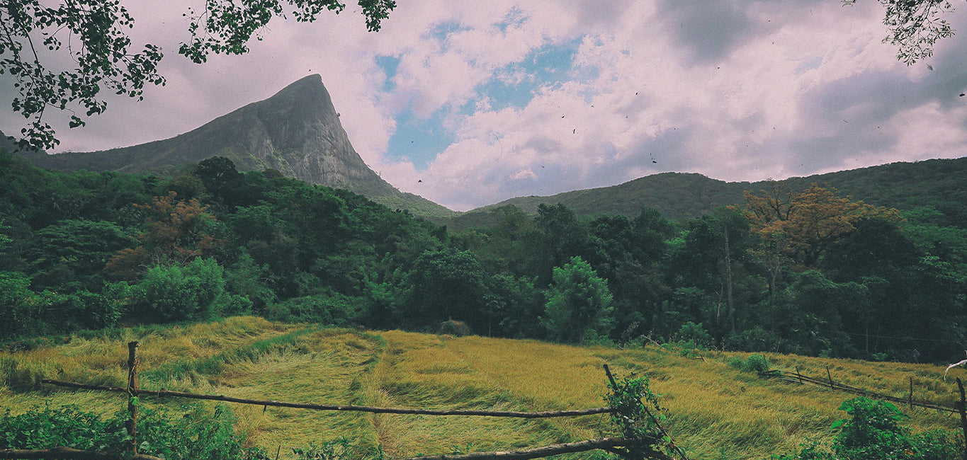
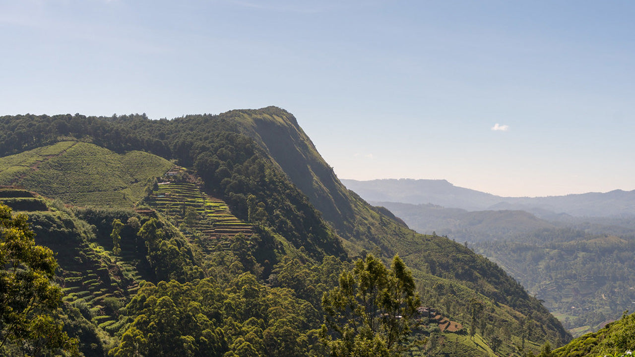
Katusu Konda


Katusu Konda, nestled in the Hanthana Mountain Range near Kandy, is a must-visit destination for hikers and nature enthusiasts. Its name, which translates to "Lizard's Back," comes from its unique shape resembling a lizard's spine. This peak offers an adventurous and rewarding experience, making it a hidden gem in Sri Lanka’s hiking trails.
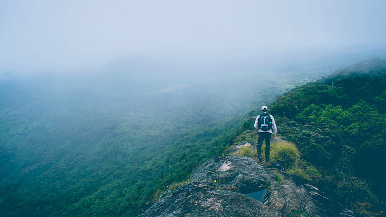
The journey begins with a picturesque trail through the rolling landscapes of the Hanthana hills, surrounded by lush greenery and a cool, refreshing climate. The initial part of the hike is relatively easy, but as you ascend, the adventure truly begins. The trail becomes narrower, leading to the summit's razor-edge ridge. Strong winds sweep across the peak, adding to the adrenaline-filled experience, while the steep drop-offs on either side provide both thrill and awe.
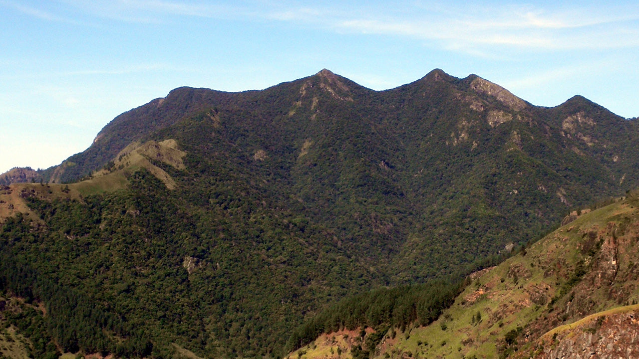
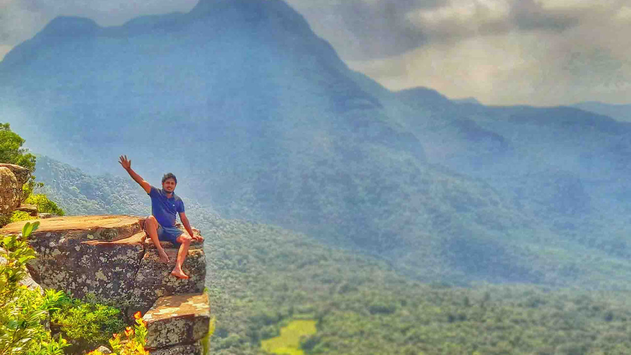
The summit rewards hikers with breathtaking 360-degree views. On a clear day, you can see the majestic Knuckles Mountain Range, the city of Kandy with its iconic landmarks, the sprawling University of Peradeniya campus, and distant landmarks such as Monaragala, Alagalla, and Hunnasgiriya. The interplay of mist, sunlight, and the endless green hills creates a magical and serene atmosphere, ideal for photography or quiet reflection.
Although the trail is not overly challenging, there are precautions hikers should take. The summit can become slippery and dangerous during rainy weather, so it’s best to check the forecast before starting. Sturdy footwear is essential, as is carrying water and light snacks for energy. Beginning the hike early in the morning allows you to enjoy cooler weather and possibly catch the sunrise. First-time hikers are encouraged to hire a local guide, as the terrain can be confusing at certain points.
Katusu Konda is more than just a hike—it’s a blend of adrenaline, natural beauty, and tranquility. Whether you’re an experienced trekker or a curious traveler, this peak offers an experience that lingers long after you descend. After conquering Katusu Konda, nearby attractions like the Hanthana Tea Museum or the tranquil Kandy Lake offer further exploration to round out your adventure.


-
 كيريغالبوتا
يبلغ ارتفاع جبل كيريغالبوثا في سريلانكا 2388 متراً (7835 قدماً) فوق مستوى سطح البحر، ويطلّ على مدينة نوارا إليا، مُلقياً بظلاله على المدينة الرئيسية. يُعدّ هذا الجبل ثاني أعلى جبل في سريلانكا، الجزيرة الساحرة، وأعلى جبالها على الإطلاق.
-
 ثوتوبولا كاندا
يُعدّ جبل توتابولاكاندا ثالث أعلى جبل في سريلانكا، ويقع في مقاطعة نوارا إليا على ارتفاع 2357 مترًا فوق مستوى سطح البحر. يقع الجبل ضمن حدود منتزه هورتون بلينز الوطني. ويبدأ مسارٌ إلى قمته، يبلغ طوله حوالي كيلومترين، على بُعد أمتار قليلة من مدخل باتيبولا إلى منتزه هورتون بلينز الوطني.
-
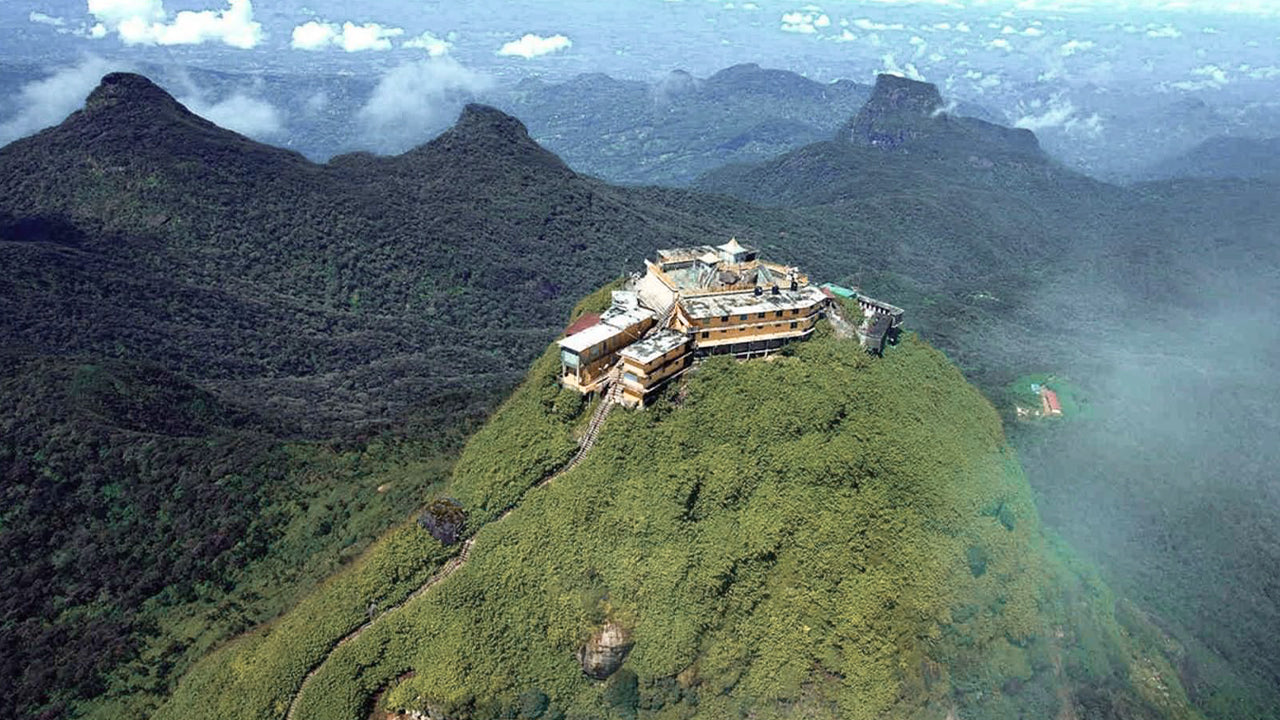 قمة آدم (جبل سري بادا)
أشهر المعالم الطبيعية في سيلان هي قمة آدم، الواقعة في مقاطعة راتنابورا. تقع القمة على حافة الكتلة الجبلية المركزية، لكن المجموعة الجبلية المحيطة بها تُعرف باسم برية القمة. يبلغ ارتفاعها حوالي 7500 قدم، وهي ثاني أعلى قمة في البلاد.
-
 قمة هاكغالا
تقع قمة هاكغالا في المرتفعات الوسطى لسريلانكا، ضمن محمية هاكغالا الطبيعية الصارمة. وهي تقع بالقرب من مدينة نوارا إليا، وتُعد جزءًا من منطقة المرتفعات الوسطى، المعروفة بمناظرها الطبيعية الخلابة ومناخها المعتدل.
-
 جوموليا
تقع قمة غوموليا ضمن سلسلة جبال ناكلز في وسط سريلانكا، وهي موقع تراث عالمي لليونسكو تشتهر بتنوعها البيولوجي وجمالها الطبيعي الخلاب. تقع القمة في مقاطعة كاندي، الواقعة في المرتفعات الوسطى لسريلانكا.
-
 قمة بامباراكاندا
تقع قمة بامباراكندا في مقاطعة بادولا بسريلانكا، ضمن إقليم أوفا. وهي جزء من المرتفعات الوسطى، وتقع بالقرب من شلالات بامباراكندا الشهيرة، وهي أعلى شلالات سريلانكا. تشتهر المنطقة بخضرتها الوارفة، ومناخها المعتدل، وجمالها الطبيعي الخلاب.
-
 قمة ريفرستون
يمكن الوصول إلى قمة ريفرستون في سريلانكا عبر السفر لمسافة 30 كيلومتراً تقريباً من مدينة ماتالي، على طول طريق ماتالي - جيراندوروكوت. يوفر هذا الطريق المتعرج والمنعطفات الحادة بعضاً من أجمل المناظر الطبيعية المحيطة، حتى أنه يُطلق عليه اسم "نهاية العالم المصغرة".