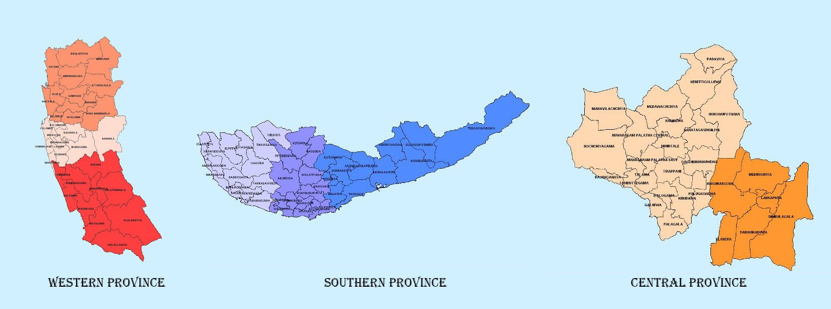
Eastern Province

Another province of Sri Lanka mostly known for its golden beaches and the natural harbour, the Eastern Province which is 9,996 km2 in extent consists of three administrative districts namely Trincomalee, Batticaloa and Ampara. Between 1988 and 2006 the province was temporarily merged with the Northern Province to form the North-East Province. However, the North-East Province North-East Province was formally de-merged into the Northern and Eastern provinces on 1? January 2007 according to a ruling of the Supreme Court.

The province is surrounded by the Northern Province on the north, the Bay of Bengal on the east, the Southern Province on the south, and the Uva, Central and North Central provinces on the west. The province’s coast is dominated by lagoons, the largest being Batticaloa Lagoon, Kokkilai lagoon, Upaar Lagoon and Ullackalie Lagoon.

Trincomalee is the capital of the Eastern Province lying on the east coast of the island, about 113 miles south of Jaffna. Trincomalee is world famous for the natural deep water harbour. The city is built on a peninsula, which divides the inner and outer harbours. The city is home to the famous ancient Koneswaram temple alluded to in its historic Tamil name Thirukonamalai from which its anglicized name is derived, and has been a sea port that has played a major role in the maritime and international trading history of Sri Lanka. It is referred to as Gokanna in Pali or Gokarna in Sanskrit.

The Bay of Trincomalee harbour is renowned for its large size and security; unlike every other in the Indian Sea, it is accessible to all types of craft in all weathers. The beaches are used for urfing, scuba diving, fishing and whale watching. The city lso has the largest Dutch fort in Sri Lanka. It is home to major Sri Lankan naval bases and a Sri Lankan Air Force base. The town is situated on a hill at the end of a natural land formation that resembles an arc; the temple is built on Swami Rock, historically referred to as Kona-ma-Malai, a cliff on the peninsula that drops 400 feet directly into the sea.

Trincomalee, a natural deep-water harbour, has attracted seafarers like Marco Polo, Ptolemy and sea traders from China and East Asia since ancient times. Trinco, as it is commonly called, has been a sea port since the days of the ancient Sri Lankan kings. The earliest known reference to the port of Gokanna is found in the Mahavamsa stating that in 5th century BC, when King Vijaya who having failed to convince his brother to come to Sri Lanka as his successor, got down his youngest son Panduvasdeva, who landed at Gokanna and was subsequently enthroned at Upatissagama.

Trincomalee has many places of worship. Among them is the Konesvaram shrine which was demolished in 1622 by the Portuguese (who called it the Temple of a Thousand Columns), and who fortified the heights with the materials derived from its destruction. Some of the artefacts from the demolished temple were kept in the Lisbon Museum including the stone inscriptions.

The entrance to the roadway leading to Koneswaram is actually the entrance to what used to be Fort Fredrick. The fort was built in 1623 by the Portuguese and captured in 1639 by the Dutch. It then went through a phase of dismantling and reconstruction and was attacked and captured by the French in 1672.

Trincomalee strategic importance has shaped

  • 스리랑카에서 인구 밀도가 가장 높은 서부 주는 면적 3,593km²에 달하며, 입법 수도인 스리 자야와르데네푸라와 상업 중심지인 콜롬보가 위치해 있습니다.
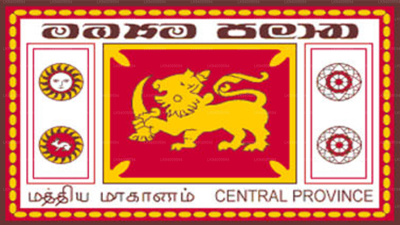
    서부 지방 
  • 스리랑카 중부 산악 지대에 위치한 중부 주는 캔디, 마탈레, 누와라엘리야의 세 행정 구역으로 구성되어 있습니다. 면적은 5,575km²로 스리랑카 전체 면적의 8.6%를 차지합니다.

    중부 지방 
  • 스리랑카 남부 주는 갈레, 마타라, 함반토타의 세 개 지역으로 이루어진 작은 지리적 지역입니다. 이 지역 주민 대다수의 주요 소득원은 농업과 어업입니다.
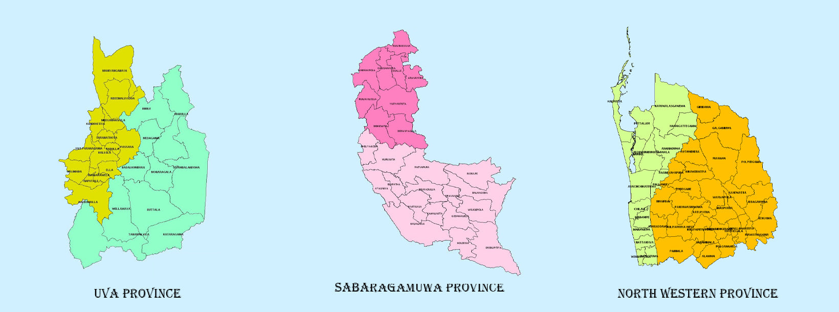
    남부 지방 
  • 우바 주는 바둘라와 모네라갈라 두 개의 행정구역으로 이루어져 있으며, 주도는 바둘라입니다. 우바 주는 동부, 남부, 중부 주와 접해 있습니다.

    우바 주 
  • 사바라가무와는 스리랑카의 남중부 지역에 위치한 또 다른 주이며, 라트나푸라와 케갈레라는 두 개의 행정 구역으로 구성되어 있습니다.

    사바라가무와 주 
  • 북서부 주는 쿠루네갈라와 푸탈람 두 개의 행정 구역으로 구성되어 있습니다. 주도는 쿠루네갈라이며 인구는 28,571명입니다. 이 지역은 코코넛 농장으로 유명합니다.
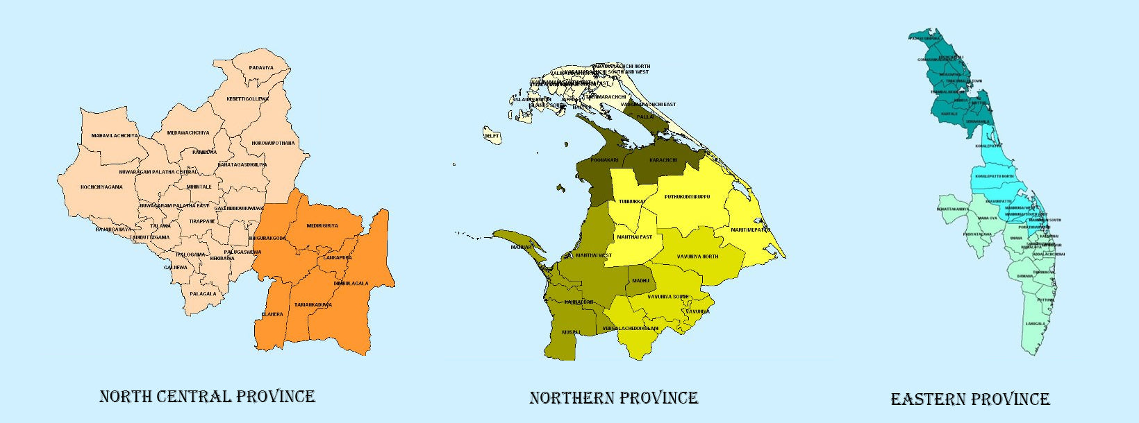
    노스웨스턴 주 
  • 스리랑카에서 가장 큰 주인 북중부 주는 건조 지대에 위치하며 면적은 10,714km²이고, 아누라다푸라와 폴론나루와 두 개의 행정 구역으로 구성되어 있습니다.

    북중부 지방 
  • 스리랑카 북부에 위치한 북부 주는 인도와 불과 35km 떨어져 있습니다. 면적은 8,884km²입니다. 서쪽으로는 만나르 만과 팔크 만, 북서쪽으로는 팔크 해협, 북쪽과 동쪽으로는 벵골 만, 남쪽으로는 동부, 북중부, 북서부 주와 접해 있습니다.

    북부 지방 
  • 황금빛 해변과 천연 항구로 유명한 스리랑카의 또 다른 주, 동부 주는 면적이 9,996km²에 달하며 트린코말리, 바티칼로아, 암파라의 세 행정 구역으로 구성되어 있습니다.

    동부 지방