
Batticaloa lagoon


Batticaloa Lagoon, located in the Eastern Province of Sri Lanka, is one of the island's most scenic and culturally significant coastal lagoons. Stretching along the Batticaloa District and surrounded by small villages, mangroves, and sandy shores, the lagoon is famous for its calm waters and natural beauty. Known as the "Land of the Singing Fish," Batticaloa Lagoon is renowned for a rare natural phenomenon where fish create musical vibrations that can sometimes be heard at night. Its tranquil atmosphere and unique ecosystem make it a remarkable destination for nature lovers and cultural explorers.
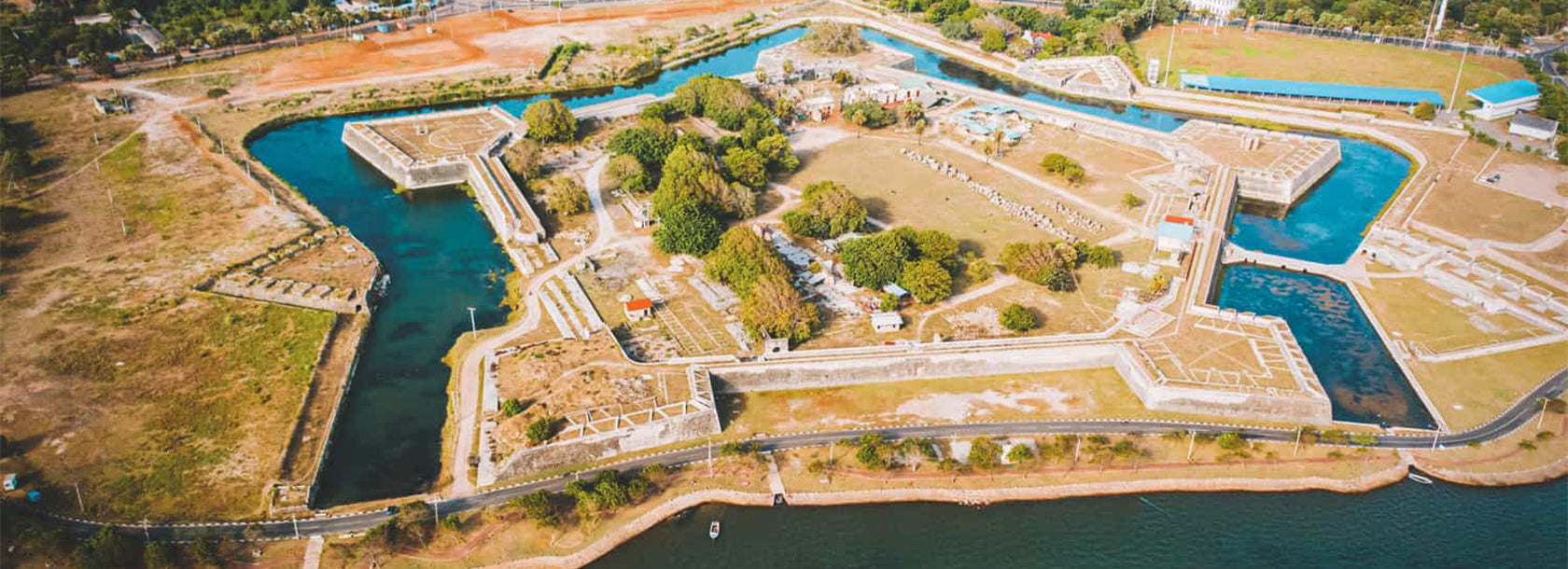
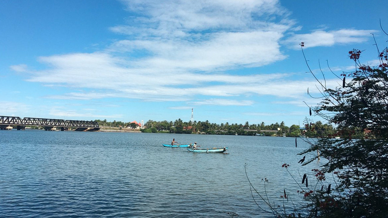
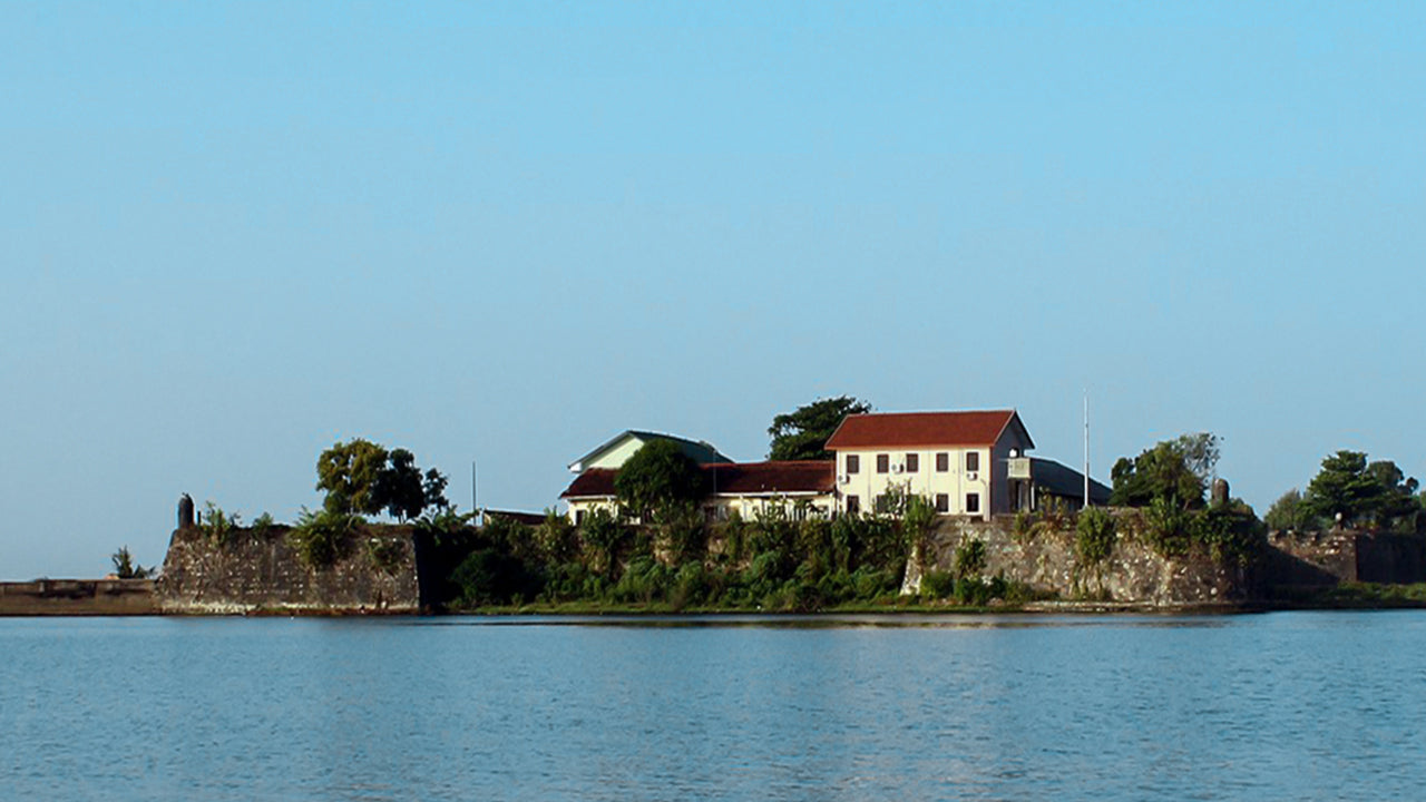
The lagoon is rich in biodiversity and is home to mangroves, coconut groves, and various species of birds and fish. The waters support traditional fishing communities, and the surrounding wetlands are crucial habitats for aquatic life. The area is also known for its beautiful bridges, narrow islands, and the scenic view of the Batticaloa Dutch Fort across the lagoon, highlighting the connection between nature, culture, and Sri Lanka's colonial heritage.
Visitors can experience a variety of activities at Batticaloa Lagoon, including catamaran rides, kayaking, and birdwatching along the peaceful shoreline. Local fishermen often offer boat tours, allowing travelers to explore small islands and observe traditional lagoon-based fishing methods. The calm surroundings make it an ideal spot for photography, reflection, and witnessing everyday lagoon life, while nearby cafes serve fresh seafood and popular eastern-style curries.
The best time to visit Batticaloa Lagoon is during the dry season, from April to September, when the water is calm and visibility is ideal for water activities. The lagoon is easily accessible from Batticaloa town and can be combined with visits to nearby attractions such as Kallady Bridge, Pasikuda Beach, and the Batticaloa Lighthouse. Travelers exploring the eastern coast of Sri Lanka will find Batticaloa Lagoon an enriching experience, where natural beauty, lagoon culture, and history come together to form one of the most peaceful coastal landscapes in the country.


