Narangala


Narangala on ilus mägi, mis tõuseb Sri Lankal Uva provintsis üle 1500 meetri kõrgusele. Selle teise kõrgeima mäe tipp Uvas pakub mõningaid parimaid vaateid kogu troopilisel saarel. Lisaks on selle tippude vallutamise mõõdukas väljakutse teinud selle matkaja seas väga populaarseks.
Matkamiskoht: Narangala tipp
Kõrgus: 1527 m
Raskusaste: Keskmine
Mida kanda: Matkasaapad, mis pakuvad head haardet, soe riietus
Mida võtta: Veepudel, energiatooted, putukate tõrjevahend
Raja kirjeldus:
Matkarada algab Thangamalai istanduse piirkonnas. Nimi tähendab tamili keeles sõna otseses mõttes "Kuldne mägi" ja see tuleneb Narangala nõlvadel kasvavatest kuldsetest rohudest. Üks Narangala kõige silmapaistvamaid jooni on selle teravneljarealine tipp, mis muudab selle kaugeltki atraktiivseks vaateks.
Matkajad peaksid oma autod parkima istanduses asuva hindu templi juurde. Kui teil pole giidi, on mõned kohalikud valmis teid juhatama. Peate minema mööda väikeseid jalgteid tees istanduses, kuni leiate suure toru, mis toob vett istandusse. Siis järgite toru, kuni jõuate tee juurde, mis läbib istandust. Seal on palju ilusaid vaateid nõlvadele, mis on kaetud ereroheliste teepõõsastega, mida saate pildistada. Pärast tee mõnda aega järgimist jõuate punkti, kust algab mäkke minek.
Esialgne osa tõusust viib teid terpentini puude all. Nende puude lehed on väga libedad, mis muudab liikumise raskeks, eriti järskudel nõlvadel. Siiski on matka läbimine Narangala kuldsete rohumaade kaudu idülliline,
mis tasub end ära raskustes, et sinna jõuda. Aeg-ajalt võib kohata metsloomi ja nende jälgi, nii et minge ettevaatlikult, et neid mitte häirida. Ületate Narangala neli madalamat tippu, igaühes suurepärased vaated, enne kui jõuate tippu.
Vaade, mis avaneb teie ees, on hingematvalt ilus. Näete Uma Oya, Badulu Oya ja Loggal Oya jõgede vahelisi orgusid ja saate linnulennult vaadata Mahaweli tasandikke, mis ulatuvad Trincomaleeni. Samuti näete kaugel asuvaid Kehelpathdoruwa ja Yahanagala mägesid, Nayabedda, Madulsima ja Poonagala mäestikke, Idalgasinna kuristiku ja Haputale kuristiku. Randenigala nõlvad ja Horton Plainsi rohelised alad on samuti nähtavad. Namunakula mäeahelik asub palju lähemal, paljude teiste kohtadega, mida saab tuvastada. Need kaunid maastikud sirutuvad tipust värvilisse panoramasse, mida nähakse ainult maalikunstis.
Tipul on tasane ala, kus saate puhata ja enne laskumist värskendada. Kuid veenduge, et te ei jäta prügi maha. Kogu matka kestus sõltub teie kogemusest ja tempos, kuid see võtab aega kuuest kuni kaheksatundi.

Erilised kohad Badullas
-
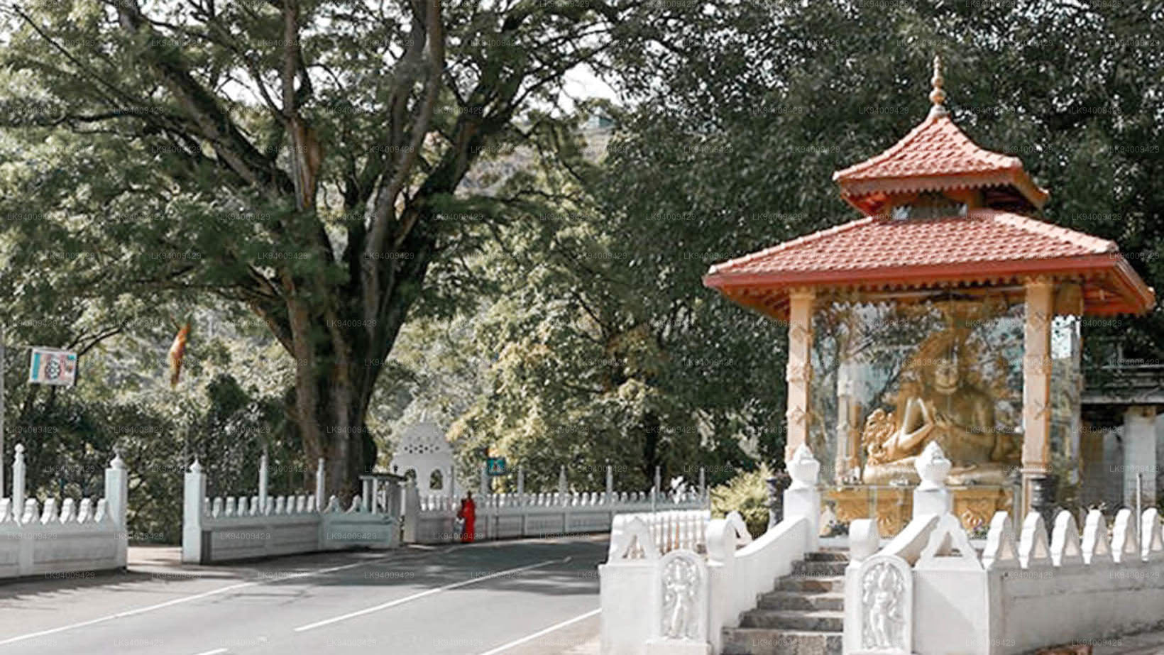
 Muthiyangana Raja Maha Vihara
Muthiyanganaya Raja Maha Viharaya asub Badulla linna keskel. Selle templi ajalugu ulatub tagasi Buddha aega, kuid Badulla ümbruse piirkond ulatub tagasi 19.–18. sajandisse eKr.
-
 Dowa Raja Maha Viharaya
Dowa Raja Maha Viharaya (Dowa neeme tempel) asub Bandarawela linnast mõne kilomeetri kaugusel Bandarawela-Badulla teel. Arvatakse, et selle templi ehitas kuningas Walagamba esimesel sajandil eKr.
-
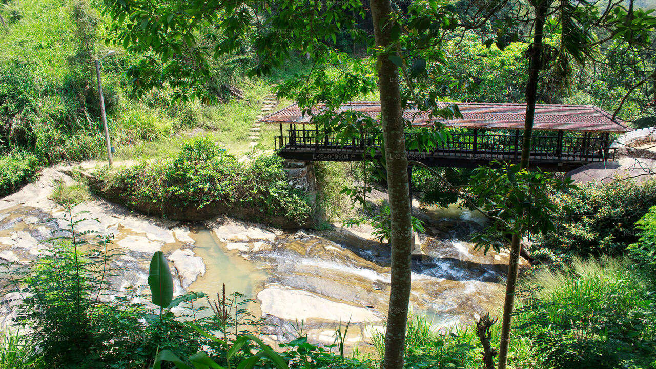 Bogoda puidust sild
Bogoda puusild ehitati 16. sajandil Dambadeniya ajastul. Väidetavalt on see Sri Lanka vanim säilinud puusild. Sild asub Badullast 7 kilomeetrit läänes.
-
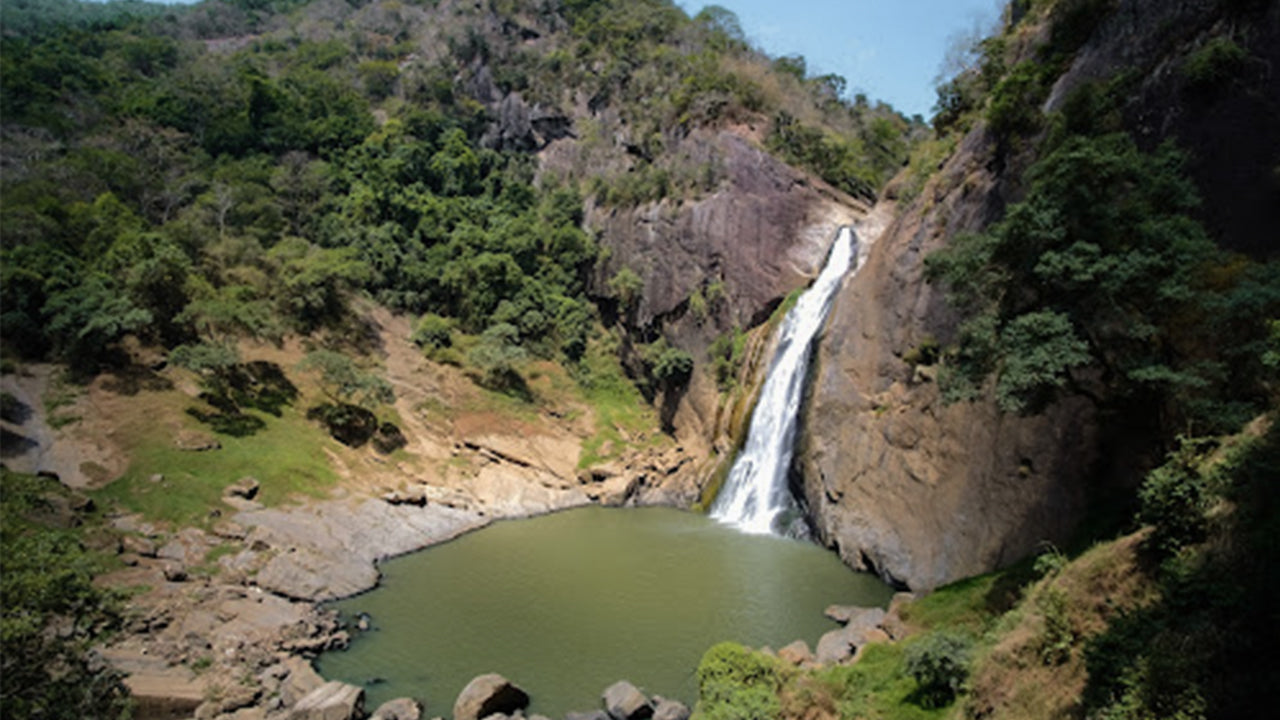 Dunhinda juga
Dunhinda juga asub umbes 5 km kaugusel Badulla linnast. See on 63 meetrit kõrge ja seda peetakse üheks Sri Lanka kaunimaks jugaks. Juga on oma nime saanud suitsuste kastepiiskade järgi.