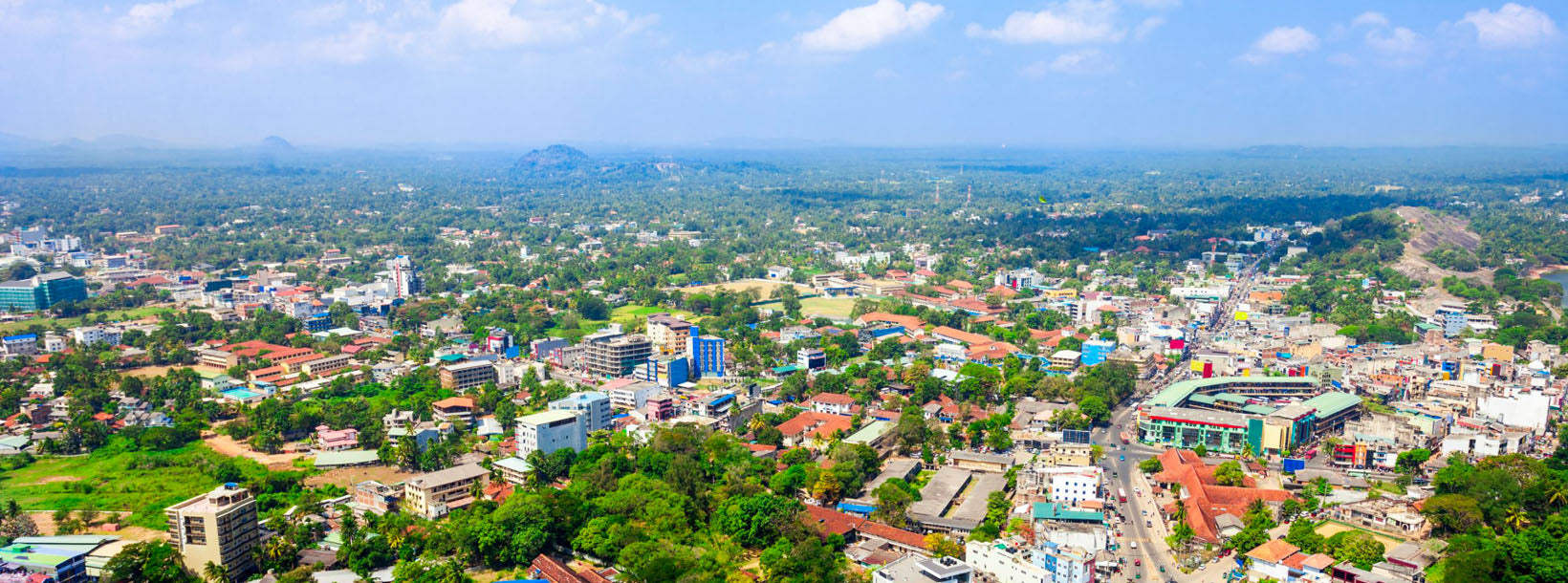
Kurunegala City
Kurunegala: Bustling city in Sri Lanka's North Western Province, featuring historic sites, vibrant markets, and a blend of modern and traditional culture.
Dambadeniya
Dambadeniya (DMBD) is een oude vervallen stad gelegen in de Noordwestelijke Provincie (Wayamba), Sri Lanka aan de hoofdweg Kurunegala–Negombo. Het diende als de hoofdstad van Sri Lanka in het midden van de 13e eeuw. Een groot deel van Dambadeniya ligt nog steeds begraven op een enorme versterkte rots. Dambadeniya ligt ongeveer 31 km van Kurunegala, de moderne hoofdstad van de Noordwestelijke Provincie. Dambadeniya ligt ongeveer 4 km van Giriulla.
Dambadeniya, ongeveer 30 km ten zuidwesten van Kurunegala, werd prominent in het midden van de 13e eeuw.[1] Het werd geselecteerd als de hoofdstad van het koninkrijk Sri Lanka door koning Vijayabahu III (1232–36). De soevereiniteit van het land was in gevaar als gevolg van invasies die Polonnaruwa als hoofdstad verdrongen. Vijayabahu, de koning van de Dambadeniya-dynastie, vocht tegen de indringers en vestigde Dambadeniya. Op de top van de Dambadeniya-rots bouwde hij versterkingen en stevige muren en poorten. De stad werd beveiligd door een gracht, een moeras en wallen rond het koninklijk paleis. Tijdens de regering van koning Parakramabahu II (1236–70) bereikte Dambadeniya het toppunt van zijn glorie. Koning Parakramabahu II's onberispelijke poëtische meesterwerken "Kavisilumina" en "Visuddi Marga Sannasa" gaven een keerpunt aan de Singalese literatuur. Het Dambadeniya-tijdperk was de reden waarom de Singalese literatuur niet beperkt bleef tot schilderijen of geschriften.
Over het Kurunegala District
Kurunegala is een district in de Noordwestelijke Provincie, Sri Lanka. Bestaat uit 4812,7 km², 48.1270 hectare en bestaat uit 30 Divisional Secretariaten, 1610 Grama Niladari Divisions en in totaal 4476 dorpen. Het bestaat uit 14 Kiesdistricten, 2 Gemeentelijke Raden, 19 Stedelijke Raden, 15 Parlementaire Ministers, 47 Provinciale Raadsleden, 15 Ministers en 337 Lokale Raadsleden.
Gezien de geografische situatie van het Kurunegala District, wordt het begrensd door vijf Districten. In het noorden door het District Anuradhapura, in het oosten door het District Matale, in het zuiden door Gampaha en het District Kegalle en in het westen door het District Puttalam. De lengtegraad van het District is noorderbreedte 228-333 en oosterlengte 104-178.
About Kurunegala District
Kurunegala is the capital of the Wayamba Province in Sri Lanka and the Kurunegala District.Kurunegala was a royal capital for only 50 years, from the end of the 13th century to the start of the next, though even before this it was strategically placed in the middle of other majestic strongholds such as Yapahuwa to the north, Dambadeniya to the south and Panduwasnuwara in the east. Ethagala a rock reaching 316 meters, towers over the town, which is located at an altitude of 116 meters above sea level. The shape of Ethagala resembles an Elephant. A transport hub, it has a railway station, and several main roads linking important parts of the country.Kurunegala is situated about 94 km from Colombo, and 42 km from Kandy.
Most of Kurunegala's residents belong to the Sinhalese majority. Other ethnic minorities include the Sri Lankan Moors, Sri Lankan Tamils, Burghers and Malays. Residents from ethnic minorities live in all parts of the city, however, sizeable communities of Moors and Tamils also live in the areas of Teliyagonna and Wilgoda.
About North Western Province
North Western Province is a province of Sri Lanka. The districts of Kurunegala and Puttalam formulate North Western or Wayamba. Its capital is Kurunegala, which has a population of 28,571. The province is known mainly for its numerous coconut plantations. Other main towns in this province are Chilaw (24,712) and Puttalam (45,661), which are both small fishing towns. The majority of the population of Wayamba province is of Sinhalese ethnicity. There is also a substantial Sri Lankan Moor minority around Puttalam and Sri Lankan Tamils in Udappu and Munneswaram. Fishing, prawn farming and rubber tree plantations are other prominent industries of the region. The province has an area of 7,888 km² and a population of 2,184,136 (2005 calculation).
Wayamba is the third largest paddy producing area in Sri Lanka .Wayamba has a highly developed agricultural economy, growing a variety of fruits and vegetables, flowering plants, spices, oil-seeds in addition to the traditional plantation crops such as Coconut, Rubber and Rice. Rich soils and varied climate give Wayamba a potential for growing of virtually any crop.
In Wayamba or North western province, home for ancient Buddhist rock temples, magnificent citadels Panduwasnuwara, Dambadeniya, Yapahuwa and Kurunegala. Impressive remains of those citadels, palaces, Buddhist temples and monasteries provide exciting sight seeing to the visitors.