Kayts Fort
The Kayts Island Fort (Kayits Dupath Balakotuwa) was built by the Portuguese in 1629 and was abandoned in 1651. In the late 1600s, Dutch controlled the fort when they took over the Kayts island. During the Dutch rule, it was not normal to undergo restoration like the former forts of Portugal
The horseshoe shaped fort with four circular bastions was built to protect Jaffna Peninsula like other Portuguese forts in the peninsula. There was one of the primary commercial ports called “Urundai” beside the fort. Therefore, the fort was known as “Urundai Fort”. The Tamil word “Urundai” literally means sphere or round-shape
Known as Urathota (Uruthota) in the ancient times, Kayts was a major port in ancient Sri Lanka. According to the Nagadeepa Tamil inscription, during the reign of King Parakramabahu I (1153-1186), Urathota was a special port for Indian merchant ships and the king had paid special attention to ships carrying horses and elephants at this port.
Urathota got its name Kayts from the Portuguese. It’s a name derived from “Caes dos Elefantes“. The term means “elephant’s mouth”. The Portuguese came to call this port “Caes dos Elefantes” because Sri Lankan elephants were exported to India through this port. The name “Caes dos Elefantes” was simplified to “Cais“. After the expulsion of the Portuguese and the arrival of the Dutch in Jaffna, the name was further evolved in to “Kays” and later to “Kayts“.
The fort at Kayts was built by the Portuguese. Antonio Bocarro, who served as chronicler-general of the Portuguese State of India has made a note of the fort in 1635. He has called this fort “Fort at the Elephants Quay“. It is said that this fort is as big as the Mannar Fort but better shaped. It has two bastions on the land side and a breastwork on the seaside which is 35 meters long and 5.5 meters wide. It is not filled up, but raised on beams and the open gallery below cannot be protected in any manner because rain water pours in through the openings in the ground for the movement of the artillery. There are twelve open embrasures above at the height, from the ground level, of 2.5 meters and from the parapet of the embrasures upwards is 1.8 meters. The fort was equipped with 8 artillery pieces, three 8 pounders, three 6 pounders and two 5 pounders. There has been enough space for ample ammunition, the captain and 40 soldiers inside this fort.
Baldaeus, a Dutch pastor, writes in his 1672 memoir, states that the Dutch sent a message of surrender to the Portuguese commander in charge of Fort Kayts during the Dutch invasion of Jaffna in 1658. However he does not mention any details of this fort. After taking control of Jaffna, the Dutch did not attempt to rebuild Kayts Fort. This may have been due to the existence of nearby Hammenhiel Fort.
The next information on this fort come from a author using a pen name “PENN”. Penn writing to the Colombo Journal in 1832 reports that the fort was already in ruins when he visited it. At the time, it was known as “Erie Fort“. A study of the ruins revealed that it was a fort 130 feet long with four cylindrical walls and thick walls. It is mentioned that there were two gates on the east and west and part of the outer slope of the fort facing the sea on the north.
According to an article published in 1926 by a British author named J Pearson, the fort, mentioned by PENN at the time, had been largely destroyed. But Pearson has methodically studied these ruins and states that this fort was not square but horseshoe-shaped. Two bastians faced the sea with the convexity facing landwards to the south
The length of the fort is 274 feet to the northern wall joining the bastions. The extreme width is 206 feet. The outer wall
자프나 지구 소개
자프나는 스리랑카 북부 주의 주도입니다. 자프나와 킬리노치 지역 인구의 85%는 힌두교도이며, 이들은 시바파 전통을 따릅니다. 나머지 인구는 대부분 로마 가톨릭이나 개신교 신자이며, 그중 일부는 식민지 시대 정착민의 후손인 버거족입니다. 타밀족은 카스트 제도에 따라 나뉘어 있으며, 농민 계층인 벨랄라르족이 다수를 차지합니다. 자프나의 주요 생산품은 해산물, 붉은 양파, 담배입니다.
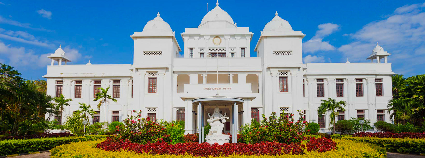
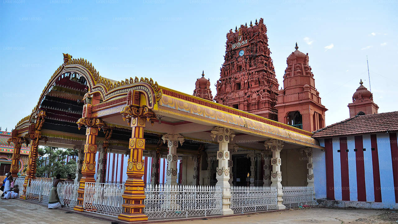
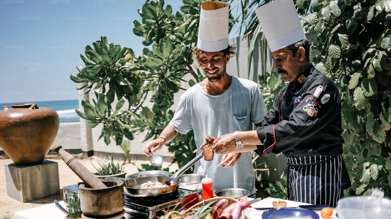
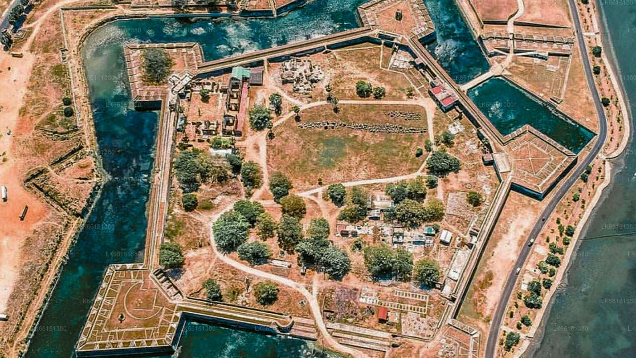
자프나는 아름다운 힌두 사원들이 있는 곳입니다. 옛 네덜란드 요새가 잘 보존되어 있으며, 그 안에는 오래된 교회가 있습니다. 네덜란드 건축 양식의 또 다른 예로는 왕궁이 있습니다. 자프나를 방문한다면 그 달콤함으로 유명한 자프나 망고를 꼭 맛보아야 합니다. 약 3km 떨어진 곳에는 자프나 최대의 종교 축제가 열리는 웅장한 날루르 칸다스와미 사원이 있습니다. 카이츠 항구는 자프나 지역의 고대 선박 정박지입니다.
북부 지방 소개
북부 주는 스리랑카의 9개 주 중 하나입니다. 주들은 19세기부터 존재해 왔지만, 1978년 스리랑카 헌법 제13차 개정안이 1987년에 주 의회를 설립하기 전까지는 법적 지위를 갖지 못했습니다. 1988년부터 2006년까지는 동부 주와 일시적으로 통합되어 북동부 주를 이루기도 했습니다. 주의 주도는 자프나입니다.
스리랑카 북부에 위치한 북부 주는 인도에서 불과 35km(22마일) 떨어져 있습니다. 서쪽으로는 만나르 만과 팔크 만, 북쪽으로는 팔크 해협, 동쪽으로는 벵골 만, 남쪽으로는 동부, 북중부, 북서부 주와 접해 있습니다. 이 지역에는 자프나 석호, 난티 카달, 춘디쿨람 석호, 바다마라치 석호, 우푸 아루 석호, 코킬라이 석호, 나이 아루 석호, 찰라이 석호 등 여러 석호가 있습니다. 스리랑카 주변의 대부분의 섬들은 북부 주의 서쪽에 위치해 있으며, 가장 큰 섬으로는 카이츠, 네둔티부, 카라이티부, 풍구두티부, 만다티부가 있습니다.
2007년 기준 북부 주의 인구는 1,311,776명입니다. 인구의 대다수는 스리랑카 타밀족이며, 소수 민족으로는 스리랑카 무어족과 싱할라족이 있습니다. 스리랑카 타밀어는 이 지역 주민 대다수가 사용하는 주요 언어이며, 싱할라어는 전체 인구의 1%가 사용합니다. 도시에서는 영어가 널리 사용되고 이해됩니다.