칼루타라 시
칼루타라는 스리랑카 서부의 해안 도시로, 고요한 해변과 유서 깊은 유적지로 유명합니다. 상징적인 불교 사원인 칼루타라 보디야와 식민지 시대 저택인 리치먼드 성은 주요 관광 명소입니다. 칼루타라는 풍부한 문화적 유산과 자연의 아름다움이 조화를 이루는 도시입니다.
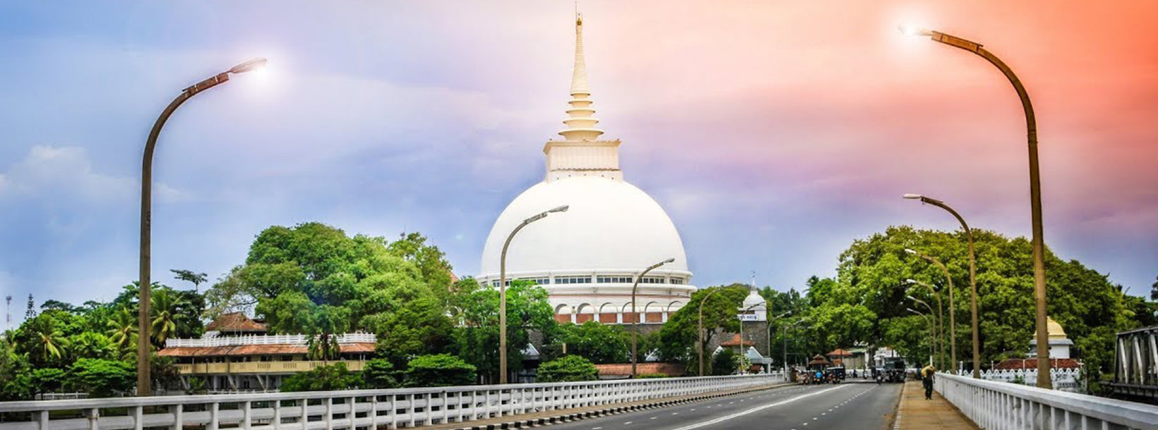
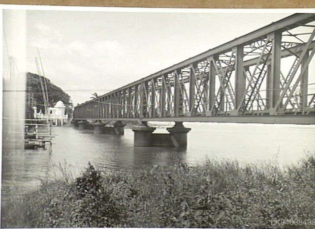
Kalutara Bridge : An Unspoken Heritage
Sri Lanka, also known as the Pearl of the Indian Ocean is adorned with the beautiful mother nature and claims a proud history going back as far as 500 BC. Colonialism plays a significant role in the country’s olden times.
It was under the influence of Portuguese, Dutch and the British in their respective eras. Several historic sites in Sri Lanka originated during these periods and still remains as evidence of these influences. The Kalutara Bridge is such significant landmark inherited as a result of the Colonial period.
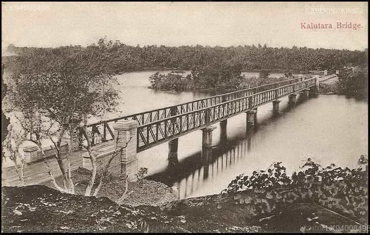
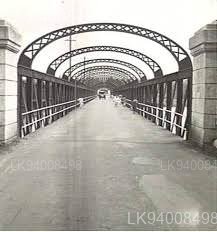
Kalutara bridge is the connecting line between the western and southern borders of the country. J. R. Mosse, Director of the PWD (Public works department) is the pioneer in designing and building the bridge and it was the largest bridge on the island built during the early 1900s. It was considered the first concrete bridge in Sri Lanka as well.
The old bridge comprised of two separate bridges, each with 6 spans of lattice girders where a single girder was an enormous 100ft long.
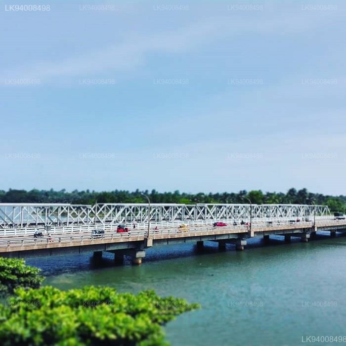
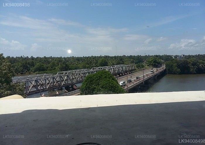
It is separated by a ridge in the middle of the river (Kalu Ganga) and it was opened for road traffic in August 1877 along with a single line of rails in the middle. It was 450ft in length. Currently, There are twin bridges for railway and one for the road traffic. And it is a perfect place to watch the sunset.
History
Being one of the largest bridges in Sri Lanka, the origins of the Kalutara Bridge date back to the early 1990s. Initially, the bridge had two separate bridges, each including 6 spans of lattice girders. Both the bridges were separated by a ridge which was in the middle of the ‘Kalu Ganga’. It was first opened for road traffic in 1877.Significance
The bridge is a significant landmark in Kalutara due to its link between the southern border and western border of the country. When travelling from the western end of the bridge towards the southern end, you will witness the majestic view of the 3 stories-high Kalutara Viharaya. Any Buddhist will not forget to offer a small sacrifice when passing the temple.Location
You will find plenty of attractions in the vicinity of the bridge. The Kalutara Bodhiya, Richmond Castle and Kalutara Viharaya are some such places. If you are staying at one of the many hotels in Kalutara close to the bridge, like Turyaa Kalutara, you can also visit many other attractions in the vicinity.Did you know?
Locals say on very clear mornings one can see Sri Pada (Adam’s Peak) Mountain from the bridge. Which is, in turn, the starting point of Kalu River. That would make Kalu River the only river in Sri Lanka of which starting point and ending point can be seen at the same time.칼루타라 지구 소개
칼루타라는 콜롬보에서 남쪽으로 약 42km 떨어진 곳에 위치해 있습니다. 한때 향신료 교역소였던 칼루타라는 포르투갈, 네덜란드, 영국의 지배를 받았습니다. 이 마을은 고품질 대나무 바구니와 매트, 그리고 가장 맛있는 망고스틴으로 유명합니다.
38m 길이의 칼루타라 다리는 칼루 강가 강 어귀에 건설되었으며, 국가의 서부와 남부 국경을 연결하는 주요 다리 역할을 합니다. 다리 남쪽 끝에는 1960년대에 건립된 3층 높이의 칼루타라 비하라가 있습니다. 이 불교 사원은 세계에서 유일하게 속이 비어 있는 사리탑이라는 특징을 가지고 있습니다.
서부 지방에 대하여
서부 지방은 스리랑카에서 인구 밀도가 가장 높은 지방입니다.입법 수도인 스리자야와르데나푸라와 국가의 행정 및 비즈니스 중심지인 콜롬보가 있는 곳입니다.서부 지방은 콜롬보(642km²), 감파하(1,386.6km²), 칼루타라(1,606km²) 지구라는 3개의 주요 지구로 나뉩니다.스리랑카의 경제 중심지로서 모든 주요 국내 및 국제 기업이 이 도시에 있으며 모든 주요 디자이너 및 주요 상점가도 여기에 있습니다.서부 지방에서 쇼핑을 즐길 준비를 하십시오.
모든 지방에서 인구가 가장 많은 이 섬의 주요 교육 기관은 거의 모두 서부 지방에 위치해 있습니다. 이 지방의 대학으로는 콜롬보 대학교, 스리자야와르데네푸라 대학교, 켈라니야 대학교, 스리랑카 오픈 대학교, 스리랑카 불교 및 팔리어 대학교, 존 코텔라왈라 국방 대학교, 모라투와 대학교가 있습니다. 서부 지방에는 국립, 지방, 사립 및 국제 학교를 포함하여 전국에서 가장 많은 학교가 있습니다.