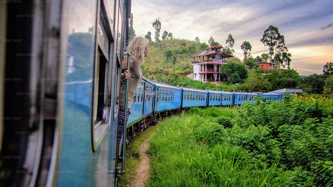
캔디 시티
스리랑카 중부의 그림 같은 도시 캔디는 풍부한 문화 유산, 활기찬 축제, 그리고 아름다운 자연 경관으로 유명합니다. 울창한 언덕에 자리 잡은 캔디는 유네스코 세계문화유산으로 지정된 불치사(Temple of the Tooth Relic)가 있는 곳으로, 역사와 아름다운 자연이 어우러진 매혹적인 도시입니다.
Digana
Digana is a village in Sri Lanka. It is located within Central Province, between Kandy and Teldeniya on A26 road. It is known for its dolomite mineral.
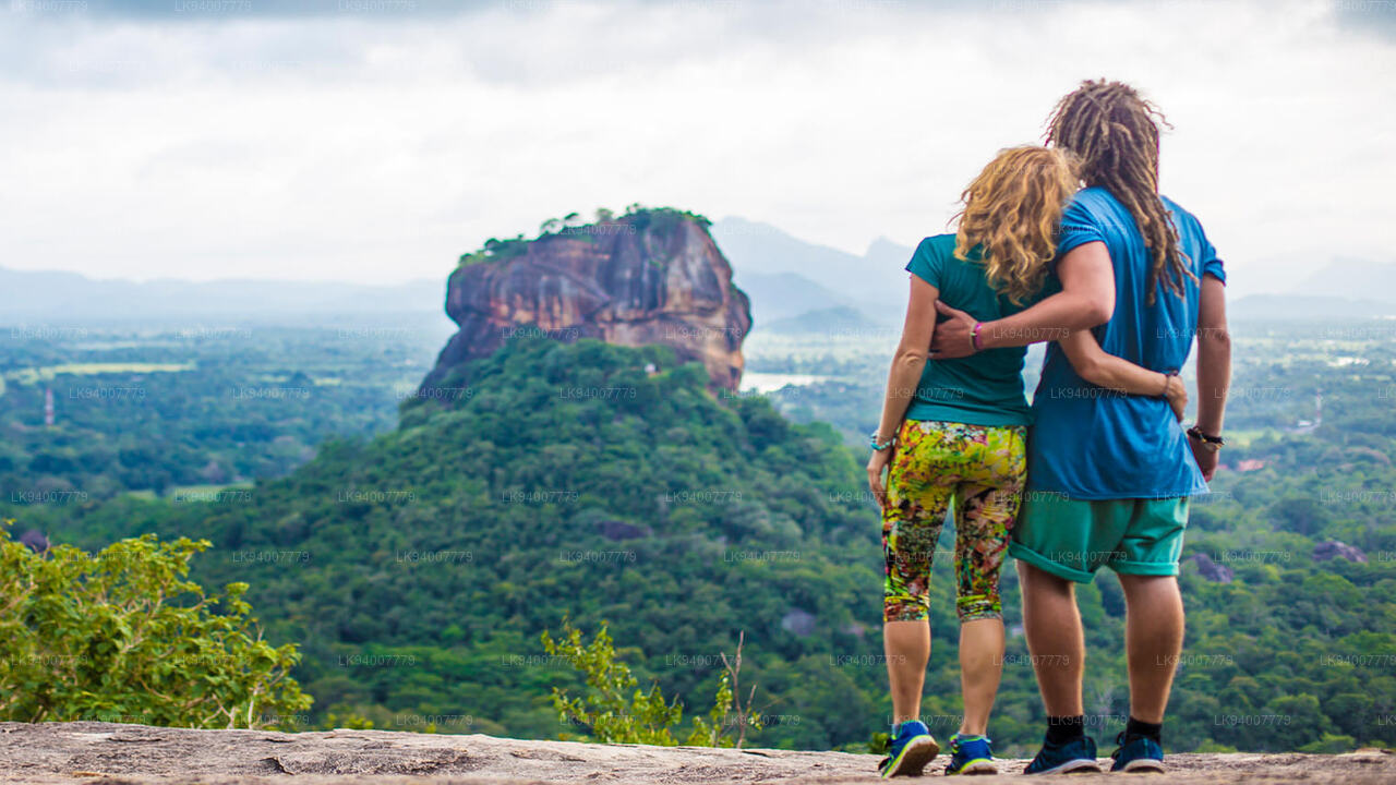
In Digana area has a historical significance and natural beauty. The excursion to Bambaragala and Pettigala is regarded as one of the best things to do around Digana as it paves the way to a region filled with wonders and amazement.
Attractions in Digana,- Pettigala, Kandy
- Bambaragala Rajamaha Viharaya
- Victoria Dam
- Mahamevnawa Buddhist Monastery
- Pallekele International Cricket Stadium
About Kandy District
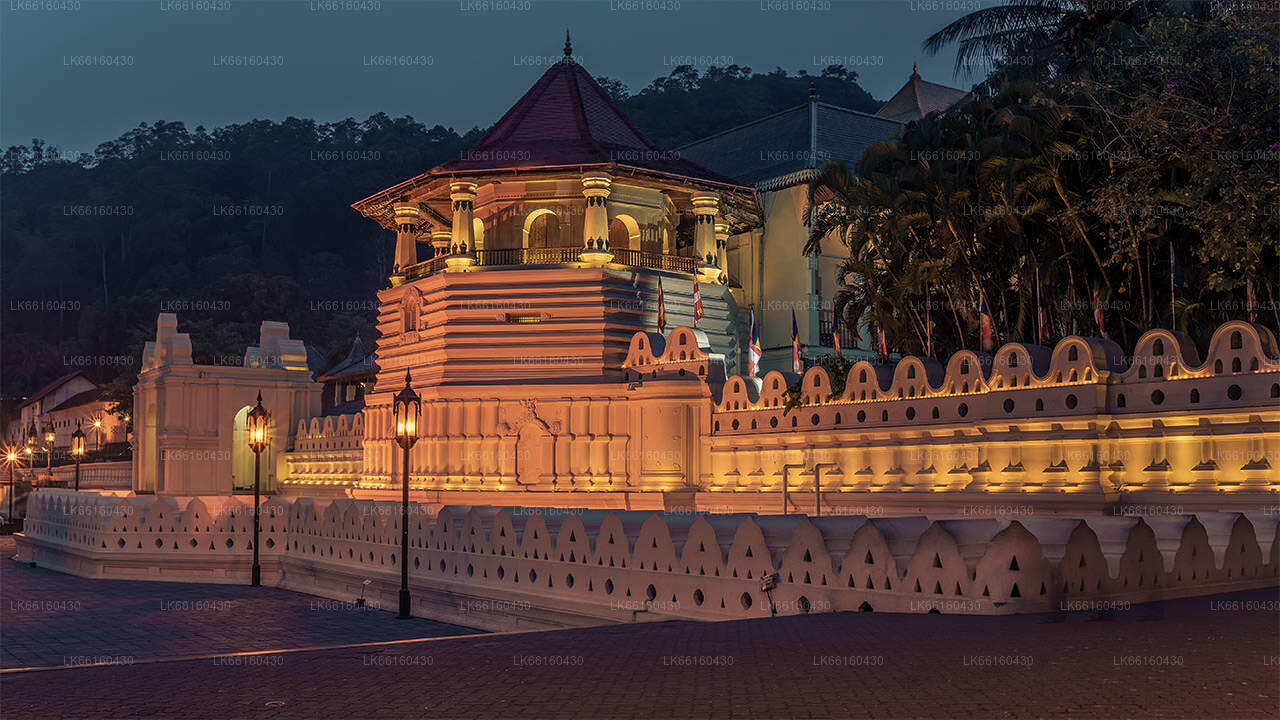
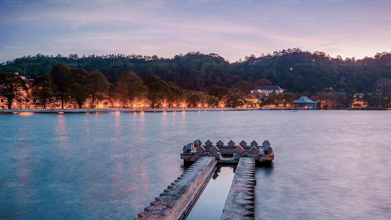
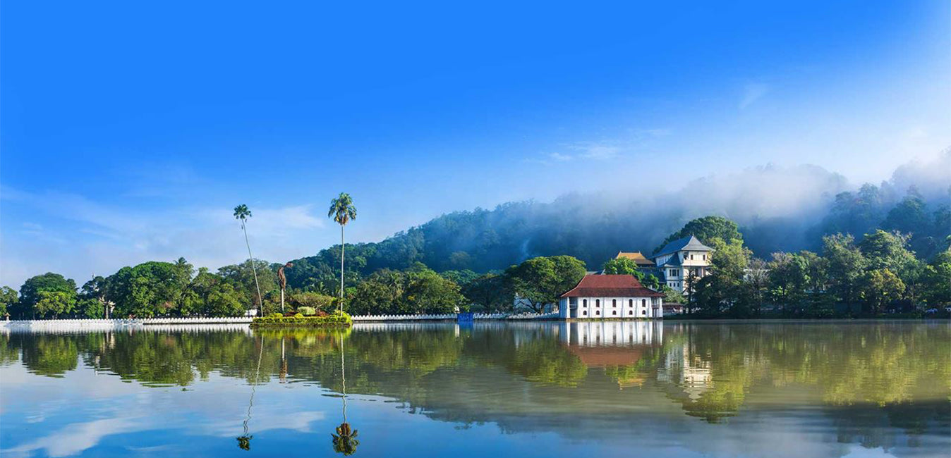
Kandy districtis situated in the centrel province of Sri Lanka. One of the seven World Heritage Sites in Sri Lanka,Kandy was once home to the Kandyan Kings of yore in the 16th-century and a fountainhead for all the music, arts, crafts and culture in the country. About 129 km away from Colombo,Kandy is ensconced amongst a hilly terrain and all eyes are drawn to the centre of the city, where theKandy Lake forms a charming feature. Kandy retains great religious significance for SriLanka, because it is in this charming city that the Dalada Maligawa or "Temple of the Tooth"is located, within which the sacred tooth relic of Lord Buddha lies well guarded.
The Royal Botanical Garden ,Peradeniyais situated about 5 km to the west of the city centre at Peradeniya and is visited by 1.2 million people per year. It is the largest botanical garden on the island. The Udawatta Kele (Udawatta Forest) is a protected sanctuary situated in the heart of the city, just north of Temple of the Tooth .
Kandy is a Sinhala majority city; there are sizeable communities belonging to other ethnic groups, such as Moors and Tamils. Kandy is second only to Colombo the center of the Sri Lankan Economy. Many major co operations have large branch officers in Kandy and many industries include textiles, furniture, Information Technology and jewellery are found here. Many agriculture research centers are located in the city.
and a fountainhead for all the music, arts, craftsand culture in the country. About 129 km away from Colombo ,Kandy is ensconced amongst a hilly terrain and all eyes are drawn to the centre of the city, where the Kandy Lake forms a charming feature.Kandy retains great religious significance for SriLanka , because it is in this charming city that the Dalada Maligawa or Temple of the Toothis located, within which the sacred tooth relic of Lord Buddha lies well guarded.
About Central Province
The Central Province of Sri Lanka consists primarily of mountainous terrain. The province has an area of 5,674 km², and a population of 2,421,148. Some major towns include Kandy, Gampola (24,730), Nuwara Eliya and Bandarawela. The population is a mixture of Sinhalese, Tamil and the Moors.
Both the hill capital Kandy and the city of Nuwara Eliya are located within the Central Province as well as Sri Pada. The province produces much of the famous Ceylon tea, planted by the British in the 1860s after a devastating disease killed all the coffee plantations in the province. Central Province attracts many tourists, with hill station towns such as Kandy, Gampola, Hatton and Nuwara Eliya. Temple tooth or Dalada maligawa is the main sacred place in Centrel province.
The climate is cool, and many areas about 1500 meters often have chilly nights. The western slopes are very wet, some places having almost 7000 mm of rain per year. The eastern slopes are parts of the mid-dry zone as it is receiving rain only from North-Eastern monsoon. The Temperatures range from 24°C at Kandy to just 16°C in Nuwara Eliya, which is located 1,889 m above sea level. The highest mountains in Sri Lanka are located in the Central Province. The terrain is mostly mountainous, with deep valleys cutting into it. The two main mountain regions are the central massif and the Knuckles range to the east of Kandy.
캔디 지구 소개
캔디 지구는 스리랑카 중부 지방에 위치하고 있습니다.스리랑카의 7개 세계문화유산 중 하나인 캔디는 16세기에 옛날 캔디 왕조의 왕들이 살았던 곳이자 나라의 모든 음악, 예술, 공예, 문화의 원천이었습니다.콜롬보에서 약 129km 떨어진 캔디는 구릉 지대에 자리 잡고 있으며 모든 시선은 캔디 호수가 매력적인 특징을 이루는 도시 중심부로 쏠립니다.캔디는 스리랑카에서 큰 종교적 의미를 지니고 있는데, 이 매력적인 도시에 달라다 말리가와 또는 "치아 사원"이 있고, 그 안에 부처님의 신성한 치아 유물이 잘 보관되어 있기 때문입니다.페라데니야 왕립 식물원은 페라데니야 시내 중심에서 서쪽으로 약 5km 떨어진 곳에 위치하고 있으며, 매년 120만 명이 방문합니다.섬에서 가장 큰 식물원입니다. 우다와타 켈레(우다와타 숲)는 도시 중심부, 불치사 바로 북쪽에 위치한 보호 구역입니다. 캔디는 싱할라족이 다수를 차지하는 도시이지만, 무어족과 타밀족 등 다른 민족 집단이 거주하는 지역 사회도 상당수 있습니다. 캔디는 스리랑카 경제의 중심지인 콜롬보에 이어 두 번째로 큰 도시입니다. 많은 주요 기업들이 캔디에 대규모 지사를 두고 있으며, 섬유, 가구, 정보 기술, 보석 등 다양한 산업이 이곳에 자리 잡고 있습니다. 또한, 수많은 농업 연구 센터가 캔디에 위치해 있으며, 전국의 음악, 예술, 공예, 문화의 발원지이기도 합니다. 콜롬보에서 약 129km 떨어진 캔디는 구릉 지대에 자리 잡고 있으며, 모든 사람의 시선은 캔디 호수가 있는 매력적인 도시 중심부로 쏠립니다. 캔디는 스리랑카에서 매우 중요한 종교적 의미를 지니고 있는데, 이 매력적인 도시에 달라다 말리가와(불치사)가 자리 잡고 있으며, 이곳에는 부처님의 성스러운 불치가 잘 보관되어 있기 때문입니다.
중부 지방 소개
스리랑카 중부 지방은 주로 산악 지형으로 이루어져 있습니다. 이 지방의 면적은 5,674km²이고 인구는 2,421,148명입니다. 주요 도시로는 캔디, 감폴라(24,730명), 누와라 엘리야, 반다라웰라가 있습니다. 인구는 싱할라족, 타밀족, 무어족이 섞여 있습니다. 언덕 주도인 캔디와 누와라 엘리야는 모두 중부 지방과 스리 파다에 있습니다. 이 지방은 1860년대에 파괴적인 질병으로 인해 이 지방의 모든 커피 농장이 파괴된 후 영국인이 심은 유명한 실론 차를 많이 생산합니다. 중부 지방은 캔디, 감폴라, 해튼, 누와라 엘리야와 같은 언덕 역 마을이 있어 많은 관광객을 유치합니다. 템플 투스 또는 달라다 말리가와는 중부 지방의 주요 성지입니다. 기후는 시원하며, 해발 1,500m 정도의 많은 지역에서는 종종 밤에 쌀쌀합니다. 서쪽 경사면은 매우 습하며, 일부 지역에서는 연간 강수량이 거의 7,000mm에 달합니다. 동쪽 경사면은 북동 몬순의 영향으로 비가 거의 내리지 않아 중건기 지대에 속합니다. 캔디의 기온은 24°C에서 해발 1,889m에 위치한 누와라 엘리야의 기온은 16°C에 불과합니다. 스리랑카에서 가장 높은 산은 중부 지방에 있습니다. 지형은 대부분 산악 지대이며, 깊은 계곡이 지형을 가로지르고 있습니다. 두 개의 주요 산악 지역은 캔디 동쪽에 있는 중앙 산괴와 너클스 산맥입니다.