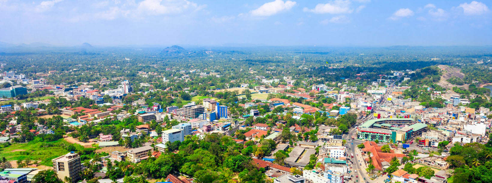
Kurunegala City
Kurunegala: Bustling city in Sri Lanka's North Western Province, featuring historic sites, vibrant markets, and a blend of modern and traditional culture.
ウマンダワ ෴ උමංදාව
ウマンダワ グローバル仏教村 (またはウマンダワ マハ ヴィハーラ僧院) は、最近開発されたいわゆる仏教宗教村で、至高の至福の段階 (アラハス段階) に達したと自称し、物議を醸している僧侶シリ サマンタバドラ セロによって運営されています。シリ・サマンタバドラ・マハ・アラハス・セロの名前。ウマンダワ自体は、誰にとっても個人的な隠れ家として宣伝されています。
ウマンダワは、一年を通して、毎日、一週間、午前 7 時から午後 5 時まで営業しています。入場はどなたでも無料です。すべての訪問者は、訪問者とゲストの対応を担当する歓迎委員会として任命された僧侶と尼僧によって歓迎されます。彼らはあらゆる質問や問い合わせに対応し、土地のガイド付きツアーも行います。宿泊客には、仏教のスピリチュアルなプログラムや宿泊施設の幅広いオプションを提供しています。ここはコミュニティの敷地内にあり、コミュニティのライフスタイルを体験し、学びたいゲスト向けです。
ウマンダワ グローバル仏教村 (またはウマンダワ マハ ヴィハーラ僧院) コミュニティは仏教僧院および非営利団体として機能しており、ブランド名「ウマンダワ マハ ヴィハーラ僧院」および会社名「シリ サダハム アシュラマヤ」で登録されています。デヒワラに本拠を置くシリ・サダハム・アシュラマヤは、資金調達、管理、マーケティング活動のほとんどを調整している場所です。ウマンダワは、コミュニティ自身による有機農業を行う自給自足コミュニティとして自らを売りにしています。この土地は約70エーカーで、出家前は医師だった僧侶(現在は病気)の資金援助で購入したものである。僧侶たちのコミュニティによると。この土地は、2015 年に所有者が変わるまでは放棄されたココナッツ農園でした。
シリ・サマンサバドラ・セロ
シリ・サマンタバドラは 1975 年にゴールのピティドゥワで生まれ、2000 年にピティドゥウェ・シリダンマとして出家しました。アイデアを明確に表現するという素晴らしい才能と、聴衆を惹きつける能力により、彼はすぐに人気の説教者になりました。人気と信者の増加に伴い、彼は名前をシリ・サマンタバドラに変更し、アルハスの段階に到達したことを自己宣言した後、自分自身をサマンタバドラ・マハ・アラハス・セロと名乗りました。サマンタバドラという名前自体は、チベット仏教において釈迦自身を呼ぶときに使われる名前です。
ウマンダワのビジョン
ウマンダワ世界仏教村では、社会の改善に応用できるさまざまなモジュールを提供しています。これらのモジュールは、 「今ここに生きる」という実践を通じて、イノベーションとスピリチュアルな導きに向けて心を準備するためにも使用できます。
ウマンダワ有機農場スリランカでは無害な食事を採用し、有機肥料の使用者はさまざまな野菜や果物を生産する儲かる有機農場を設立し、偉大なスリランカそのものの模範となっています。
うまんだわ製品About Kurunegala District
Kurunegala is the capital of the Wayamba Province in Sri Lanka and the Kurunegala District.Kurunegala was a royal capital for only 50 years, from the end of the 13th century to the start of the next, though even before this it was strategically placed in the middle of other majestic strongholds such as Yapahuwa to the north, Dambadeniya to the south and Panduwasnuwara in the east. Ethagala a rock reaching 316 meters, towers over the town, which is located at an altitude of 116 meters above sea level. The shape of Ethagala resembles an Elephant. A transport hub, it has a railway station, and several main roads linking important parts of the country.Kurunegala is situated about 94 km from Colombo, and 42 km from Kandy.
Most of Kurunegala's residents belong to the Sinhalese majority. Other ethnic minorities include the Sri Lankan Moors, Sri Lankan Tamils, Burghers and Malays. Residents from ethnic minorities live in all parts of the city, however, sizeable communities of Moors and Tamils also live in the areas of Teliyagonna and Wilgoda.
About North Western Province
North Western Province is a province of Sri Lanka. The districts of Kurunegala and Puttalam formulate North Western or Wayamba. Its capital is Kurunegala, which has a population of 28,571. The province is known mainly for its numerous coconut plantations. Other main towns in this province are Chilaw (24,712) and Puttalam (45,661), which are both small fishing towns. The majority of the population of Wayamba province is of Sinhalese ethnicity. There is also a substantial Sri Lankan Moor minority around Puttalam and Sri Lankan Tamils in Udappu and Munneswaram. Fishing, prawn farming and rubber tree plantations are other prominent industries of the region. The province has an area of 7,888 km² and a population of 2,184,136 (2005 calculation).
Wayamba is the third largest paddy producing area in Sri Lanka .Wayamba has a highly developed agricultural economy, growing a variety of fruits and vegetables, flowering plants, spices, oil-seeds in addition to the traditional plantation crops such as Coconut, Rubber and Rice. Rich soils and varied climate give Wayamba a potential for growing of virtually any crop.
In Wayamba or North western province, home for ancient Buddhist rock temples, magnificent citadels Panduwasnuwara, Dambadeniya, Yapahuwa and Kurunegala. Impressive remains of those citadels, palaces, Buddhist temples and monasteries provide exciting sight seeing to the visitors.


