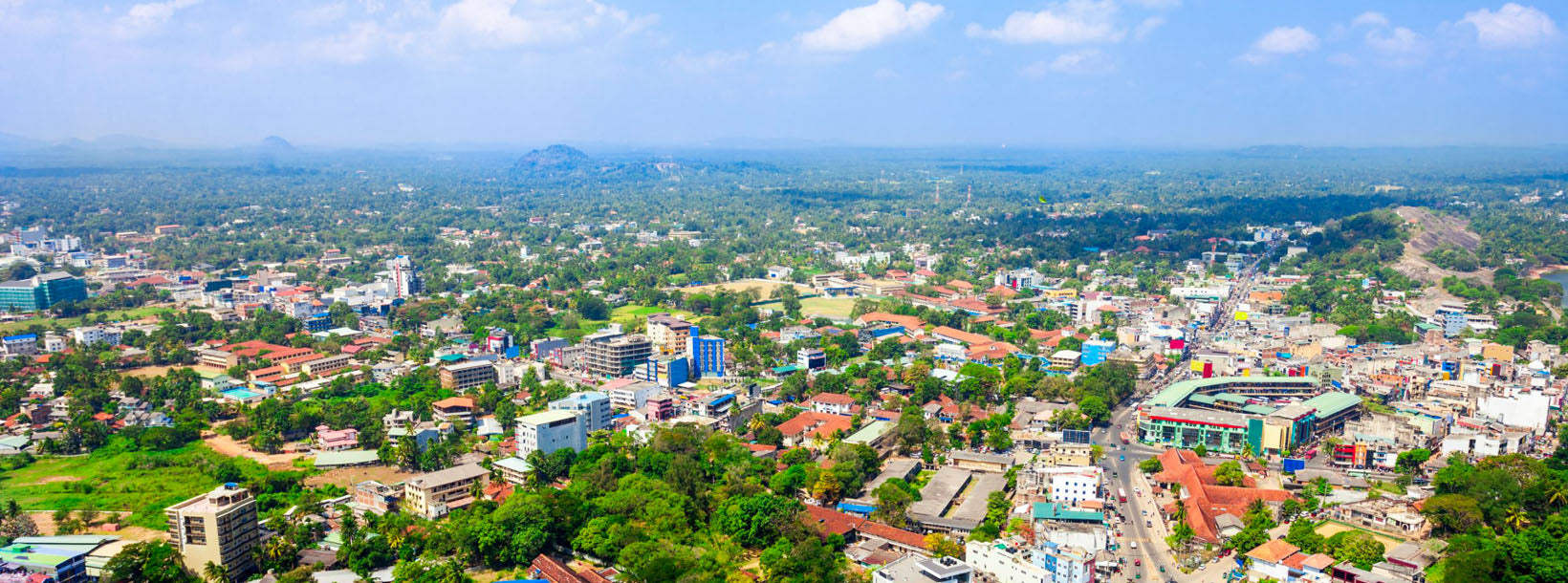
Kurunegala City
Kurunegala: Bustling city in Sri Lanka's North Western Province, featuring historic sites, vibrant markets, and a blend of modern and traditional culture.
Dambadeniya
Dambadeniya (DMBD) er en ødelagt oldtidsby beliggende i North Western Province (Wayamba), Sri Lanka på hovedvejen Kurunegala–Negombo. Den fungerede som hovedstad i Sri Lanka i midten af det 13. århundrede. Meget af Dambadeniya ligger stadig begravet på en enorm befæstet klippe. Dambadeniya ligger omkring 31 km fra Kurunegala, den moderne hovedstad i North Western Province. Dambadeniya ligger omkring 4 km fra Giriulla.
Dambadeniya, omkring 30 km sydvest for Kurunegala, blev fremtrædende i midten af det 13. århundrede.[1] Det blev udvalgt som hovedstad for kongeriget Sri Lanka af kong Vijayabahu III (1232–36). Landets suverænitet var truet som følge af invasioner, der fortrængte Polonnaruwa som hovedstad. Vijayabahu, kongen af Dambadeniya-dynastiet, kæmpede mod angriberne og etablerede Dambadeniya. På toppen af Dambadeniya-klippen byggede han befæstninger samt solide mure og porte. Byen blev sikret af en voldgrav, en marsk og volde omkring det kongelige palads. Under kong Parakramabahu II's regeringstid (1236–70) nåede Dambadeniya sit højdepunkt. Kong Parakramabahu II's fejlfri poetiske mesterværker "Kavisilumina" og "Visuddi Marga Sannasa" markerede et vendepunkt for den singalesiske litteratur. Dambadeniya-æraen var grunden til, at singalesisk litteratur ikke var begrænset til malerier eller skrifter.
Om Kurunegala-distriktet
Kurunegala er et distrikt i North Western Province, Sri Lanka. Består af 4812,7 km² 48.1270 hektar og består af 30 divisionssekretariater, 1610 Grama Niladari-divisioner og 4476 landsbyer i alt. Det består af 14 valgkredse, 2 kommunalbestyrelser, 19 byråd, 15 parlamentariske ministre, 47 provinsrådsmedlemmer, 15 ministre og 337 lokale rådsmedlemmer.
Set i forhold til Kurunegala-distriktets geografiske beliggenhed, grænser det op til fem distrikter. Mod nord til Anuradhapura-distriktet, mod øst til Mathale-distriktet, mod syd til Gampaha og Kegalle-distriktet og mod vest til Puttalam-distriktet. Distriktets længdegradsplacering er nordlig bredde 228-333 og østlig længde 104-178.
About Kurunegala District
Kurunegala is the capital of the Wayamba Province in Sri Lanka and the Kurunegala District.Kurunegala was a royal capital for only 50 years, from the end of the 13th century to the start of the next, though even before this it was strategically placed in the middle of other majestic strongholds such as Yapahuwa to the north, Dambadeniya to the south and Panduwasnuwara in the east. Ethagala a rock reaching 316 meters, towers over the town, which is located at an altitude of 116 meters above sea level. The shape of Ethagala resembles an Elephant. A transport hub, it has a railway station, and several main roads linking important parts of the country.Kurunegala is situated about 94 km from Colombo, and 42 km from Kandy.
Most of Kurunegala's residents belong to the Sinhalese majority. Other ethnic minorities include the Sri Lankan Moors, Sri Lankan Tamils, Burghers and Malays. Residents from ethnic minorities live in all parts of the city, however, sizeable communities of Moors and Tamils also live in the areas of Teliyagonna and Wilgoda.
About North Western Province
North Western Province is a province of Sri Lanka. The districts of Kurunegala and Puttalam formulate North Western or Wayamba. Its capital is Kurunegala, which has a population of 28,571. The province is known mainly for its numerous coconut plantations. Other main towns in this province are Chilaw (24,712) and Puttalam (45,661), which are both small fishing towns. The majority of the population of Wayamba province is of Sinhalese ethnicity. There is also a substantial Sri Lankan Moor minority around Puttalam and Sri Lankan Tamils in Udappu and Munneswaram. Fishing, prawn farming and rubber tree plantations are other prominent industries of the region. The province has an area of 7,888 km² and a population of 2,184,136 (2005 calculation).
Wayamba is the third largest paddy producing area in Sri Lanka .Wayamba has a highly developed agricultural economy, growing a variety of fruits and vegetables, flowering plants, spices, oil-seeds in addition to the traditional plantation crops such as Coconut, Rubber and Rice. Rich soils and varied climate give Wayamba a potential for growing of virtually any crop.
In Wayamba or North western province, home for ancient Buddhist rock temples, magnificent citadels Panduwasnuwara, Dambadeniya, Yapahuwa and Kurunegala. Impressive remains of those citadels, palaces, Buddhist temples and monasteries provide exciting sight seeing to the visitors.