Kankesanthurai


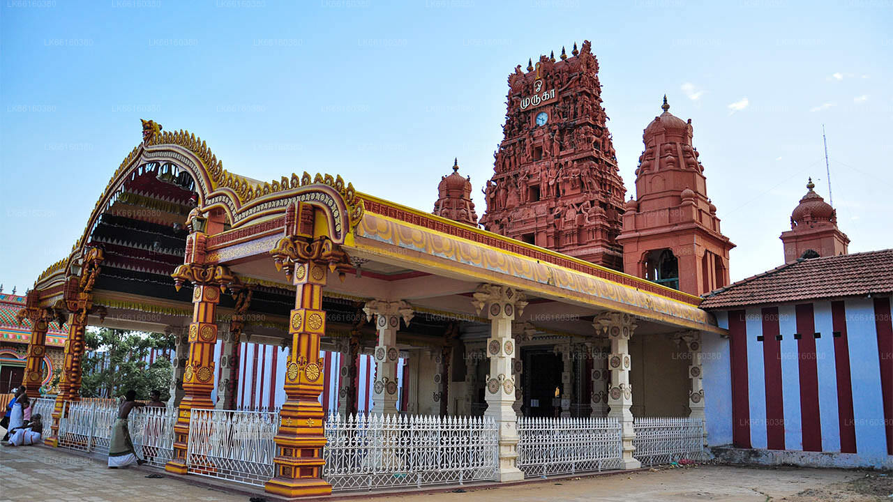
Kankesanthurai colloquially known as KKS, is a port suburb, fishing division and resort hub of the Jaffna District, Northern Province, Sri Lanka. Formerly an electoral district, Kankesanthurai is home to the Kankesanthurai beach, Keerimalai Naguleswaram temple (a Pancha Ishwaram) and the Maviddapuram Kandaswamy Temple. The port's harbour has served as an arrival and departure point for pilgrims since classical antiquity and is named after the Sri Lankan Tamil god Murukan. Kankesanthurai suburb has many fishing villages and Grama Niladhari (village officers) and is a northern part of Valikamam, one of the three regions of ancient habitation on the Jaffna peninsula, located on the peninsula's northern coast, 12 miles from Jaffna city, 85 miles from Mannar and 155 miles from Trincomalee.
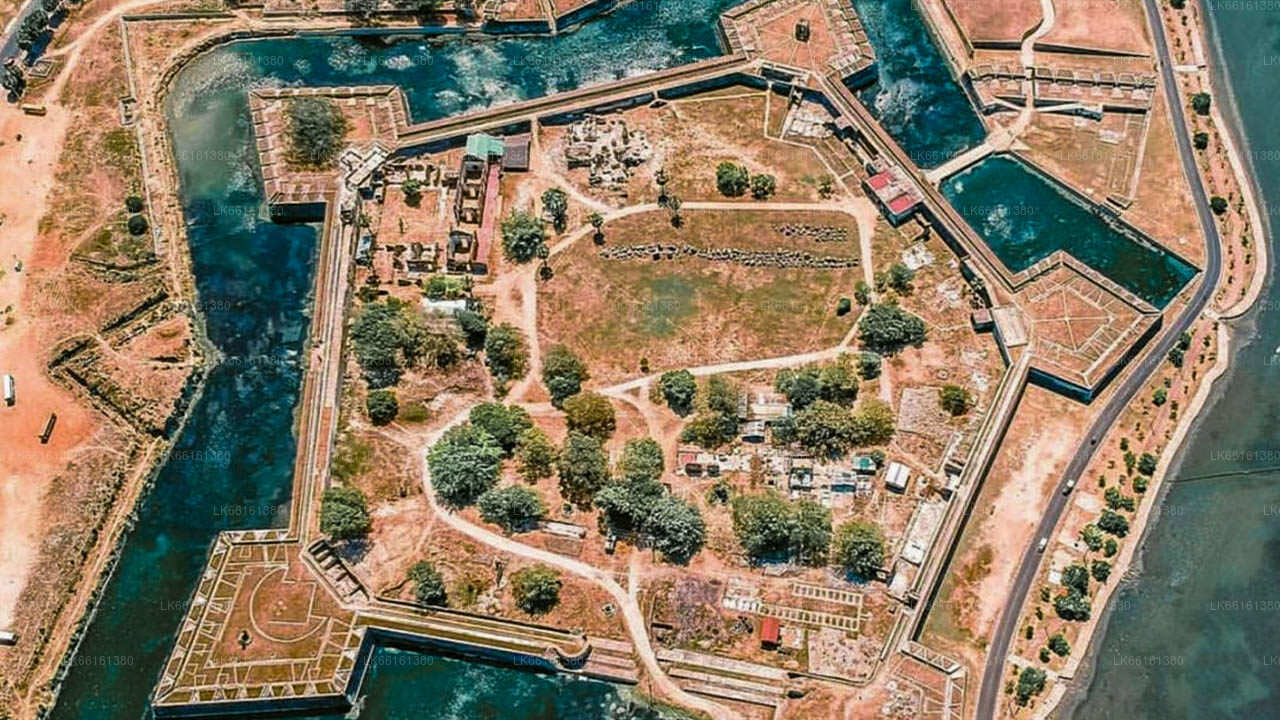
A popular tourist destination for its temples, its sandy, palm tree filled coastal stretch of beach and the Keerimalai Springs, other prominent landmarks in Kankesanthurai include the suburb's natural harbour, its fort and lighthouse.
History
During the civil war, the port at Kankesanturai was closed by the Sri Lankan Navy. Between 1983 and 1993, the northern part of the Valikamam region were declared a High Security Zone (HSZ) by the armed forces, where 6000 acres of land was confiscated around Kankesanthurai and all the residents (25,000 Tamil families) expelled, without compensation or return. The temples were inside the HSZ and as a result its priests were evicted by the military. The temple's structures were bombed, most significantly Naguleswaram in 1990, and their contents looted. Between 2002-2005, US military intelligence and military personnel visited the security zone, including Jaffna Airport and KKS harbour to review and inspect basing opportunities. Following the end of the civil war the military relaxed some restrictions on entering the HSZ, allowing priests and worshipers to return to the temples. The Maviddapuram Kandaswamy temple's 108-foot gopuram has been re-built but much of its 17th century structural renovations were destroyed during the civil war.
Attractions
Naguleswaram temple
Naguleswaram temple is a famous Hindu temple of Kankesanthurai. One of the oldest shrines of the region, it is the northernmost shrine on the island of the Pancha Ishwarams of Lord Siva, venerated by Hindus across the world from classical antiquity. Hindus believe its adjacent water tank, the Keerimalai Springs, to have curative properties. Maviddapuram Kandaswamy Temple is towards the south of the harbour.
Keerimalai springs, Kankesanthurai
Freshwater at Keerimalai springs is sourced from underground. "Maasi Magam" and “Aadi Amaavaasai” festival days, the latter falling during the Tamil month of “Aadi” (mid July-mid August) brings Hindu pilgrims to the town to carry out rituals for their forefathers and take a divine dip in the natural springs. These rituals are usually carried