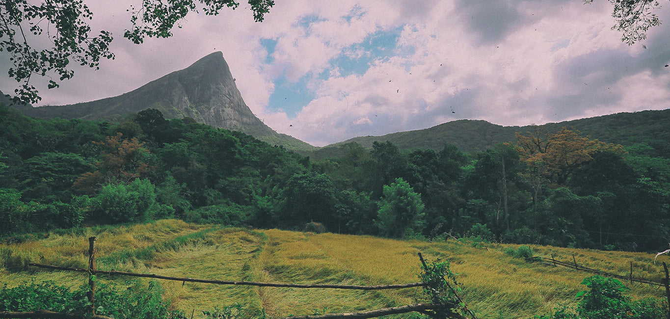
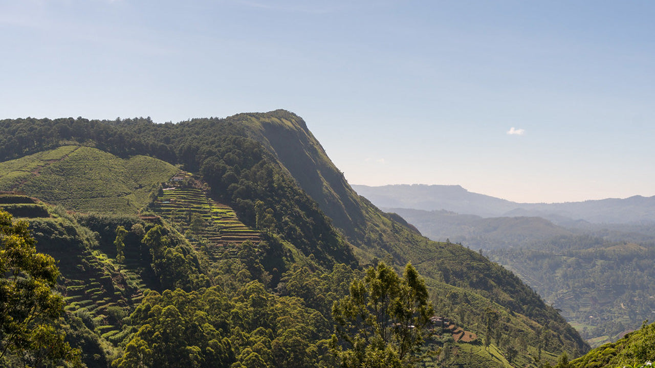
Kirigalpotta


Kirigalpoththa mountain in Sri Lanka – The Second Tallest Mountain on the Island. Reaching upto 2388m (7835 feet) above mean sea level, Kirigalpoththa Mountain in Sri Lanka looms in the district of Nuwara Eliya casting its shadow over the main city.The name Kirigalpoththa literally translates to Milk (Tree) Bark Rock (Kiri – milk, gal – rock and poththa- tree bark), possibly because the mountain has many tall trees with mottled white bark. Reached by a nature trail in the Horton Plains National Park; this mountain is the second tallest of the island paradise Sri Lanka, and the tallest of the mountains in the island whose summits are are open to access to the general public.
Kirigalpoththa mountain in Sri Lanka: Some Things to Know
- Location : Nuwara Eliya District
- Nearest Village : Pattipola
- Nearest Town : Nanuoya
- Trail to climb Kirigalpoththa is located at : Horton Plains National Park
- Trail Head : Horton Plains Visitor Centre
- Trail End : Kirigalpoththa Summit
- Length of Trail : 5.6 km
- Elevation Gain : 252m (Elevation at Trail Head: 2139m – Elevation at Trail End: 2392m)
- Climb Difficulty Level : Moderate
- Climb Time : 3 – 4 hours
- Weather Conditions : The Nuwara Eliya area is usually cold and rainy in general. But it is more so in the monsoon months. The dryest months comparatively speaking are February to April and July to September. Strong winds and cold weather are almost guaranteed higher up on the trail.
- Permit Required : Yes. Can be obtained at the entrance of Hortons Plains National Park
- Things to take on your climb: Water bottle, light sweater, raincoat, bug spray and salt for leeches, first aid equipment such as plaster, disinfectant, and bandages. (Some strong climbing rope may also be advantageous)
- Clothes to be worn : Thick clothes that will protect your skin from brambles and such and tall skidproof boots to avoid slipping in mud.
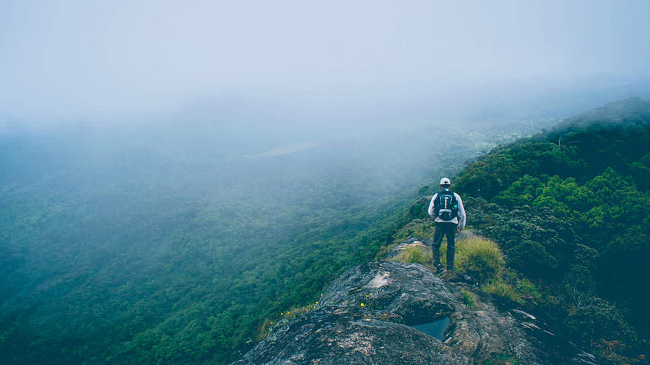
- Other tips: Do not stray from the established trail as the plain is marshy. Do not attempt as a solo climber.


-
 Kirigalpotta
Wznosząca się na wysokość 2388 m (7835 stóp) nad poziomem morza góra Kirigalpoththa na Sri Lance góruje w dystrykcie Nuwara Eliya, rzucając cień na główne miasto. Jest to druga co do wysokości góra na rajskiej wyspie Sri Lanki i najwyższa góra na wyspie.
-
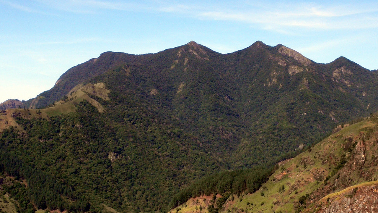
 Thotupola Kanda
Totapolakanda to trzeci co do wysokości szczyt na Sri Lance, położony w dystrykcie Nuwara Eliya, na wysokości 2357 m n.p.m. Góra znajduje się na terenie Parku Narodowego Równiny Hortona. Szlak na szczyt góry, o długości około dwóch kilometrów, rozpoczyna się kilka metrów od wejścia do Parku Narodowego Równiny Hortona w Pattipola.
-
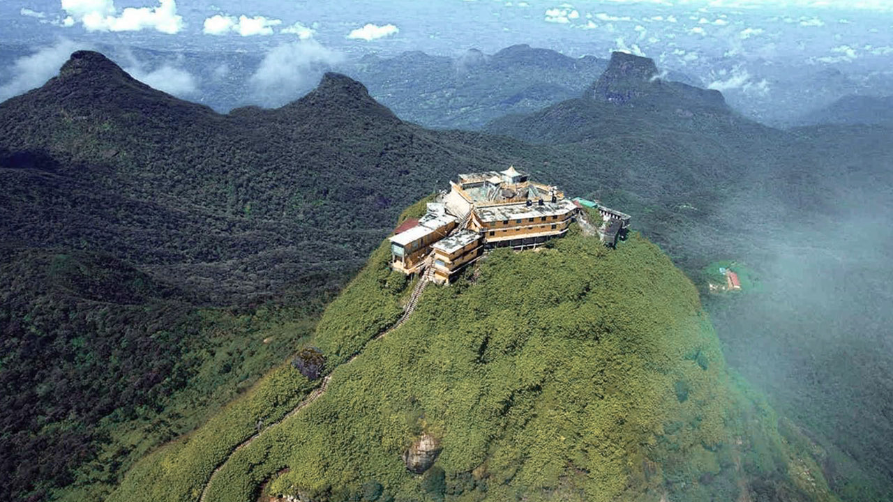 Szczyt Adama (góra Sri Pada)
Najbardziej znanym walorem przyrodniczym Cejlonu jest Szczyt Adama, położony w dystrykcie Ratnapura. Znajduje się na skraju masywu centralnego, ale otacza go grupa gór zwana Dziką Przyrodą Szczytu. Ma wysokość około 2300 metrów i jest drugim co do wysokości szczytem w kraju.
-
 Szczyt Hakgala
Szczyt Hakgala znajduje się w centralnych górach Sri Lanki, na terenie ścisłego rezerwatu przyrody Hakgala. Znajduje się w pobliżu miasta Nuwara Eliya i jest częścią regionu Central Highlands, znanego z przepięknych krajobrazów i chłodniejszego klimatu.
-
 Gommolija
Szczyt Gommolliya jest częścią pasma górskiego Knuckles w centralnej Sri Lance, wpisanego na Listę Światowego Dziedzictwa UNESCO, znanego z bioróżnorodności i piękna krajobrazu. Szczyt znajduje się w dystrykcie Kandy, położonym w centralnych górach Sri Lanki.
-
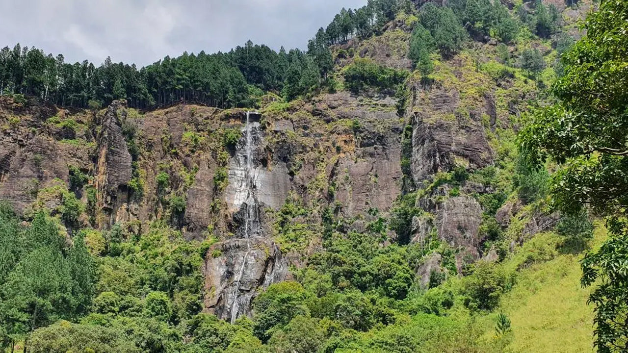 Szczyt Bambarakanda
Szczyt Bambarakanda znajduje się w dystrykcie Badulla na Sri Lance, w prowincji Uva. Jest częścią centralnych wyżyn i znajduje się w pobliżu słynnego wodospadu Bambarakanda, najwyższego wodospadu na Sri Lance. Obszar ten słynie z bujnej zieleni, chłodnego klimatu i zachwycającego piękna przyrody.
-
 Szczyt Riverston
Na szczyt Riverston na Sri Lance można dotrzeć, podróżując około 30 km od miasta Matale drogą Matale–Girandurukotte. Ta tajemnicza, kręta droga z ostrymi, serpentynowymi zakrętami oferuje jedne z najpiękniejszych widoków na okolicę; do tego stopnia, że nazywana jest Mini Krańcem Świata.