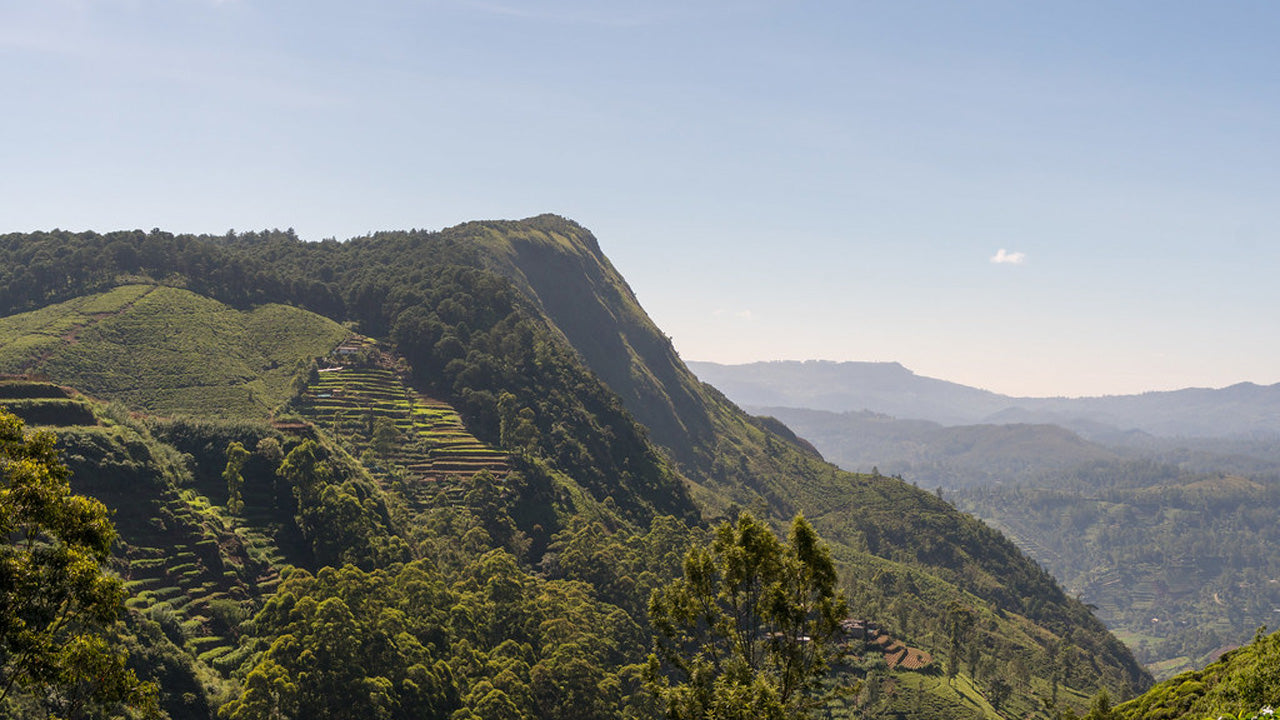
Szczyty
Sri Lanka szczyci się różnorodnością gór i szczytów, z których każdy ma swój urok. Ritigala owiana jest tajemnicą, bujnymi lasami i historycznymi ruinami, a Mihintale ma znaczenie kulturowe jako miejsce narodzin buddyzmu. Namunukula, ukryty klejnot, oferuje spokojne schronienia z zapierającymi dech w piersiach krajobrazami i chłodnym klimatem.
Gommolliya Peak
Location:
Gommolliya Peak is part of the Knuckles Mountain Range in central Sri Lanka, a UNESCO World Heritage Site known for its biodiversity and scenic beauty. The peak is located in the Kandy District, which is in the central highlands of Sri Lanka.
Height:
Gommolliya Peak has an elevation of approximately 1,866 meters (6,122 feet) above sea level, making it one of the prominent peaks in the Knuckles Range.
Notable Features:
1. Geographical Significance:
The Knuckles Mountain Range, including Gommolliya, is known for its unique topography, characterized by jagged peaks and deep valleys, often resembling the knuckles of a hand, hence the name. The range offers panoramic views of the surrounding hills and valleys, making it a popular destination for hikers and trekkers.
2. Flora and Fauna:
The Knuckles Range, where Gommolliya is located, is rich in biodiversity. The forests in the area are home to various species of flora and fauna, some of which are endemic to Sri Lanka. Common wildlife in the area includes wild boars, deer, monkeys, and several species of birds. The region is also known for its diverse plant life, including numerous endemic species.
3. Trekking and Hiking:
Gommolliya Peak is part of the trekking routes in the Knuckles Mountain Range. The hike to the peak can be challenging, as it involves navigating through dense forests and steep terrain. Trekking to Gommolliya offers breathtaking views of the surrounding mountain ranges, valleys, and tea plantations.
4. Scenic Views:
From the summit of Gommolliya Peak, trekkers are treated to stunning panoramic views of the central highlands of Sri Lanka, including vistas of the Victoria Reservoir, Hunnasgiriya, and the distant Pidurutalagala (the highest peak in Sri Lanka). The area also offers beautiful views of the Knuckles Range and the surrounding landscapes, with mist and cloud cover creating a mystical atmosphere.
5. Climate:
The climate around Gommolliya Peak is cool and temperate due to its elevation. The weather can be unpredictable, with fog and mist frequently covering the area, especially in the mornings and evenings. It is common to experience rainfall, contributing to the lush greenery in the region.
6. Access:
The peak is accessible via a trek from the nearest town or village. While the route to Gommolliya is not as popular as some other peaks in Sri Lanka, it is a well-known destination for experienced hikers looking to explore the Knuckles Mountain Range. Visitors typically trek through the forested areas of the range, with guides being recommended due to the challenging terrain.
Cultural and Environmental Significance:
The Knuckles Mountain Range, including Gommolliya Peak, has immense cultural and environmental importance. The region is a vital part of Sri Lanka's natural heritage, offering both conservation value and unique cultural experiences. It is a protected area, ensuring the preservation of its ecosystems and biodiversity.
-
KirigalpottaWznosząca się na wysokość 2388 m (7835 stóp) nad poziomem morza góra Kirigalpoththa na Sri Lance góruje w dystrykcie Nuwara Eliya, rzucając cień na główne miasto. Jest to druga co do wysokości góra na rajskiej wyspie Sri Lanki i najwyższa góra na wyspie.
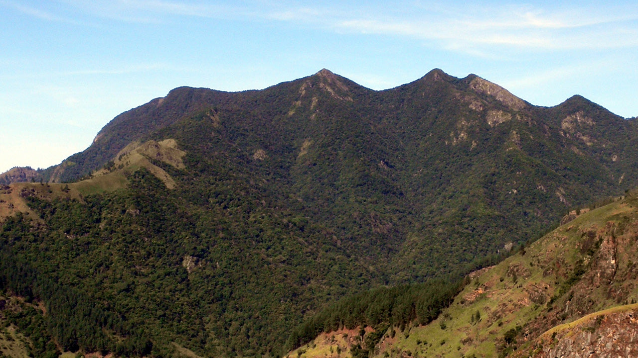
-
Thotupola KandaTotapolakanda to trzeci co do wysokości szczyt na Sri Lance, położony w dystrykcie Nuwara Eliya, na wysokości 2357 m n.p.m. Góra znajduje się na terenie Parku Narodowego Równiny Hortona. Szlak na szczyt góry, o długości około dwóch kilometrów, rozpoczyna się kilka metrów od wejścia do Parku Narodowego Równiny Hortona w Pattipola.
-
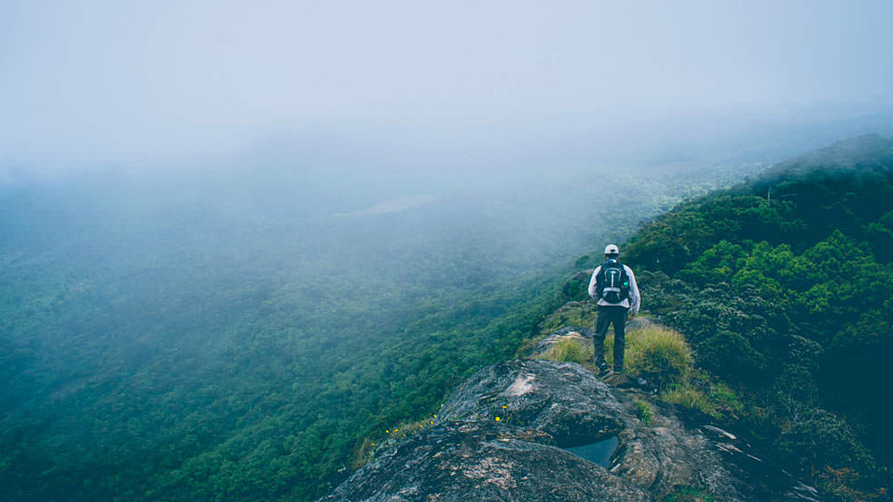
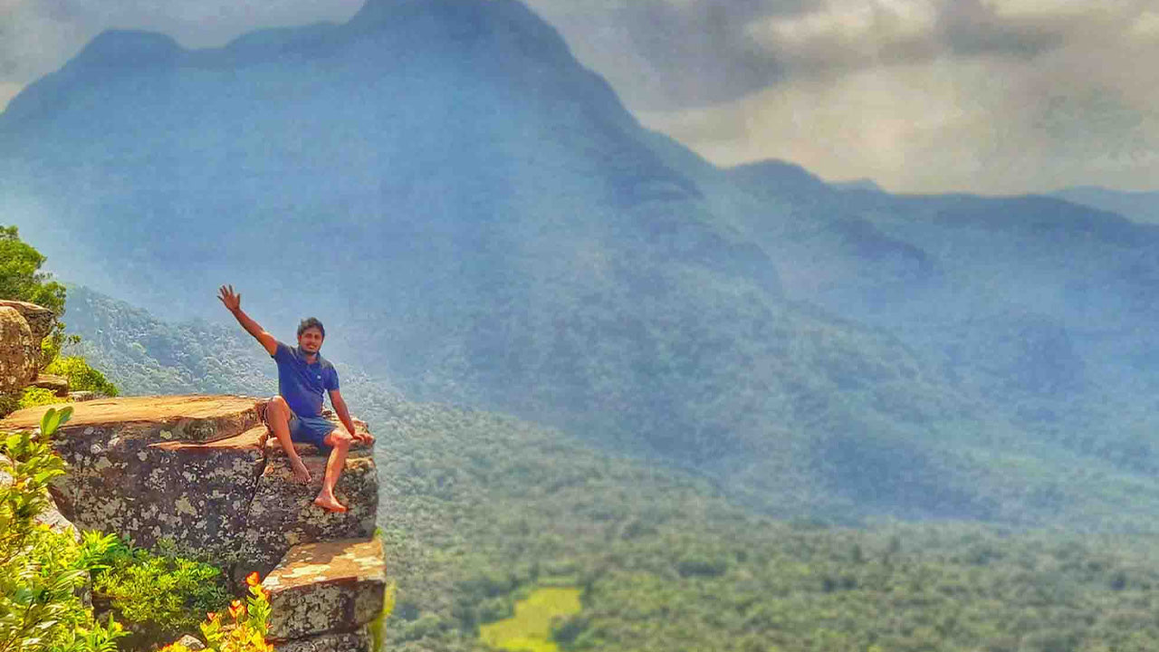
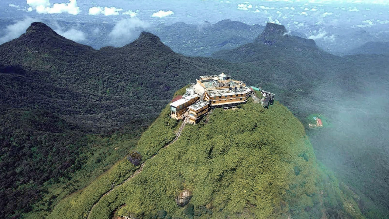
Szczyt Adama (góra Sri Pada)Najbardziej znanym walorem przyrodniczym Cejlonu jest Szczyt Adama, położony w dystrykcie Ratnapura. Znajduje się na skraju masywu centralnego, ale otacza go grupa gór zwana Dziką Przyrodą Szczytu. Ma wysokość około 2300 metrów i jest drugim co do wysokości szczytem w kraju.
-
Szczyt HakgalaSzczyt Hakgala znajduje się w centralnych górach Sri Lanki, na terenie ścisłego rezerwatu przyrody Hakgala. Znajduje się w pobliżu miasta Nuwara Eliya i jest częścią regionu Central Highlands, znanego z przepięknych krajobrazów i chłodniejszego klimatu.
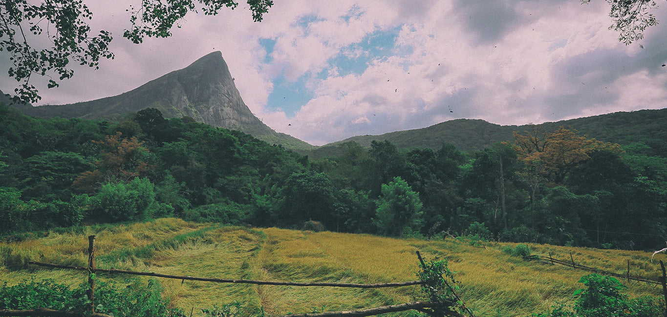
-
GommolijaSzczyt Gommolliya jest częścią pasma górskiego Knuckles w centralnej Sri Lance, wpisanego na Listę Światowego Dziedzictwa UNESCO, znanego z bioróżnorodności i piękna krajobrazu. Szczyt znajduje się w dystrykcie Kandy, położonym w centralnych górach Sri Lanki.
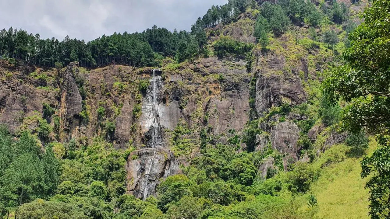
-
Szczyt BambarakandaSzczyt Bambarakanda znajduje się w dystrykcie Badulla na Sri Lance, w prowincji Uva. Jest częścią centralnych wyżyn i znajduje się w pobliżu słynnego wodospadu Bambarakanda, najwyższego wodospadu na Sri Lance. Obszar ten słynie z bujnej zieleni, chłodnego klimatu i zachwycającego piękna przyrody.
-
Szczyt RiverstonNa szczyt Riverston na Sri Lance można dotrzeć, podróżując około 30 km od miasta Matale drogą Matale–Girandurukotte. Ta tajemnicza, kręta droga z ostrymi, serpentynowymi zakrętami oferuje jedne z najpiękniejszych widoków na okolicę; do tego stopnia, że nazywana jest Mini Krańcem Świata.