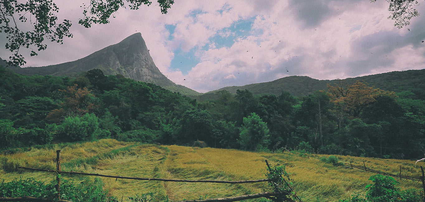
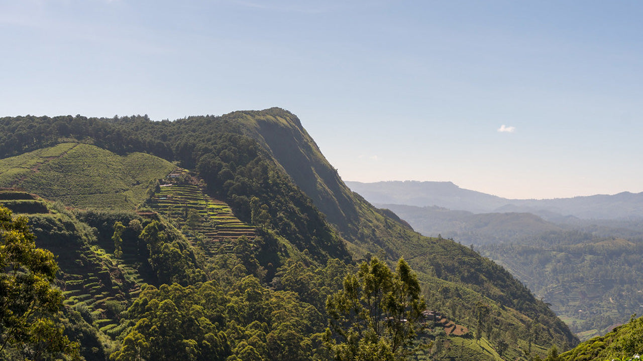
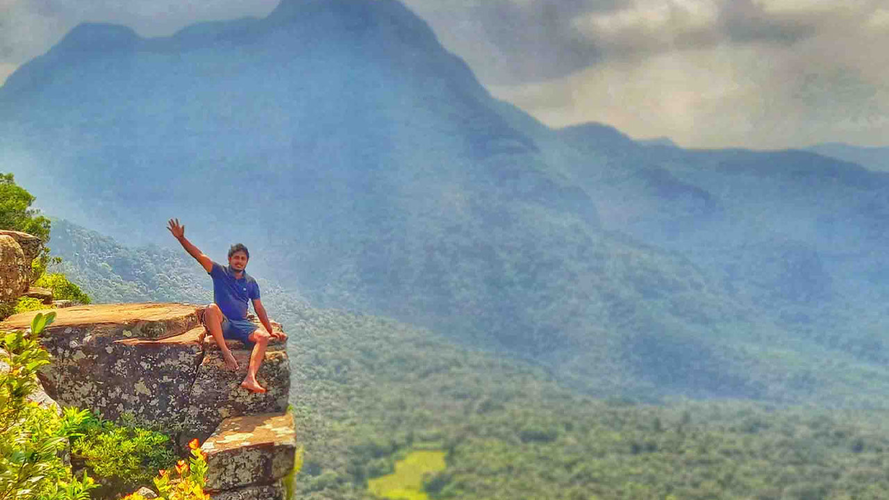
Katusu Konda


Katusu Konda, nestled in the Hanthana Mountain Range near Kandy, is a must-visit destination for hikers and nature enthusiasts. Its name, which translates to "Lizard's Back," comes from its unique shape resembling a lizard's spine. This peak offers an adventurous and rewarding experience, making it a hidden gem in Sri Lanka’s hiking trails.
The journey begins with a picturesque trail through the rolling landscapes of the Hanthana hills, surrounded by lush greenery and a cool, refreshing climate. The initial part of the hike is relatively easy, but as you ascend, the adventure truly begins. The trail becomes narrower, leading to the summit's razor-edge ridge. Strong winds sweep across the peak, adding to the adrenaline-filled experience, while the steep drop-offs on either side provide both thrill and awe.
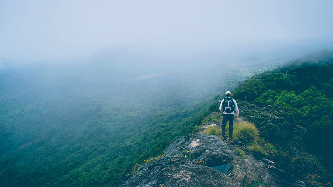
The summit rewards hikers with breathtaking 360-degree views. On a clear day, you can see the majestic Knuckles Mountain Range, the city of Kandy with its iconic landmarks, the sprawling University of Peradeniya campus, and distant landmarks such as Monaragala, Alagalla, and Hunnasgiriya. The interplay of mist, sunlight, and the endless green hills creates a magical and serene atmosphere, ideal for photography or quiet reflection.
Although the trail is not overly challenging, there are precautions hikers should take. The summit can become slippery and dangerous during rainy weather, so it’s best to check the forecast before starting. Sturdy footwear is essential, as is carrying water and light snacks for energy. Beginning the hike early in the morning allows you to enjoy cooler weather and possibly catch the sunrise. First-time hikers are encouraged to hire a local guide, as the terrain can be confusing at certain points.
Katusu Konda is more than just a hike—it’s a blend of adrenaline, natural beauty, and tranquility. Whether you’re an experienced trekker or a curious traveler, this peak offers an experience that lingers long after you descend. After conquering Katusu Konda, nearby attractions like the Hanthana Tea Museum or the tranquil Kandy Lake offer further exploration to round out your adventure.


-
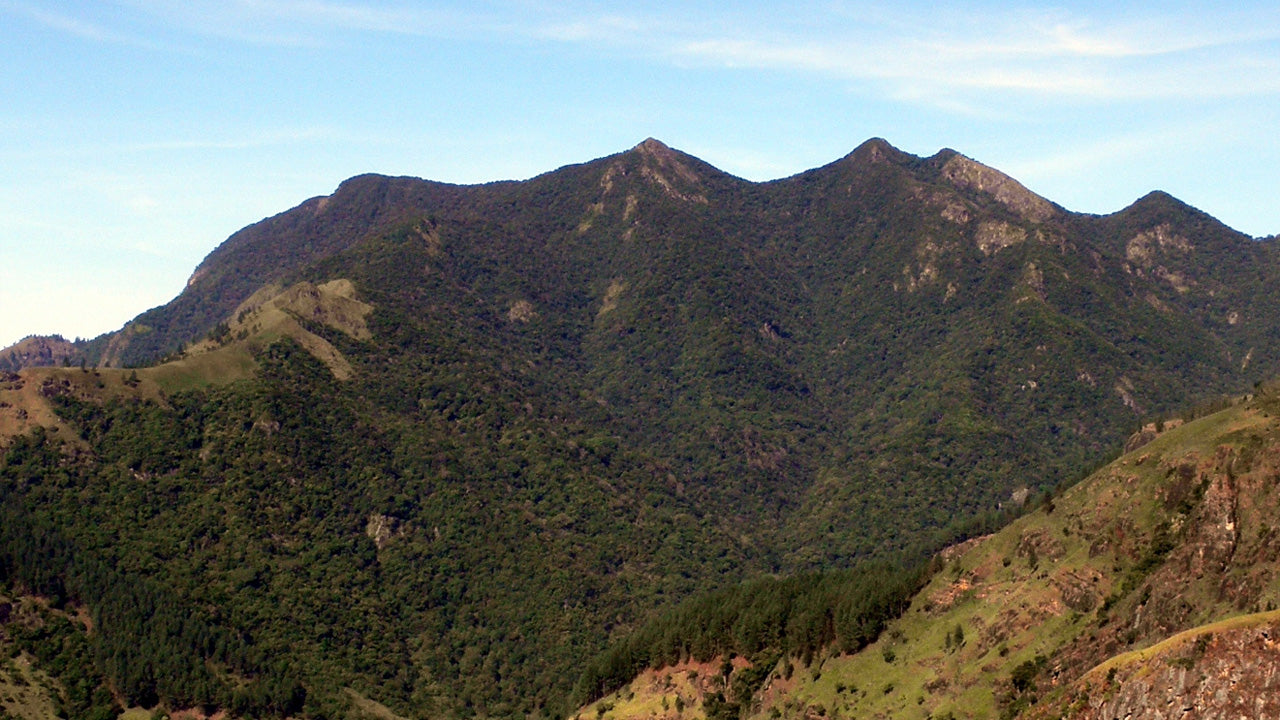
 Kirigalpotta
Wznosząca się na wysokość 2388 m (7835 stóp) nad poziomem morza góra Kirigalpoththa na Sri Lance góruje w dystrykcie Nuwara Eliya, rzucając cień na główne miasto. Jest to druga co do wysokości góra na rajskiej wyspie Sri Lanki i najwyższa góra na wyspie.
-
 Thotupola Kanda
Totapolakanda to trzeci co do wysokości szczyt na Sri Lance, położony w dystrykcie Nuwara Eliya, na wysokości 2357 m n.p.m. Góra znajduje się na terenie Parku Narodowego Równiny Hortona. Szlak na szczyt góry, o długości około dwóch kilometrów, rozpoczyna się kilka metrów od wejścia do Parku Narodowego Równiny Hortona w Pattipola.
-
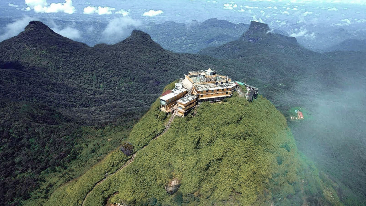 Szczyt Adama (góra Sri Pada)
Najbardziej znanym walorem przyrodniczym Cejlonu jest Szczyt Adama, położony w dystrykcie Ratnapura. Znajduje się na skraju masywu centralnego, ale otacza go grupa gór zwana Dziką Przyrodą Szczytu. Ma wysokość około 2300 metrów i jest drugim co do wysokości szczytem w kraju.
-
 Szczyt Hakgala
Szczyt Hakgala znajduje się w centralnych górach Sri Lanki, na terenie ścisłego rezerwatu przyrody Hakgala. Znajduje się w pobliżu miasta Nuwara Eliya i jest częścią regionu Central Highlands, znanego z przepięknych krajobrazów i chłodniejszego klimatu.
-
 Gommolija
Szczyt Gommolliya jest częścią pasma górskiego Knuckles w centralnej Sri Lance, wpisanego na Listę Światowego Dziedzictwa UNESCO, znanego z bioróżnorodności i piękna krajobrazu. Szczyt znajduje się w dystrykcie Kandy, położonym w centralnych górach Sri Lanki.
-
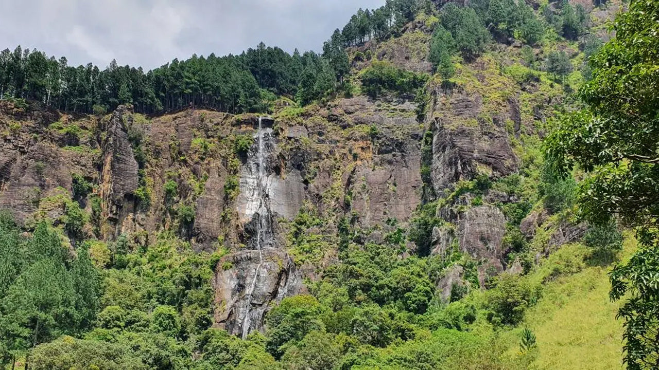 Szczyt Bambarakanda
Szczyt Bambarakanda znajduje się w dystrykcie Badulla na Sri Lance, w prowincji Uva. Jest częścią centralnych wyżyn i znajduje się w pobliżu słynnego wodospadu Bambarakanda, najwyższego wodospadu na Sri Lance. Obszar ten słynie z bujnej zieleni, chłodnego klimatu i zachwycającego piękna przyrody.
-
 Szczyt Riverston
Na szczyt Riverston na Sri Lance można dotrzeć, podróżując około 30 km od miasta Matale drogą Matale–Girandurukotte. Ta tajemnicza, kręta droga z ostrymi, serpentynowymi zakrętami oferuje jedne z najpiękniejszych widoków na okolicę; do tego stopnia, że nazywana jest Mini Krańcem Świata.