Ritigala Archaeological complex
This site is the monastic complex on the lower slopes of Ritigala-kande – the Ritigala Mountain – situated in Sri Lanka’s North Central Province, 25 miles (40 kilometers) southeast of Anuradhapura. These ruins are some of the most distinctive the island has to offer. The Buddhist dagobas (domed relic chambers) and statuary of Anuradhapura and elsewhere are conspicuous by their absence.
The Archeological Site of Ritigala is situated at the eastern slopes of the Ritigala mountain range, the car park and entrance of the excavation site is 20 km to the northwest of Habarana by road. It can be reached from a turn-off at the Habarana-Anuradhapura Road (A11) at a distance of 12 km from Habarana. An 8.5 km along a graveled road leads to the car park of Ritigala at the foot of the mountain range. The distance from Anuradhapura New Town is 55 km, from Polonnaruwa Archeological Site 63 km, from Kandy 113 km, and from Trincomalee 105 km.
Attraction of Ritigala archaeological complex
The reservoir: the perimeter of this huge polygonal reservoir measures 366 meters. it is said to have been dug during the reign of King Pandukabhaya (437-367 BC). Because of its location even before the entrance to the monastery, its use would have been to allow pilgrims and visitors to perform a ritual bath before entering the premises. The reservoir is crossed by a river which supplied it with water. Visitors would walk along it clockwise and reach the other side of the river.
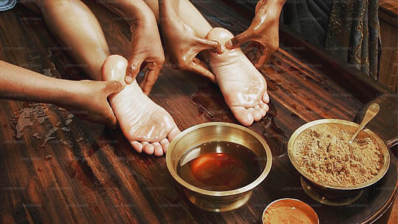
The hospital: among the remains still visible are those of an ancient hospital and facilities for making herbal medicines, a field in which the monks particularly excelled. We can still see a bathtub used for Ayurvedic baths, as well as stones used to reduce roots and herbs to powder.
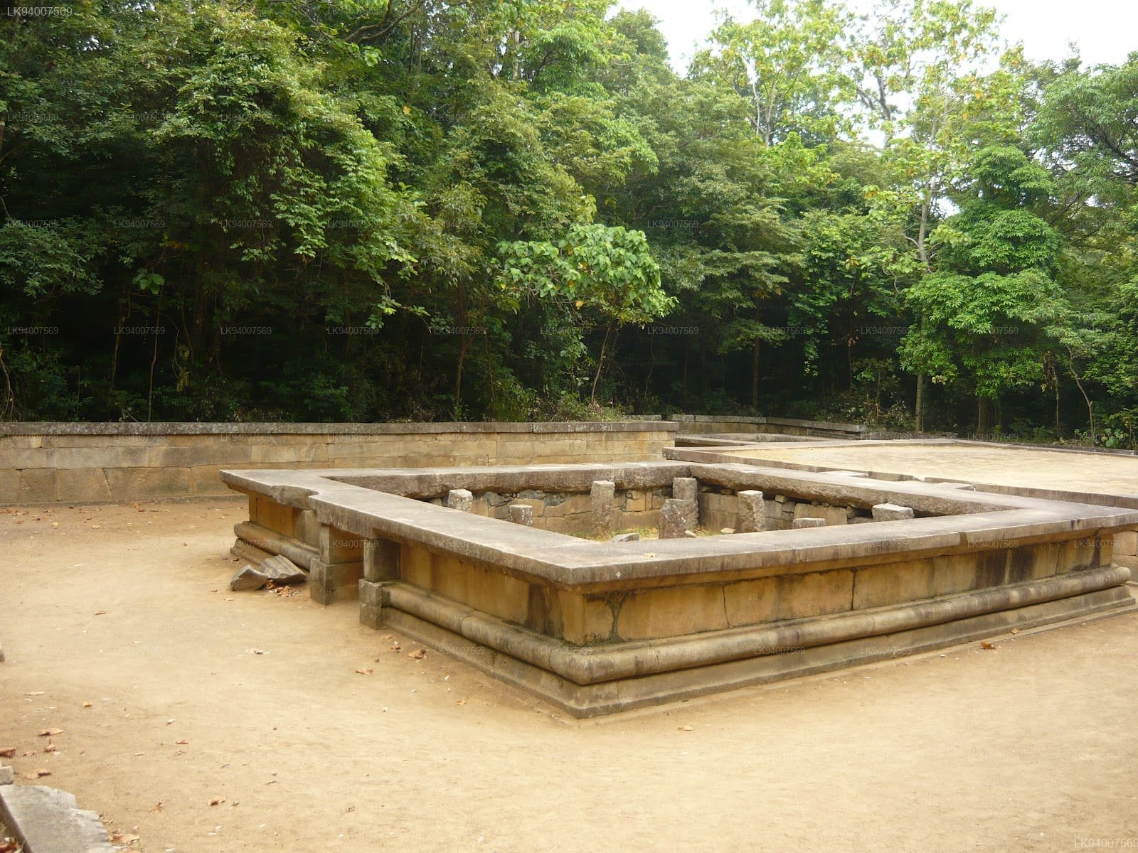
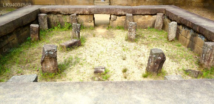
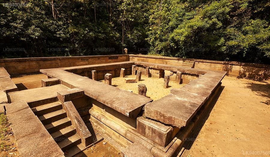
The double platforms: about fifty terraces are visible in Ritigala. On each of them, a double platform was built. They were probably surmounted by buildings housing meditation cells and other spaces devoted to common rites and teachings. Each of these platforms is oriented east-west and a stone bridge connects each pair. These platforms are typical of forest hermitages like that of Ritigala.
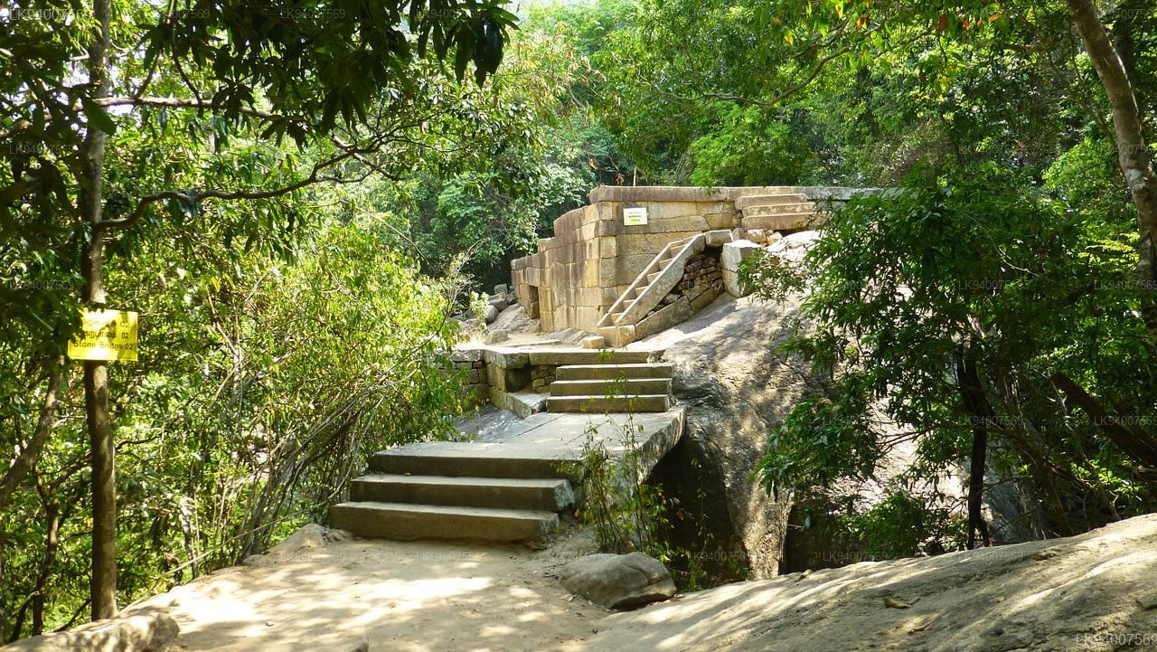
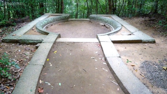
The traffic circles: the paved path is crossed by traffic circles visible at each intersection. These are large slabs forming a circle from which two or more paths start.
-
 스리 마하 보디야
자야 스리 마하 보디는 스리랑카 아누라다푸라 마하메우나 정원에 있는 신성한 보리수입니다. 이 나무는 부처가 깨달음을 얻은 인도 부다가야의 역사적인 스리 마하 보디의 남쪽 가지입니다. 기원전 288년에 심어졌으며, 심은 날짜가 알려진 세계에서 가장 오래된 인간 심은 나무입니다.
-
 루완웰리세야
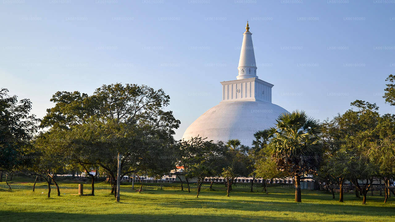
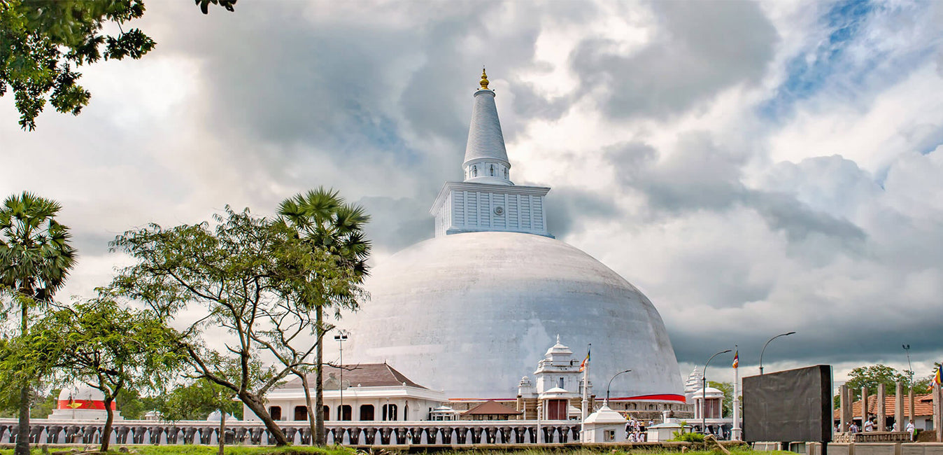
루완웰리 마하 세야(Ruwanweli Maha Seya)는 마하투파(Mahatupa, 위대한 투파)로도 알려져 있으며, 스리랑카 아누라다푸라에 있는 사리탑(사리가 보관된 반구형 구조물)입니다. 2쿼트(약 1.6리터) 또는 1도나(약 1.2리터)에 달하는 부처님의 사리가 모셔져 있어, 세계 최대 규모의 사리 소장품입니다. 이 탑은 기원전 140년경 싱할라 왕조의 두투게무누 왕에 의해 건립되었으며, 그는 촐라 왕조의 엘라라(엘랄란) 왕이 패배한 후 스리랑카의 왕이 되었습니다.
-
 투파라마야
투파라마야투파라마야 사원은 마힌다 테로(마힌다가마나야)가 스리랑카에 도착한 후 건립된 최초의 불교 사원입니다. 마하메우나 공원의 성지에 위치한 투파라마야 스투파는 이 섬에서 가장 오래된 다고바로, 데바남피야 티사 왕(기원전 247-207년) 재위 당시의 것입니다. 이 사원은 정부로부터 스리랑카의 고고학 유적지로 공식 인정받았습니다.
-
 로바마하파야
로바마하파야는 스리랑카 고대 도시 아누라다푸라의 루완웰리세야와 스리 마하보디야 사이에 위치한 건물입니다. 청동 기와로 지붕을 덮었기 때문에 청동 궁전 또는 로하프라사다야라고도 불립니다. 고대에는 이 건물에 식당과 우포사타가라(우포사타의 집)가 있었습니다.
-
 아바야기리 다고바
아바야기리 비하라는 스리랑카 아누라다푸라에 위치했던 대승불교, 소승불교, 금강승 불교의 주요 사찰 유적지였습니다. 이곳은 세계에서 가장 광범위한 불교 유적지 중 하나이며, 스리랑카에서 가장 신성한 불교 순례 도시 중 하나입니다.
-
 제타바나라마야
제타바나라마 스투파(Jetavanarama stupa) 또는 제타바나라마야(Jetavanaramaya)는 유네스코 세계문화유산 도시인 스리랑카 아누라다푸라에 있는 제타바나 사원 유적지에 위치한 불교 사리탑입니다. 높이 122미터(400피트)로 세계에서 가장 높은 스투파였으며, 아누라다푸라의 마하세나 왕(273~301)이 건립했을 당시에는 세계에서 세 번째로 높은 건축물이었습니다.
-
 미리사웨티야 스투파
미리사웨티 스투파는 스리랑카 고대 도시 아누라다푸라에 위치한 기념 건물이자 스투파입니다. 두투가무누 왕(기원전 161년~기원전 137년)은 엘라라 왕을 물리친 후 미리사웨티 스투파를 건립했습니다. 그는 부처님의 사리를 홀에 안치한 후, 홀을 떠나 티사 웨와로 가서 목욕을 했습니다.
-
 란카라마
란카라마란카라마는 스리랑카 아누라다푸라 고대 왕국의 갈헤바카다에 있는 고대 유적지에 발라감바 왕이 세운 사리탑입니다. 사리탑의 고대 형태에 대해서는 알려진 바가 없으며, 후에 개축되었습니다. 유적을 통해 석주가 줄지어 서 있는 것을 알 수 있으며, 사리탑을 감싸는 집(바타다게)이 있었을 가능성이 높습니다.
-
 말하는 무지야
이수루무니야(Isurumuniya)는 스리랑카 아누라다푸라의 티사 웨와(Tissa Wewa, 티사 탱크) 근처에 위치한 불교 사원입니다. 이 비하라에는 특별히 흥미로운 네 가지 조각상이 있는데, 이수루무니야 연인상, 코끼리 연못상, 그리고 왕족상입니다. 고대 메가기리 비하라(Meghagiri Vihara) 또는 메이기리 비하라(Meygiri Vihara)는 현재 이수루무니 비하라(Isurumuni Vihara)로 알려져 있습니다.