Wangedi Kanda

Wangedi Kanda Wangedi Kanda Wangedi Kanda

Wangedigala liegt in unmittelbarer Nähe der Autobahn A4 Badulla – Colombo . Aufgrund seines natürlichen Campingplatzes auf dem Berggipfel ist es ein beliebtes Campingziel. „Wangediya“ bedeutet auf Singhalesisch Mörser, daher wird angenommen, dass der Name Wangedigala von der natürlichen Form des Berges abgeleitet ist, die einem Mörser ähnelt.

So erreichen Sie Wangedigala

Um Wangedigala zu erreichen, fahren Sie von Belihuloya aus etwa 14 km auf dem Colombo - Batticaloa Highway und dann etwa 3,2 km auf der Kalupahana - Ohiya Road. Es gibt mehrere Ausgangspunkte für die Wanderung, aber die Route über die Kalupahana Black and White Bridge ist die einfachste und schnellste.

Der Aufstieg auf den Wangedigala ist schwierig, da man steil an Ästen entlangklettern muss. Wenn Sie den Wanderwegen folgen, werden Sie feststellen, dass einige Abschnitte des Weges verschwunden sind.

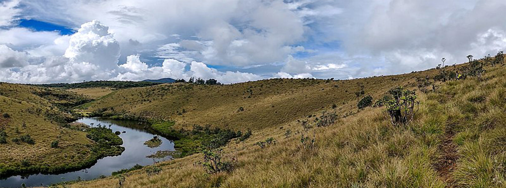
Beim Wandern durch den Wangedigala Kanda-Wald bieten sich Wanderern atemberaubende Ausblicke auf die Umgebung, darunter die Bambarakanda-Wasserfälle , die Lanka-Ella-Wasserfälle und bis nach Ohiya.

About Ratnapura District

Ratnapura is the provincial capital of Sabaragamuwa Province of Sri Lanka and the Ratnapura District in which the town is situated. Located some 101 km south east of Colombo, it is the centre of a long-established industry of precious stone mining including rubies, sapphires, and other gems. Apart from gem mining, the town is known for rice and fruit cultivations. Large plantations of tea and rubber surround the town. Tea grown in this region is called low-country tea. There is a well-established tourism industry in Ratnapura. Sinharaja Forest Reserve, Udawalawe National Park, Kitulgala, and Sri pada are especially popular among tourists.

Most of the large-scale gem businessmen of Sri Lanka operate from Ratnapura. The Rattnapura town depends on the gem trade. The town's agricultural industry is also well developed. Large plantations of tea and rubber surround the town. Although rice fields also used to be a common sight around the town, rice cultivation presently faces an uncertain future in Ratnapura because many farmers are giving up their rice cultivation and switching to gem mining which is a more productive way of earning money.

Special places in Rattnapura: The mountain Sri Pada -Adam's Peak, Maha Saman Devala, Delgamu Viharaya, Pothgul Viharaya, Sts. Peter and Paul Cathedral St. Luke's Church, Rathneswaram Sivan Kovil, Jumma Mosque, Diva Guhava

About Sabaragamuwa Province

The Sabaragamuwa Province of Sri Lanka contains two main cities called Ratnapura and Kegalle. At an elevation of approximately 500 feet above sea level, Ratnapura is the provincial capital of Sabargamuwa. It is 60 miles (100 km) from the main coastal city of Colombo. Province of Sabaragamuwa The gem-mining centre of Sri Lanka is also a major crossroad between southern plains and the hill country to the east.

In Sabaragamuwa province there is a route to Sri Pada from Ratnapura direction. Excursions include Sinharaja Forest Reserve and Udawalawe National Park. The route towards hill country is beautiful. The surrounding area is a popular trekking destination and a good place for bird watching.