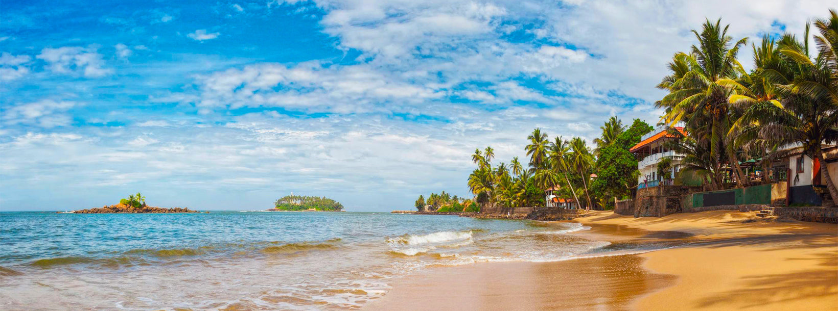
Moragalla Beach

Moragalla Beach Moragalla Beach Moragalla Beach

Moragalla is a beach that is just a few kilometers south of the tourist domain of Beruwala. This wide stretch of sandy haven adjoins the estuary of the Bentota River, otherwise known as the Bentara River.

While the beach of Moragalla is not anything special, just a nice long stretch of pale yellow sands and reasonably clear blue water; but for some reason this slightly lesser known place does have a sort of tranquility to it. The sea around the Moragalla is quite shallow due to the underwater coral reef the lies not far from the coastline.  As such it’s perfect for pursuits such as snorkeling, windsurfing, diving and etc.

The Bentara River on the southern end of the beach is also a place to be explored in detail. Lined with over 20 varieties of mangrove trees and several islands floating midstream, the river is an interesting avenue for boat trips.

As one nears the southern end of the strip of Moragalla beach, a land formation that appears to be an island starts becoming visible. However the truth is that this no island; but the hooked end of Bentota beach that forms a panhandle. This land formation can be reached quite quickly by rowing across using a boat; or by traveling the long way around along the coastline.  On reaching this section of land, a flight of crude stairs built into a rocky mound becomes visible. Climbing these stairs through the dense jungle-like greenery, leads to a little temple where a little yoga ashram is located. Following a little footpath past the shrine leads to the edge of a cliff with a great view. This place is good for watching the beautiful sunsets of the tropics.

Moragalla is increasingly becoming commercialized these days. As such, it is the responsibility of all visitors to keep the beach clean and beautiful.

Moragalla Beach Moragalla Beach Moragalla Beach
?LK94009784: Text by Lakpura™. Images by Google, copyright(s) reserved by original authors.?

Informazioni sul distretto di Kalutara

Kalutara si trova a circa 42 chilometri a sud di Colombo. Un tempo importante centro per il commercio delle spezie, Kalutara fu controllata in diversi periodi da portoghesi, olandesi e britannici. La città è famosa per la produzione di cesti e stuoie in bambù di alta qualità, nonché per i suoi deliziosi frutti di mangostano.

Il ponte di Kalutara, lungo 38 metri, è stato costruito alla foce del fiume Kalu Ganga e rappresenta un collegamento fondamentale tra le regioni occidentali e meridionali dello Sri Lanka. All’estremità meridionale del ponte si trova il Kalutara Vihara, un tempio buddhista a tre piani costruito negli anni Sessanta. Questo tempio è unico al mondo perché ospita l’unico stupa cavo esistente.

Informazioni sulla Provincia Occidentale

La Provincia Occidentale è la provincia più densamente popolata dello Sri Lanka. Essa ospita la capitale legislativa, Sri Jayewardenepura Kotte, oltre a Colombo, che è il principale centro amministrativo e commerciale del paese. La provincia è suddivisa in tre distretti principali: Colombo (642 chilometri quadrati), Gampaha (1.386,6 chilometri quadrati) e Kalutara (1.606 chilometri quadrati).

In quanto centro economico dello Sri Lanka, la Provincia Occidentale accoglie tutte le principali aziende locali e internazionali. Inoltre, vi si trovano numerosi negozi di marchi di alta moda e grandi catene commerciali, rendendola una destinazione ideale per lo shopping e le attività economiche.

Essendo la provincia con la popolazione più elevata del paese, ospita quasi tutte le principali istituzioni educative dello Sri Lanka. Le università presenti nella provincia includono l’Università di Colombo, l’Università di Sri Jayewardenepura, l’Università di Kelaniya, l’Università Aperta dello Sri Lanka, l’Università Buddhista e Pali dello Sri Lanka, l’Università della Difesa Generale Sir John Kotelawala e l’Università di Moratuwa.

Inoltre, la Provincia Occidentale possiede il maggior numero di scuole del paese, comprendendo scuole nazionali, provinciali, private e internazionali.