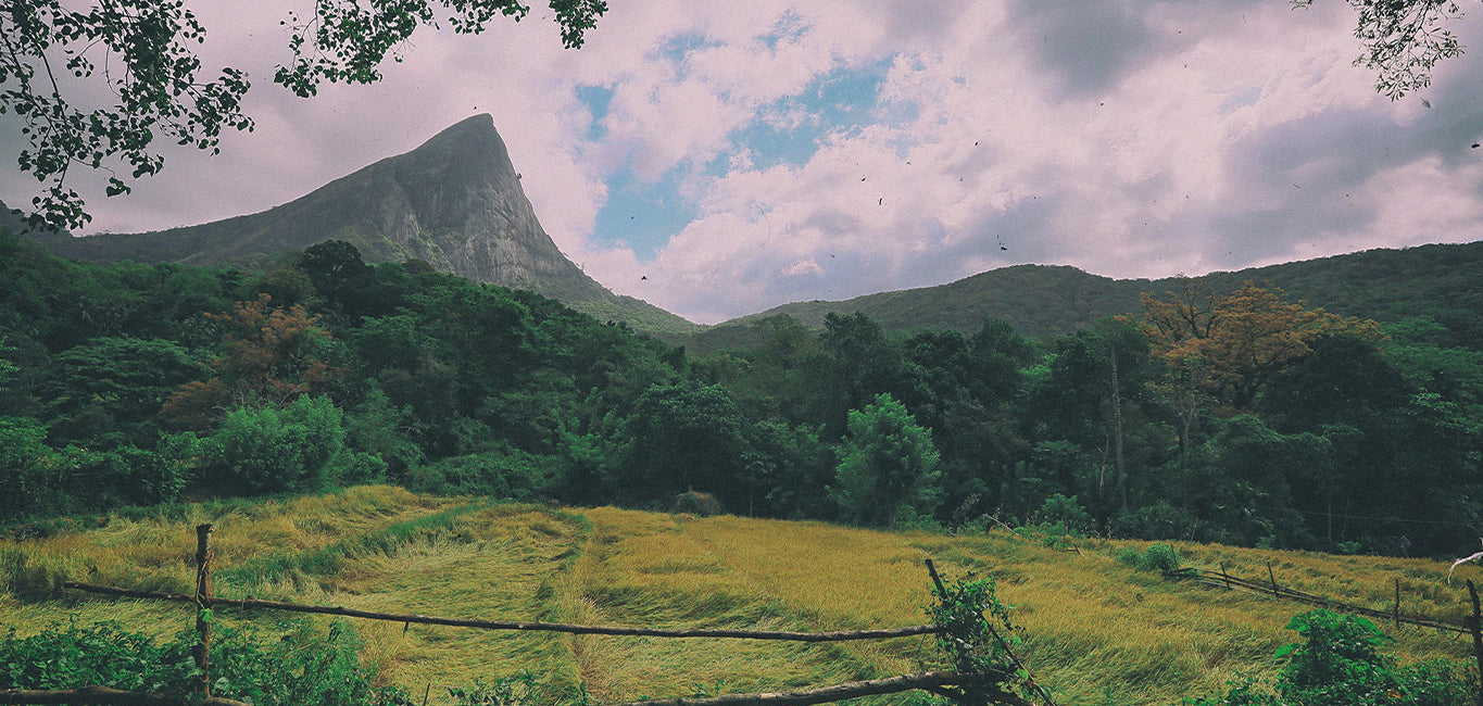
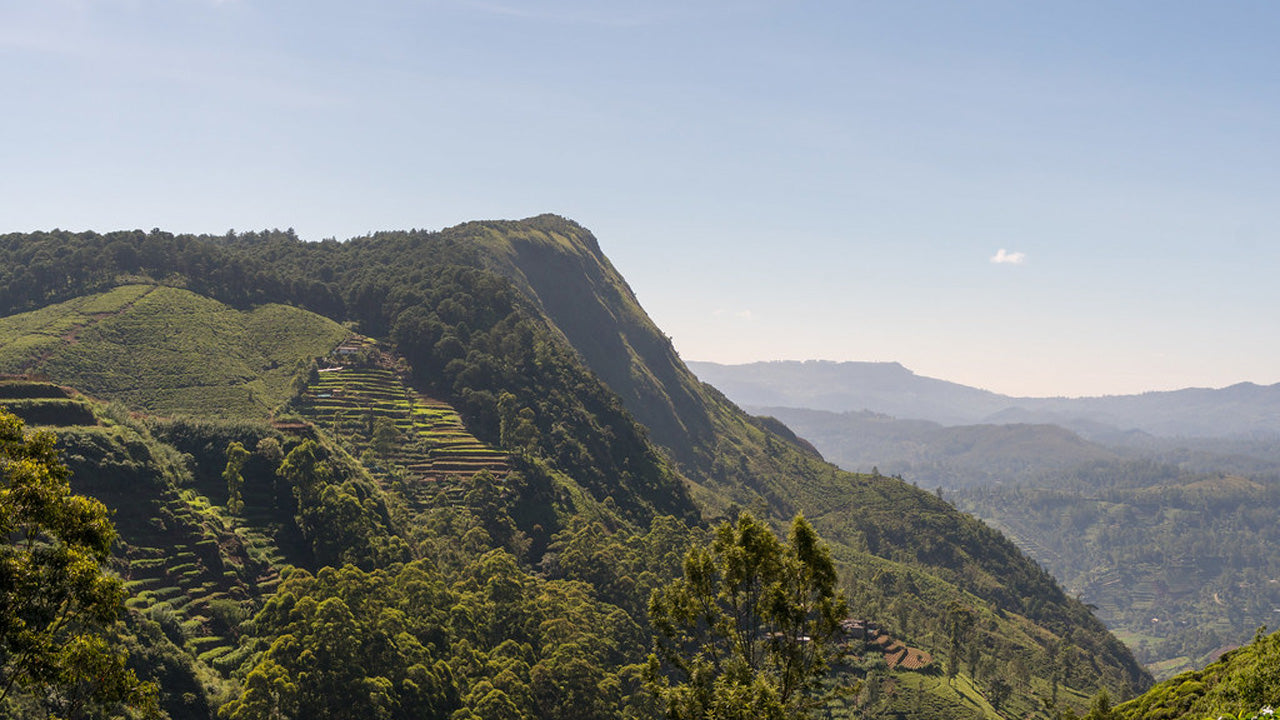
Katusu Konda


Katusu Konda, nestled in the Hanthana Mountain Range near Kandy, is a must-visit destination for hikers and nature enthusiasts. Its name, which translates to "Lizard's Back," comes from its unique shape resembling a lizard's spine. This peak offers an adventurous and rewarding experience, making it a hidden gem in Sri Lanka’s hiking trails.
The journey begins with a picturesque trail through the rolling landscapes of the Hanthana hills, surrounded by lush greenery and a cool, refreshing climate. The initial part of the hike is relatively easy, but as you ascend, the adventure truly begins. The trail becomes narrower, leading to the summit's razor-edge ridge. Strong winds sweep across the peak, adding to the adrenaline-filled experience, while the steep drop-offs on either side provide both thrill and awe.
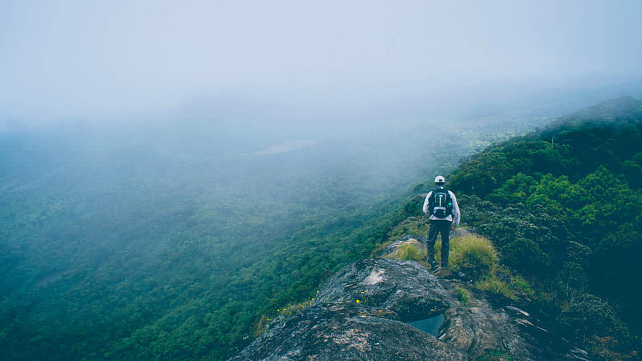
The summit rewards hikers with breathtaking 360-degree views. On a clear day, you can see the majestic Knuckles Mountain Range, the city of Kandy with its iconic landmarks, the sprawling University of Peradeniya campus, and distant landmarks such as Monaragala, Alagalla, and Hunnasgiriya. The interplay of mist, sunlight, and the endless green hills creates a magical and serene atmosphere, ideal for photography or quiet reflection.
Although the trail is not overly challenging, there are precautions hikers should take. The summit can become slippery and dangerous during rainy weather, so it’s best to check the forecast before starting. Sturdy footwear is essential, as is carrying water and light snacks for energy. Beginning the hike early in the morning allows you to enjoy cooler weather and possibly catch the sunrise. First-time hikers are encouraged to hire a local guide, as the terrain can be confusing at certain points.
Katusu Konda is more than just a hike—it’s a blend of adrenaline, natural beauty, and tranquility. Whether you’re an experienced trekker or a curious traveler, this peak offers an experience that lingers long after you descend. After conquering Katusu Konda, nearby attractions like the Hanthana Tea Museum or the tranquil Kandy Lake offer further exploration to round out your adventure.


-
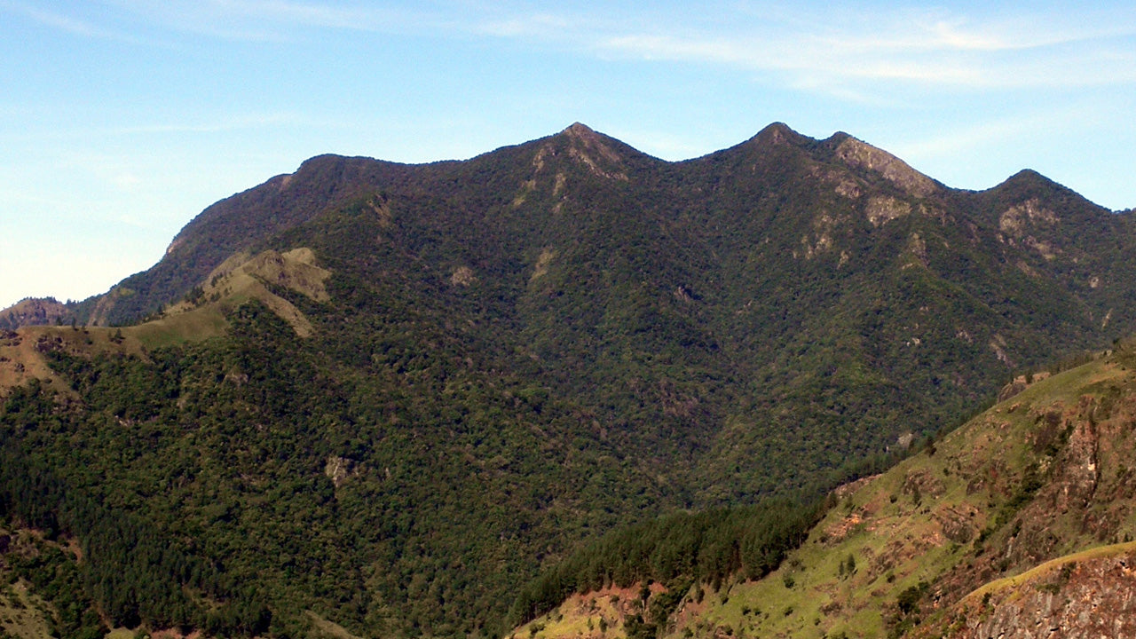
 キリガルポッタ
スリランカのキリガルポッタ山は、海抜2,388メートル(7,835フィート)に達し、ヌワラエリヤ地区の中心街にそびえ立ち、街に影を落としています。この山は、楽園の島スリランカで2番目に高い山であり、島内で最も高い山でもあります。
-
 トトゥポラ・カンダ
トタポラカンダはスリランカで3番目に高い山で、ヌワラエリヤ県に位置し、海抜2,357メートルです。この山はホートン・プレインズ国立公園内にあります。山頂まで続く約2キロメートルの登山道は、ホートン・プレインズ国立公園のパティポラ入口から数メートルのところから始まります。
-
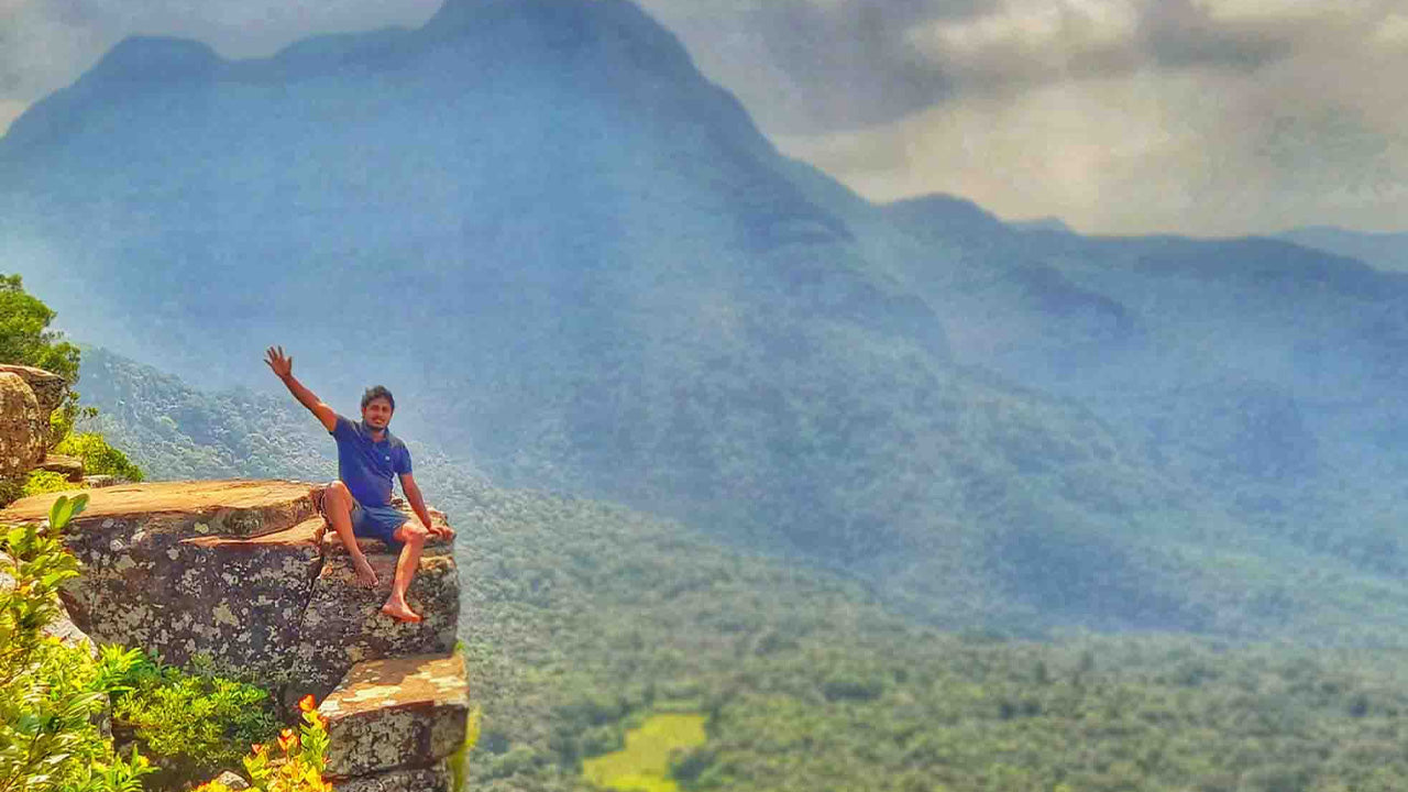
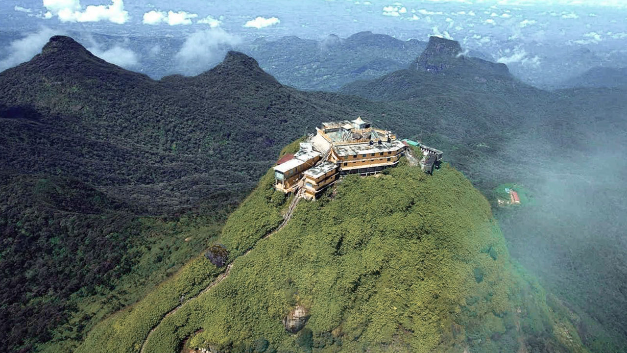 アダムズ ピーク (スリ パダ山)
セイロンで最も有名な地形は、ラトナプラ地区にあるアダムスピークです。中央山塊の端に位置し、周囲の山々は「ウィルダネス・オブ・ザ・ピーク」と呼ばれています。標高は約2200メートルで、セイロン島で2番目に高い山です。
-
 ハクガラピーク
ハクガラピークはスリランカ中央高地、ハクガラ厳正自然保護区内に位置しています。ヌワラエリヤの町の近くに位置し、息を呑むような景観と涼しい気候で知られる中央高地地域に属しています。
-
 ゴムリヤ
ゴムリヤゴムリヤ峰は、スリランカ中部にあるナックルズ山脈の一部で、その生物多様性と景観の美しさで知られるユネスコ世界遺産に登録されています。この峰は、スリランカ中央高地のキャンディ県に位置しています。
-
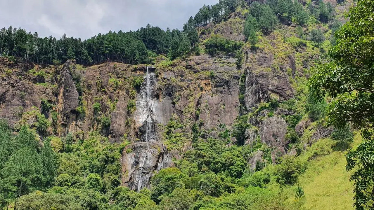 バンバラカンダピーク
バンバラカンダ峰は、スリランカのウバ州バドゥッラ地区にあります。中央高地に位置し、スリランカで最も高い滝として有名なバンバラカンダ滝の近くにあります。この地域は、豊かな緑、涼しい気候、そして息を呑むような自然美で知られています。
-
 リバーストンピーク
スリランカのリバーストンピークへは、マタレの町から約30km、マタレ・ギランドゥルコッテ道路を下って行くことができます。この秘密の曲がりくねった道は、急なヘアピンカーブが続き、周囲の田園地帯の絶景を堪能できます。「ミニ世界の果て」と呼ばれるほどです。