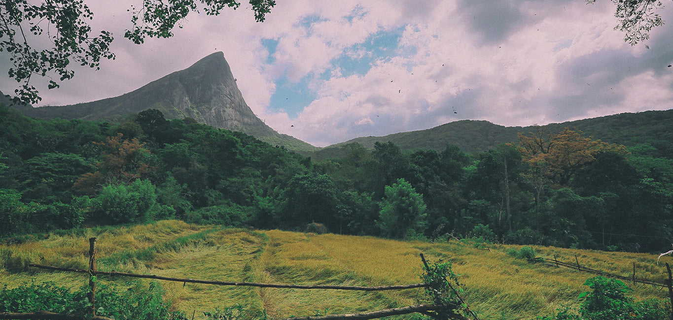
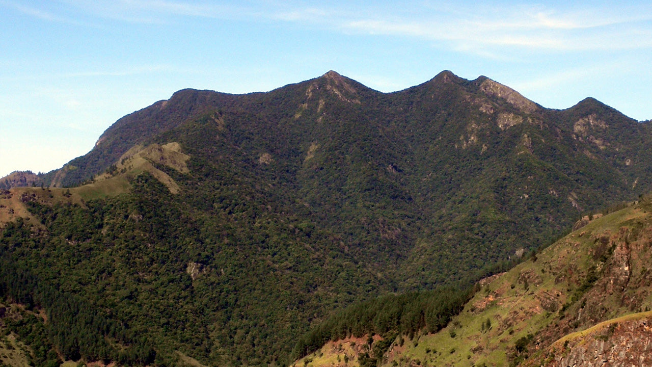
ハクガラ山脈


ハクガラピークは、スリランカの中央州に位置する著名な山で、ヌワラエリヤの丘の町の近くにそびえ立ち、風光明媚なハクガラ山脈の一部を形成しています。その劇的な標高と涼しい気候で知られ、このピークは島の中央高地において文化的、歴史的、および自然的な重要性を持っています。霧に包まれた風景、森林、そして起伏のある丘に囲まれたハクガラピークは、スリランカの低地地域と対照的な美しい景観を提供し、高地の風景と静かな山岳地帯を求める人々にとって魅力的な目的地となっています。
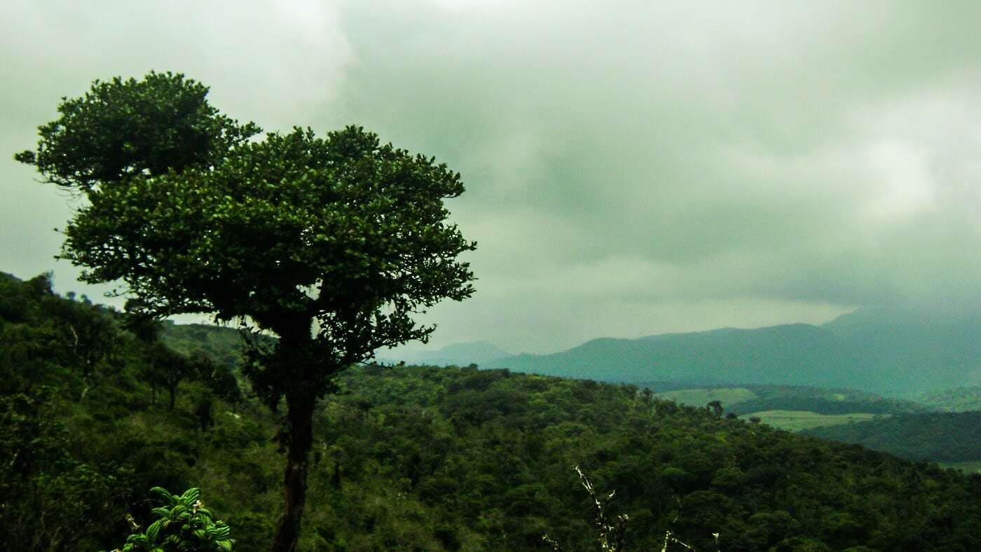
ハクガラピーク周辺の生物多様性は豊かで独特であり、涼しい温度で繁栄する高山森林や草原によって形成されています。この地域は、高地の気候に適応した固有種の鳥類、蝶、および植物種をサポートしています。密な森林の覆いと自然の植生は、この地域の生態的な重要性に寄与し、中央州内の近隣の保護区域や植物園とつながっています。これらの生態系は、スリランカの高地の生物多様性を保存する上で重要な役割を果たしています。
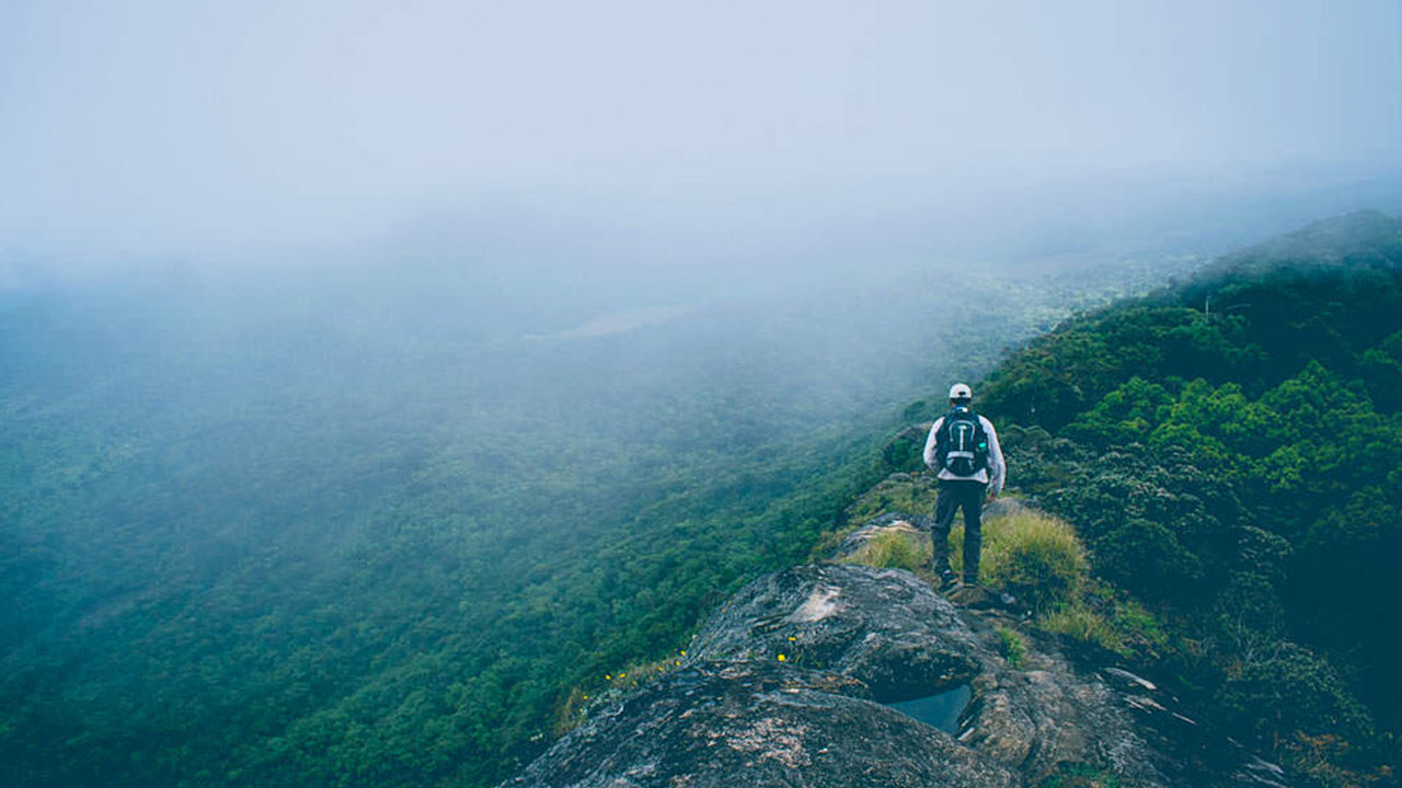
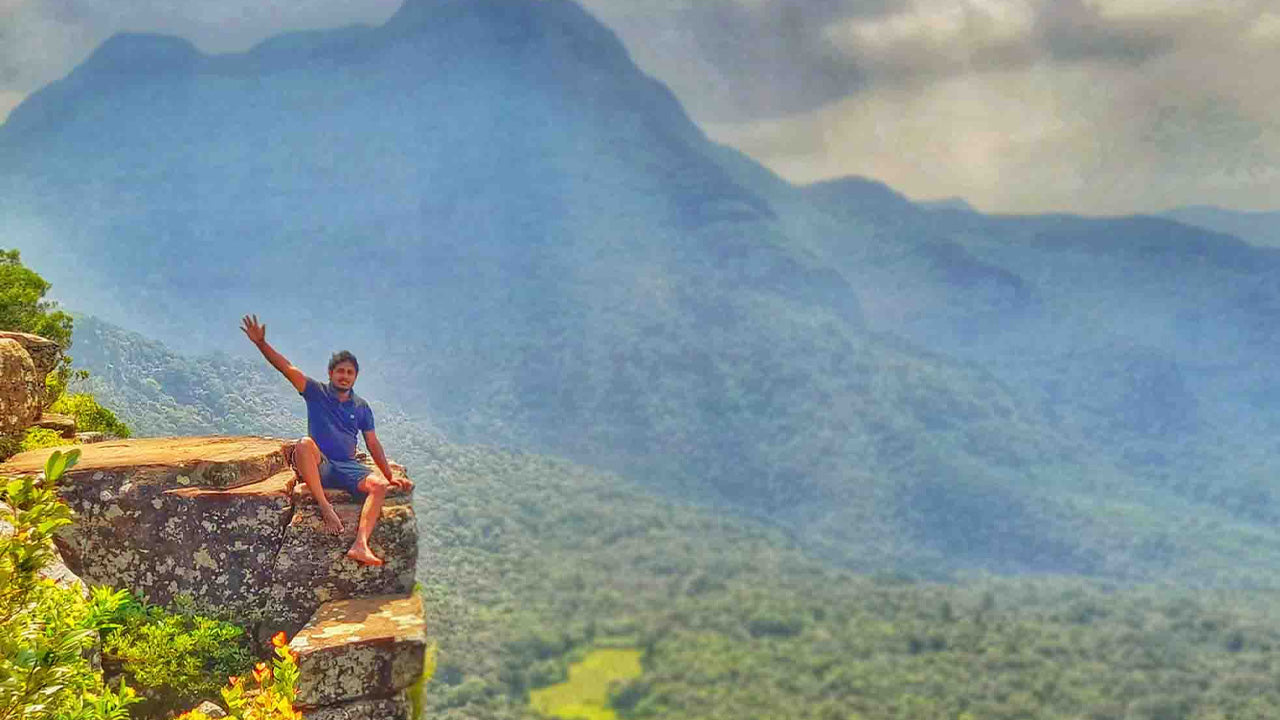
ハクガラピークに訪れる人々は、自然、ハイキング、および風光明媚な探索を中心とした体験を楽しむことができます。ピークに向かうトレイルは、周囲の谷や山脈のパノラマビューを楽しむためのハイキング、バードウォッチング、および写真撮影の機会を提供します。穏やかな雰囲気は、ゆっくりとした探検や、瞑想、そして自然の周囲を堪能することを促進します。旅行者はしばしば、ハクガラピークへの訪問をヌワラエリヤの近隣の観光地と組み合わせて、スリランカの丘陵地帯での体験をさらに充実させます。
ハクガラピークは一年中訪れることができますが、最も好ましい条件は、1月から4月の乾季の間で、視界がクリアで、ハイキングの条件がより快適です。早朝は、霧が山々に広がる前に最高の景色を提供します。アクセスは主にヌワラエリヤを通じて行われ、ピークへと他の中央州の地域を結ぶ確立されたルートがあります。季節ごとの天候の変化、涼しい風や時折の雨は体験に特徴を加え、ハクガラピークを自然愛好家や高地探検家にとって rewardingな目的地にしています。


-
 キリガルポッタ
スリランカのキリガルポッタ山は、海抜2,388メートル(7,835フィート)に達し、ヌワラエリヤ地区の中心街にそびえ立ち、街に影を落としています。この山は、楽園の島スリランカで2番目に高い山であり、島内で最も高い山でもあります。
-
 トトゥポラ・カンダ
トタポラカンダはスリランカで3番目に高い山で、ヌワラエリヤ県に位置し、海抜2,357メートルです。この山はホートン・プレインズ国立公園内にあります。山頂まで続く約2キロメートルの登山道は、ホートン・プレインズ国立公園のパティポラ入口から数メートルのところから始まります。
-
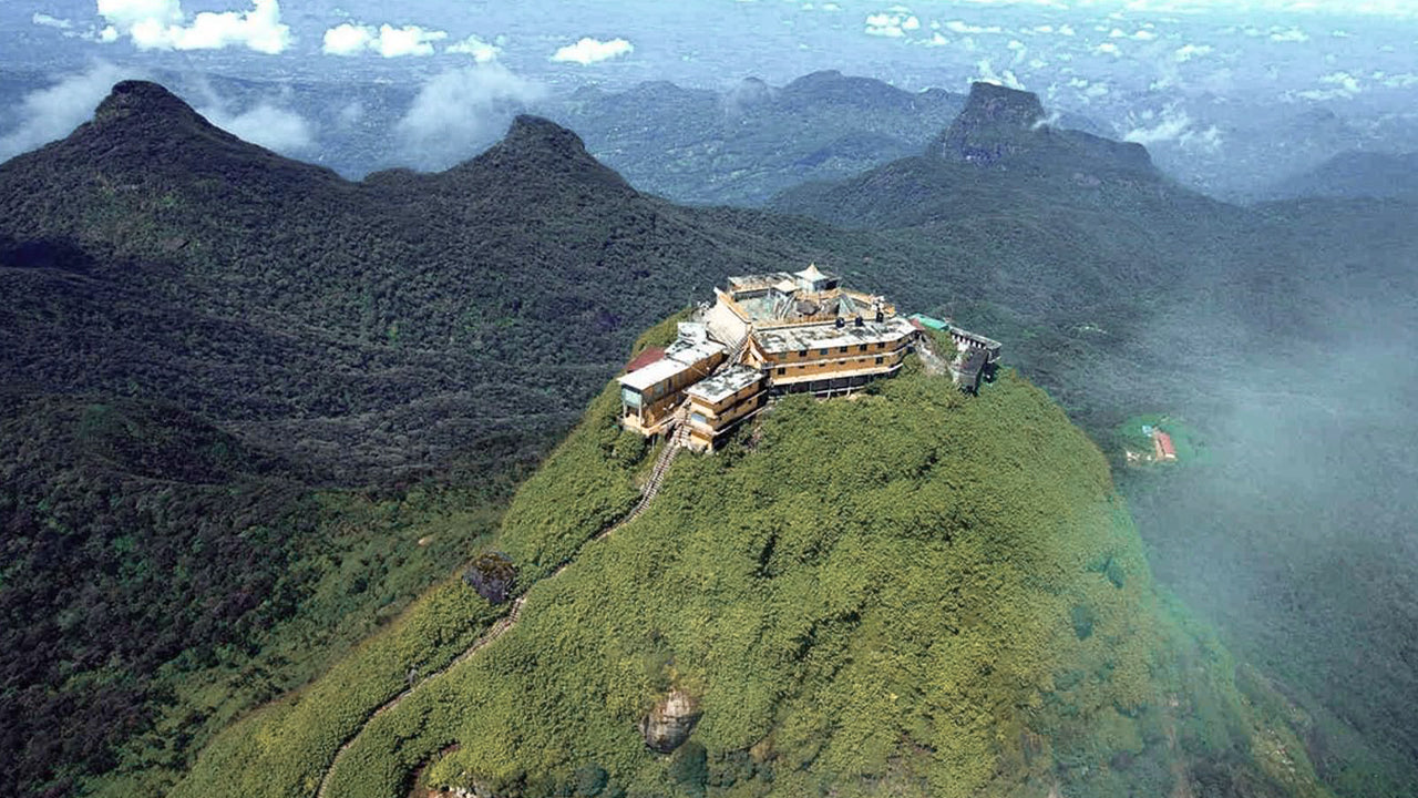 アダムズ ピーク (スリ パダ山)
セイロンで最も有名な地形は、ラトナプラ地区にあるアダムスピークです。中央山塊の端に位置し、周囲の山々は「ウィルダネス・オブ・ザ・ピーク」と呼ばれています。標高は約2200メートルで、セイロン島で2番目に高い山です。
-
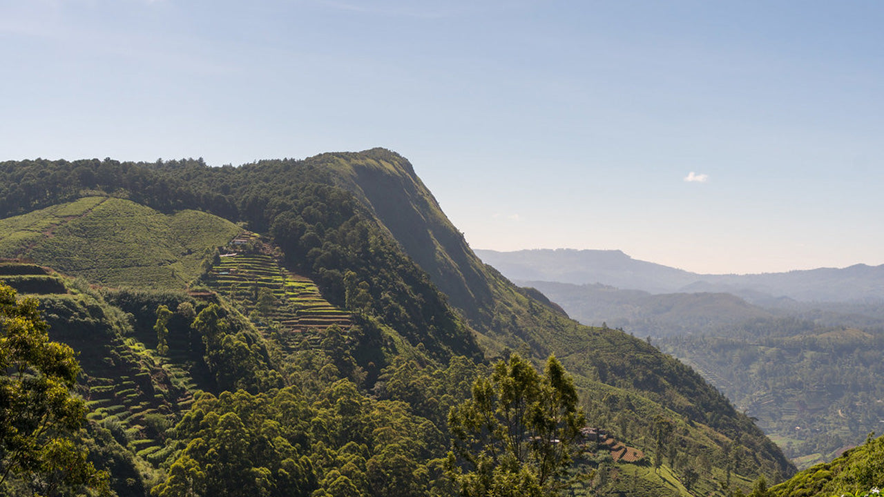 ハクガラピーク
ハクガラピークはスリランカ中央高地、ハクガラ厳正自然保護区内に位置しています。ヌワラエリヤの町の近くに位置し、息を呑むような景観と涼しい気候で知られる中央高地地域に属しています。
-
 ゴムリヤ
ゴムリヤゴムリヤ峰は、スリランカ中部にあるナックルズ山脈の一部で、その生物多様性と景観の美しさで知られるユネスコ世界遺産に登録されています。この峰は、スリランカ中央高地のキャンディ県に位置しています。
-
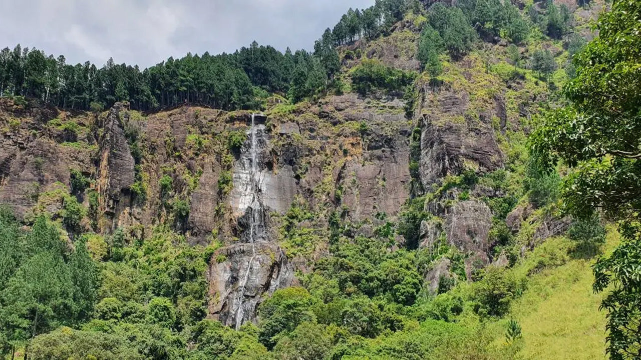 バンバラカンダピーク
バンバラカンダ峰は、スリランカのウバ州バドゥッラ地区にあります。中央高地に位置し、スリランカで最も高い滝として有名なバンバラカンダ滝の近くにあります。この地域は、豊かな緑、涼しい気候、そして息を呑むような自然美で知られています。
-
 リバーストンピーク
スリランカのリバーストンピークへは、マタレの町から約30km、マタレ・ギランドゥルコッテ道路を下って行くことができます。この秘密の曲がりくねった道は、急なヘアピンカーブが続き、周囲の田園地帯の絶景を堪能できます。「ミニ世界の果て」と呼ばれるほどです。