Ritigala Archaeological complex
This site is the monastic complex on the lower slopes of Ritigala-kande – the Ritigala Mountain – situated in Sri Lanka’s North Central Province, 25 miles (40 kilometers) southeast of Anuradhapura. These ruins are some of the most distinctive the island has to offer. The Buddhist dagobas (domed relic chambers) and statuary of Anuradhapura and elsewhere are conspicuous by their absence.
The Archeological Site of Ritigala is situated at the eastern slopes of the Ritigala mountain range, the car park and entrance of the excavation site is 20 km to the northwest of Habarana by road. It can be reached from a turn-off at the Habarana-Anuradhapura Road (A11) at a distance of 12 km from Habarana. An 8.5 km along a graveled road leads to the car park of Ritigala at the foot of the mountain range. The distance from Anuradhapura New Town is 55 km, from Polonnaruwa Archeological Site 63 km, from Kandy 113 km, and from Trincomalee 105 km.
Attraction of Ritigala archaeological complex
The reservoir: the perimeter of this huge polygonal reservoir measures 366 meters. it is said to have been dug during the reign of King Pandukabhaya (437-367 BC). Because of its location even before the entrance to the monastery, its use would have been to allow pilgrims and visitors to perform a ritual bath before entering the premises. The reservoir is crossed by a river which supplied it with water. Visitors would walk along it clockwise and reach the other side of the river.
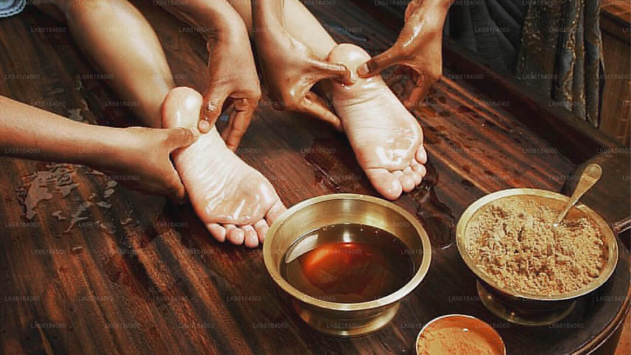
The hospital: among the remains still visible are those of an ancient hospital and facilities for making herbal medicines, a field in which the monks particularly excelled. We can still see a bathtub used for Ayurvedic baths, as well as stones used to reduce roots and herbs to powder.
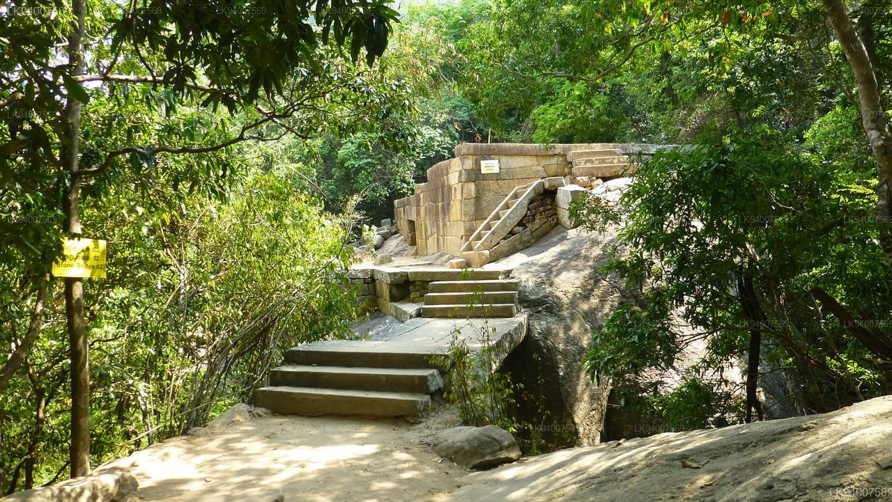
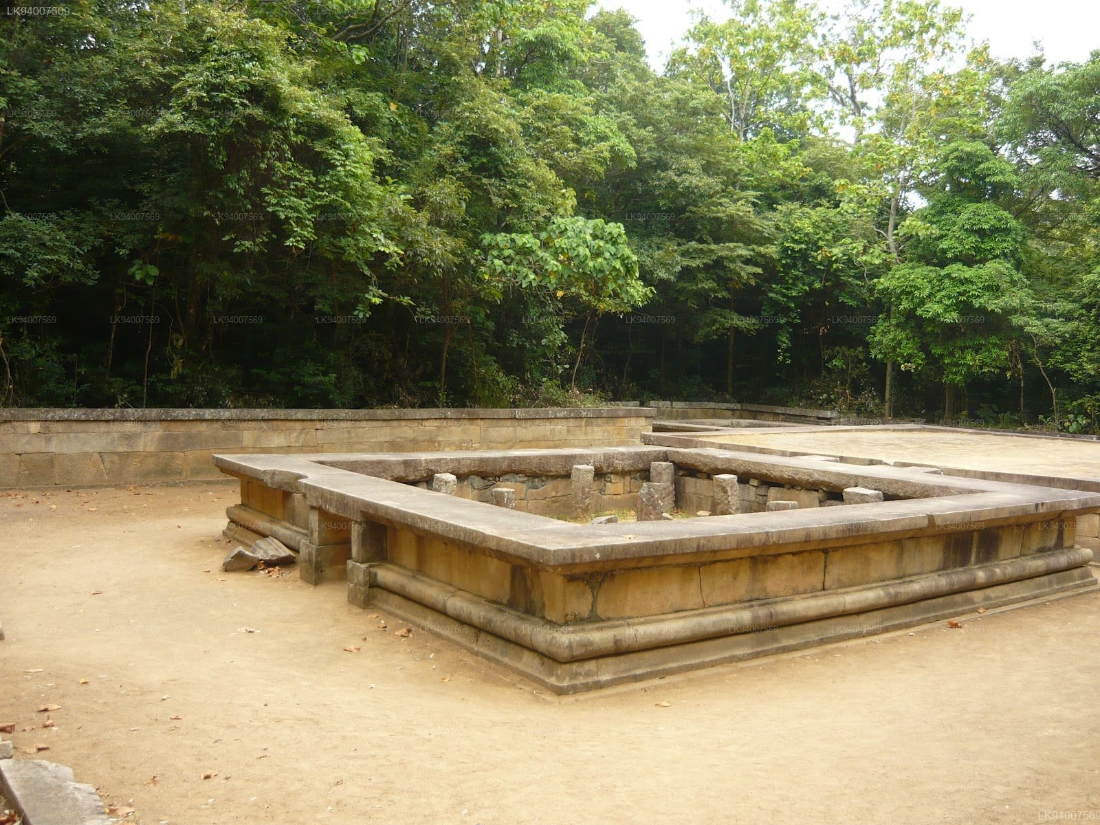
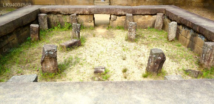
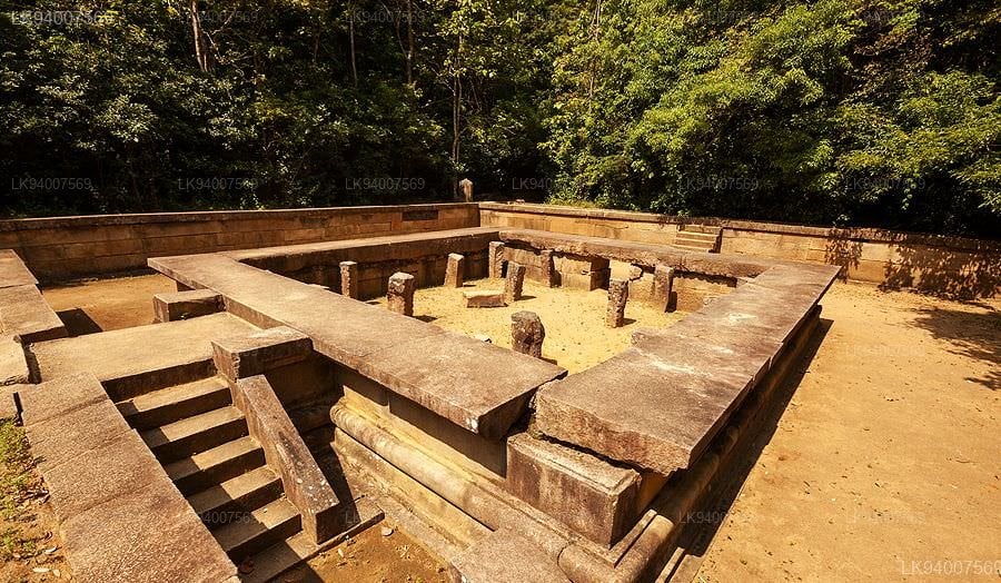
The double platforms: about fifty terraces are visible in Ritigala. On each of them, a double platform was built. They were probably surmounted by buildings housing meditation cells and other spaces devoted to common rites and teachings. Each of these platforms is oriented east-west and a stone bridge connects each pair. These platforms are typical of forest hermitages like that of Ritigala.
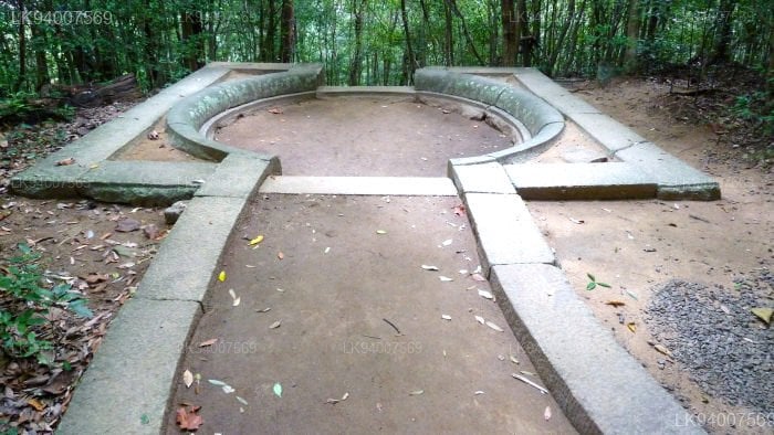
The traffic circles: the paved path is crossed by traffic circles visible at each intersection. These are large slabs forming a circle from which two or more paths start.
-
 श्री महा बोधिया
जय श्री महाबोधि, श्रीलंका के अनुराधापुरा स्थित महामेवना उद्यान में स्थित एक पवित्र वृक्ष है। यह भारत के बुद्ध गया स्थित ऐतिहासिक श्री महाबोधि वृक्ष की दक्षिणी शाखा है, जिसके नीचे बुद्ध को ज्ञान की प्राप्ति हुई थी। इसे 288 ईसा पूर्व में लगाया गया था और यह ज्ञात रोपण तिथि के साथ दुनिया का सबसे पुराना जीवित मानव-रोपित वृक्ष है।
-
 रुवानवेलिसेया
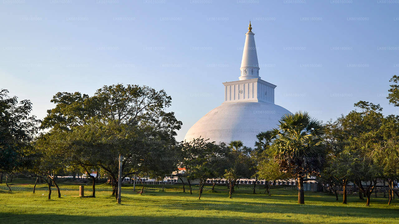
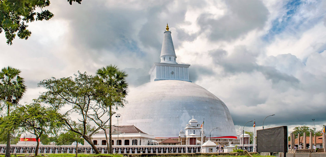
रुवानवेली महा सेया, जिसे महाथुपा (महान थुपा) के नाम से भी जाना जाता है, श्रीलंका के अनुराधापुरा में स्थित एक स्तूप (अवशेषों से युक्त एक अर्धगोलाकार संरचना) है। इस स्तूप में बुद्ध के अवशेषों के दो क्वार्ट या एक डोना रखे हुए हैं, जिससे यह दुनिया भर में उनके अवशेषों का सबसे बड़ा संग्रह बन जाता है। इसका निर्माण सिंहली राजा दुतुगेमुनु ने लगभग 140 ईसा पूर्व में करवाया था, जो चोल राजा एलारा (एल्लालन) की हार के बाद श्रीलंका के राजा बने थे।
-
 थुपरमाया
थुपरमाया, श्रीलंका में महिंदा थेरो (महिंदागमनया) के आगमन के बाद निर्मित पहला बौद्ध मंदिर है। महामेवना पार्क के पवित्र क्षेत्र में स्थित, थुपरमाया स्तूप, द्वीप पर निर्मित सबसे प्राचीन दगोबा है, जिसका निर्माण राजा देवनम्पिया तिस्सा (247-207 ईसा पूर्व) के शासनकाल में हुआ था। इस मंदिर को श्रीलंका सरकार द्वारा एक पुरातात्विक स्थल के रूप में औपचारिक रूप से मान्यता दी गई है।
-
 लोवमहापाया
लोवमहापया, श्रीलंका के प्राचीन शहर अनुराधापुरा में रुवानवेलिसेया और श्री महाबोधिया के बीच स्थित एक इमारत है। इसे पीतल का महल या लोहाप्रसादया भी कहा जाता है क्योंकि इसकी छत काँसे की टाइलों से ढकी हुई थी। प्राचीन काल में, इस इमारत में भोजन कक्ष और उपोसथगर (उपोसथ घर) शामिल थे।
-
 अभयगिरी दगोबा
अभयगिरि विहार, श्रीलंका के अनुराधापुरा में स्थित महायान, थेरवाद और वज्रयान बौद्ध धर्म का एक प्रमुख मठ स्थल था। यह दुनिया के सबसे विशाल खंडहरों में से एक है और देश के सबसे पवित्र बौद्ध तीर्थस्थलों में से एक है।
-
 जेतवनरमैया
जेतवनराम स्तूप या जेतवनरमैया एक स्तूप या बौद्ध अवशेष स्मारक है, जो श्रीलंका के अनुराधापुरा, यूनेस्को विश्व धरोहर शहर में जेतवन मठ के खंडहरों में स्थित है। 122 मीटर (400 फीट) ऊँचा, यह दुनिया का सबसे ऊँचा स्तूप था, और अनुराधापुरा के राजा महासेना (273-301) द्वारा बनवाए जाने के समय यह दुनिया की तीसरी सबसे ऊँची संरचना थी।
-
 मिरिसावेतिया स्तूप
मिरीसावेती स्तूप, श्रीलंका के प्राचीन शहर अनुराधापुर में स्थित एक स्मारक भवन, स्तूप है। राजा दुतुगामुनु (161 ईसा पूर्व से 137 ईसा पूर्व) ने राजा एलारा को पराजित करने के बाद मिरीसावेती स्तूप का निर्माण कराया था। राजदंड में बुद्ध के अवशेषों को रखने के बाद, वे राजदंड छोड़कर तिस्सा वेवा में स्नान के लिए गए थे।
-
 लंकाराम
लंकाराम, श्रीलंका के प्राचीन अनुराधापुर राज्य के गलहेबकाडा नामक प्राचीन स्थान पर राजा वलगम्बा द्वारा निर्मित एक स्तूप है। इस स्तूप के प्राचीन स्वरूप के बारे में कुछ भी ज्ञात नहीं है, और बाद में इसका जीर्णोद्धार किया गया। खंडहरों से पता चलता है कि वहाँ पत्थर के स्तंभों की पंक्तियाँ हैं और इसमें कोई संदेह नहीं है कि स्तूप को ढकने के लिए इसके चारों ओर एक घर (वटदगे) बनाया गया था।
-
 अपनी तरह का इकलौता
इसुरुमुनिया एक बौद्ध मंदिर है जो श्रीलंका के अनुराधापुरा में तिस्सा वेवा (तिसा तालाब) के पास स्थित है। इस विहार में चार विशेष नक्काशी हैं। ये हैं: इसुरुमुनिया प्रेमी, हाथी तालाब और राजपरिवार। प्राचीन मेघगिरि विहार या मेगिरि विहार को वर्तमान में इसुरुमुनि विहार के रूप में जाना जाता है।