Kabaragala mountain

Kabaragala Kabaragala Kabaragala

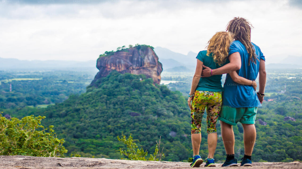
Kabaragala is one of the largest plateaus in the Sabaragamuwa Province of Sri Lanka, located in the Kegalle District. Rising majestically within the Hanthana Mountain Range, it offers breathtaking panoramic views of lush valleys and distant peaks. The area is well known for its biodiversity and cool climate, making it an attractive destination for hikers and nature enthusiasts. With its open grassy plains and mist-covered landscapes, Kabaragala provides a unique contrast to the dense rainforests of the Sinharaja Forest or the steep trails of Adam’s Peak.

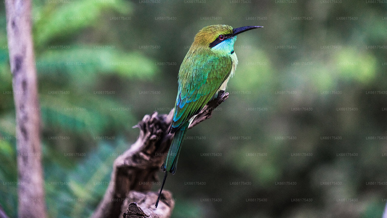
The biodiversity around Kabaragala includes many endemic birds and butterflies, along with tea estates and spice gardens surrounding the region. Visitors often encounter freshwater streams and patches of forest that shelter small mammals and reptiles. The plateau’s unique blend of grasslands and woodland ecosystems makes it a hotspot for both birdwatching and photography. It is also a serene place for meditation and outdoor relaxation.

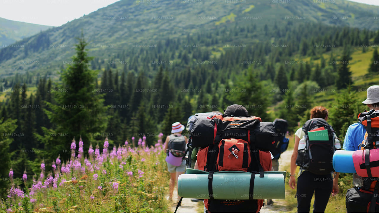
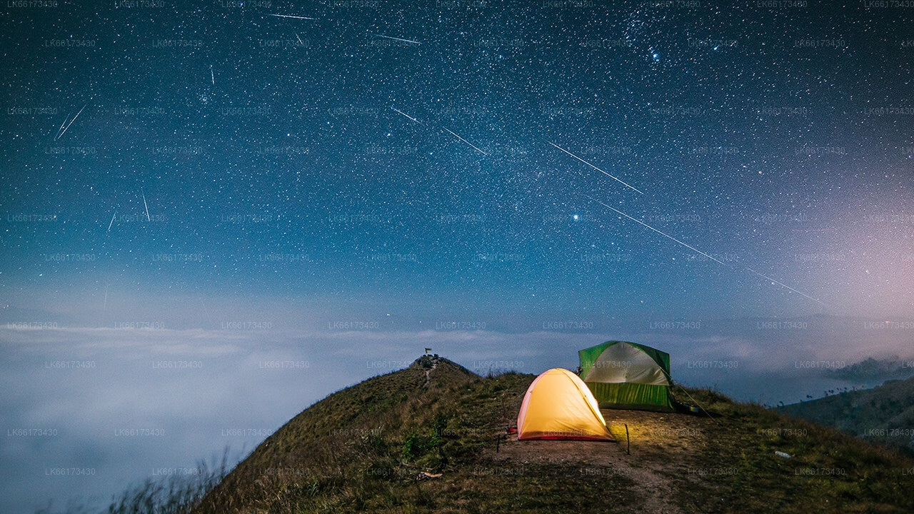
For those seeking adventure, Kabaragala offers rewarding hiking trails suitable for both beginners and experienced trekkers. The wide plateau provides ample space for camping under the stars, with spectacular sunrise and sunset views. Experiences here are often combined with tours of nearby tea estates, villages, and cultural attractions in Kandy or the Kurunegala District, allowing travelers to enjoy both nature and culture within a single journey.

Kabaragala can be visited throughout the year, but the months from January to March and again from July to September are considered the most suitable due to clear weather. Access is usually via roads through Gampaha or the Kegalle District, followed by a moderate hike to the plateau. Travelers from Colombo or other parts of the Western Province often plan day tours or overnight camping trips here. With its sweeping landscapes, biodiversity, and cultural proximity to sites like the Dambulla Cave Temple or the Sigiriya Rock Fortress, Kabaragala remains a highlight for travelers exploring central Sri Lanka.

कैंडी जिले के बारे में

कैंडी जिला श्रीलंका के मध्य प्रांत में स्थित है। श्रीलंका के सात विश्व धरोहर स्थलों में से एक, कैंडी 16वीं शताब्दी में प्राचीन काल के कैंडियन राजाओं का घर था और देश में संगीत, कला, शिल्प और संस्कृति का एक स्रोत था। कोलंबो से लगभग 129 किमी दूर, कैंडी एक पहाड़ी इलाके के बीच बसा है और सभी की निगाहें शहर के केंद्र की ओर खिंची चली जाती हैं, जहाँ कैंडी झील एक आकर्षक विशेषता बनाती है। कैंडी श्रीलंका के लिए बहुत धार्मिक महत्व रखता है, क्योंकि यह इस आकर्षक शहर में है कि दलदा मालिगावा या "दांत का मंदिर" स्थित है, जिसके भीतर भगवान बुद्ध का पवित्र दांत अवशेष अच्छी तरह से संरक्षित है।

पेराडेनिया का रॉयल बॉटनिकल गार्डन, पेराडेनिया शहर के केंद्र से लगभग 5 किमी पश्चिम में स्थित है और इसे देखने हर साल 12 लाख लोग आते हैं। यह द्वीप का सबसे बड़ा बॉटनिकल गार्डन है। उदावत्ता केले (उदावत्ता वन) एक संरक्षित अभयारण्य है जो शहर के मध्य में, टूथ टेम्पल के ठीक उत्तर में स्थित है।

कैंडी एक सिंहली बहुल शहर है; यहाँ मूर और तमिल जैसे अन्य जातीय समूहों के भी बड़े समुदाय रहते हैं। कैंडी, कोलंबो के बाद श्रीलंकाई अर्थव्यवस्था का केंद्र है। कई प्रमुख सहकारी समितियों की कैंडी में बड़ी शाखाएँ हैं और कपड़ा, फ़र्नीचर, सूचना प्रौद्योगिकी और आभूषण जैसे कई उद्योग यहाँ स्थित हैं। शहर में कई कृषि अनुसंधान केंद्र स्थित हैं।

और देश के सभी संगीत, कला, शिल्प और संस्कृति का एक स्रोत। कोलंबो से लगभग 129 किलोमीटर दूर, कैंडी एक पहाड़ी इलाके में बसा है और सभी की नज़रें शहर के केंद्र की ओर खिंची चली जाती हैं, जहाँ कैंडी झील एक मनमोहक विशेषता है। कैंडी श्रीलंका के लिए बहुत धार्मिक महत्व रखता है, क्योंकि इसी आकर्षक शहर में दलदा मालिगावा या दंत मंदिर स्थित है, जिसके भीतर भगवान बुद्ध के पवित्र दंत अवशेष सुरक्षित रूप से रखे गए हैं।

मध्य प्रांत के बारे में

श्रीलंका का मध्य प्रांत मुख्यतः पहाड़ी भूभाग से बना है। प्रांत का क्षेत्रफल 5,674 वर्ग किमी है और इसकी जनसंख्या 2,421,148 है। कुछ प्रमुख शहरों में कैंडी, गमपोला (24,730), नुवारा एलिया और बंदरवेला शामिल हैं। जनसंख्या सिंहली, तमिल और मूरों का मिश्रण है। पहाड़ी राजधानी कैंडी और नुवारा एलिया शहर, दोनों ही मध्य प्रांत के साथ-साथ श्री पाडा में स्थित हैं। यह प्रांत प्रसिद्ध सीलोन चाय का अधिकांश उत्पादन करता है, जिसे अंग्रेजों ने 1860 के दशक में एक विनाशकारी बीमारी के बाद प्रांत के सभी कॉफी बागानों को नष्ट करने के बाद लगाया था। मध्य प्रांत कैंडी, गमपोला, हैटन और नुवारा एलिया जैसे हिल स्टेशन शहरों के साथ कई पर्यटकों को आकर्षित करता है। मंदिर दांत या दलदा मालिगावा मध्य प्रांत का मुख्य पवित्र स्थान है।

यहाँ की जलवायु ठंडी है, और लगभग 1500 मीटर की ऊँचाई वाले कई इलाकों में अक्सर रातें सर्द होती हैं। पश्चिमी ढलान बहुत नम हैं, कुछ स्थानों पर प्रति वर्ष लगभग 7000 मिमी वर्षा होती है। पूर्वी ढलान मध्य-शुष्क क्षेत्र के भाग हैं क्योंकि यहाँ केवल उत्तर-पूर्वी मानसून से ही वर्षा होती है। कैंडी में तापमान 24°C से लेकर नुवारा एलिया में केवल 16°C तक रहता है, जो समुद्र तल से 1,889 मीटर की ऊँचाई पर स्थित है। श्रीलंका के सबसे ऊँचे पर्वत मध्य प्रांत में स्थित हैं। भूभाग अधिकांशतः पहाड़ी है, जिसमें गहरी घाटियाँ हैं। दो मुख्य पर्वतीय क्षेत्र हैं: सेंट्रल मासिफ और कैंडी के पूर्व में नकल्स पर्वतमाला।