Lakpura
Lakpura®

Mannar City

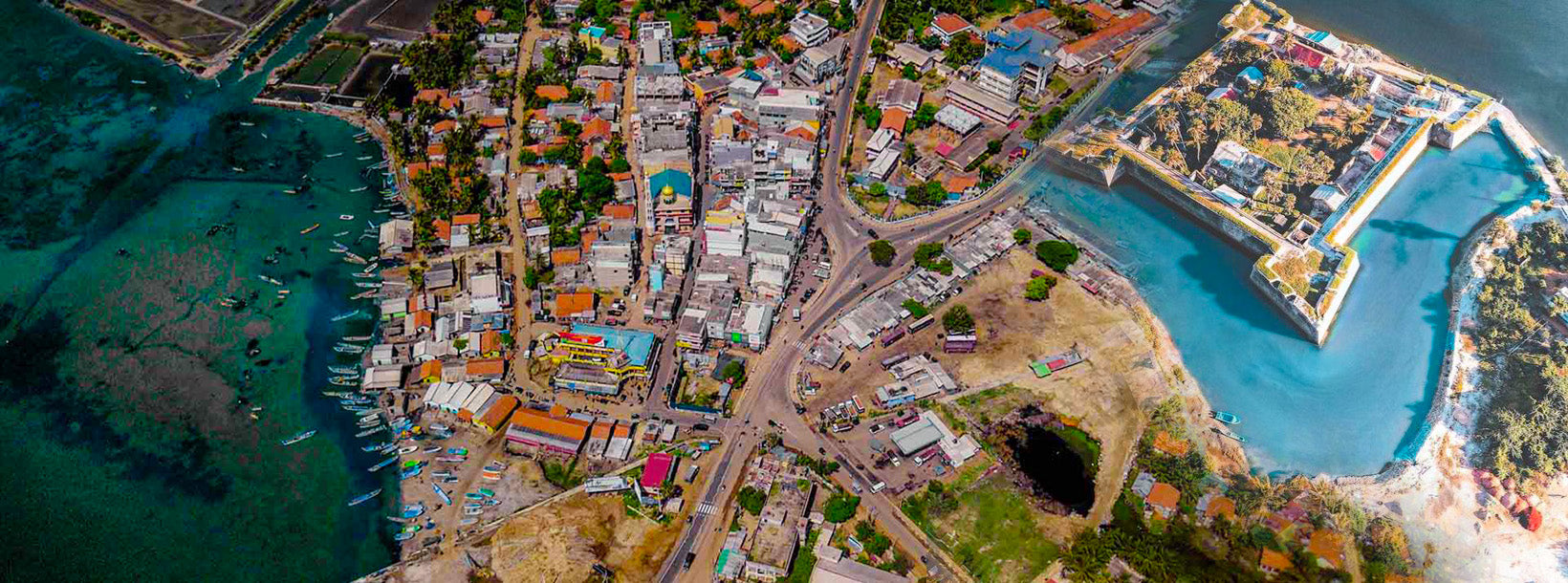
Mannar sits at the far north-western edge of Sri Lanka, roughly 325 km from Colombo, where the mainland thins into a long peninsula that reaches almost close enough to touch the southern tip of India. The district is one of the least-visited corners of the island, and that relative quietness is a large part of its appeal. Dry-zone scrubland, wide lagoons, pearl-white salt flats, and a coastline that has anchored trade routes for more than two millennia give Mannar a character found nowhere else in Sri Lanka.

Where exactly is Mannar, and how do you get there from Colombo?

The standard road route from Colombo runs north on the A9 to Anuradhapura, then north-west on the A14 through Madawachchiya to Mannar town — a journey of around five to six hours depending on traffic. The A14 continues all the way to Talaimannar at the island's tip. A rail line also links Colombo to Madawachchiya, from where buses and tuk-tuks connect to the island, though service frequency is limited. Hiring a private vehicle remains the most practical option for visitors who want to stop at points of interest along the way.

The landscape you pass through is classic Sri Lankan dry zone: sparse thorny forest, occasional paddy fields, and groves of palmyra palms whose silhouettes are almost synonymous with the north. As you approach the coast the scrub gives way to salt marshes and open sky.

What makes Mannar Island unusual?

Despite being called an island, Mannar Island is technically a peninsula — a tongue of land jutting westward from the mainland. A causeway carrying the A14 road crosses the shallow lagoon to reach it, a crossing of around 3 km over waters that are rarely more than a metre deep. The island's westernmost point, Talaimannar, aligns almost exactly with Dhanushkodi on India's Rameswaram peninsula, the two land masses separated only by the shallow reef chain known historically as Adam's Bridge (or Rama's Bridge) that runs through the Palk Strait.

Historically the island went by several names — Manthei, Mathota, Mahathiththa, Mahaputu, and Mawatuthota — reflecting centuries of use by traders, pilgrims, and colonial powers. Arab pearl merchants, Portuguese colonisers, and Dutch administrators all left traces here. The small fishing harbour on the south-eastern shore still supplies much of the district's catch, and the sight of colourful outrigger boats against the pale lagoon is one of Mannar's enduring images.

What is Adam's Bridge, and can you see it?

Adam's Bridge is a chain of limestone shoals and sandbanks stretching roughly 50 km between Talaimannar and Dhanushkodi in India. At its shallowest points the water is only about a metre deep, and the reef is intermittently visible from the shore and from the air. The formation carries enormous religious significance for Hindus, who identify it with the bridge described in the Ramayana epic. It is also of interest to geologists studying the geological and sea-level history of the Indian Ocean region. Visitors can view the reef from Talaimannar beach, particularly at low tide, though there is no public access to walk along it.

What is the Shrine of Our Lady of Madhu?

St. Mary's Church at Madhu — formally known as the Shrine of Our Lady of Madhu — stands around 50 km south-east of Mannar town, reached by turning inland off the A14 at the Madhu Road junction and following the A378 for about 12 km. The Portuguese-style church, rebuilt in the nineteenth century, houses a statue of the Virgin Mary that Catholic tradition dates to 1670, when it was carried to this remote forest location by Catholics fleeing Dutch persecution on the coast.

The site draws hundreds of thousands of pilgrims each year — Catholic, Hindu, and Buddhist alike — making it one of the most visited interdenominational shrines in South Asia. The annual feast, held in August, brings enormous crowds from across Sri Lanka and from the Tamil diaspora internationally. Even outside the feast season the atmosphere at Madhu is quietly devout; the surrounding forest and the scale of the church compound make it feel genuinely set apart from ordinary life.

Why is Madhu also significant for Buddhists and Hindus?

The village and forest around Madhu carry spiritual weight that predates the arrival of Christianity by well over a thousand years. According to historical accounts, the area has been considered sacred since at least the reign of King Gajabahu I (roughly 114–136 CE), who is credited with introducing the Hindu Pattini cult to ancient Lanka. A Pattini Devale — a shrine dedicated to the goddess Pattini Amma — was established in the Mannar region rather than in the then-capital Anuradhapura, a deliberate geographical separation that underlines the site's distinct religious identity.

During the Portuguese period Hindus referred to the shrine as the Amman Kovil, and a nearby tank retains the Tamil name Kovil Kulam (tank of the devale) to this day. Pilgrims continue to visit seeking Pattini Amma's blessing, particularly those seeking healing or the blessing of fertility. A note in the Ceylon Census Report of 1911 observed that the earth of Madhu itself was believed to have medicinal properties — a belief that contributed to the site's reputation long before modern roads made it easily accessible.

What wildlife can you see around Mannar?

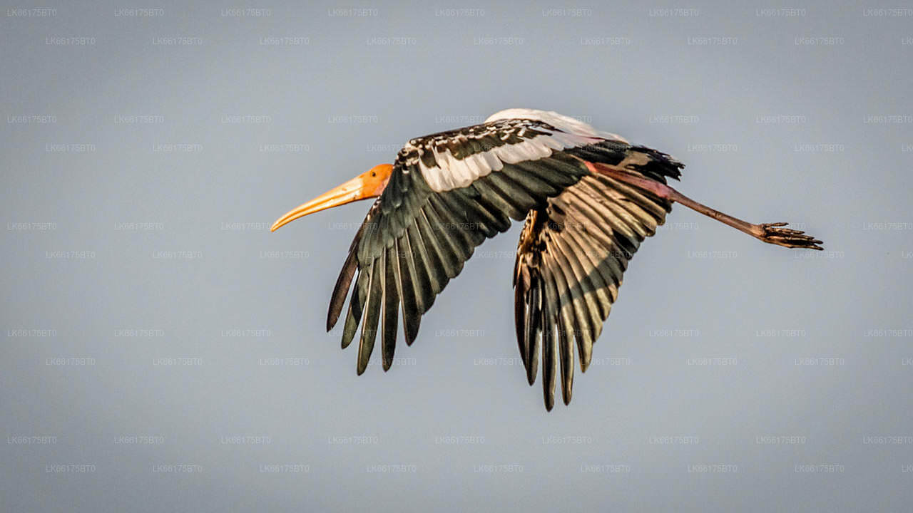
Mannar District sits on one of the main migratory flyways for waterbirds moving between Central Asia and the Indian subcontinent. The lagoons and wetlands around the island host large flocks of flamingos, pelicans, painted storks, and numerous wader species, particularly between October and March. The Giant's Tank, a large ancient reservoir east of Mannar town, is a recognised bird habitat. Spot-billed pelicans breed at several locations in the district, and the area is increasingly visited by serious birdwatchers for its sheer numbers and diversity.

The dry scrub forests of the mainland section of the district also shelter elephants, deer, and smaller mammals, though wildlife sightings are incidental here rather than the result of a structured safari circuit.

What is the best time of year to visit Mannar?

Mannar lies in the dry zone and receives most of its rainfall from the north-east monsoon, which runs roughly from October to January. The most comfortable period for travel is between February and September, when the weather is dry and skies are clear. The August pilgrimage season at Madhu brings heavy traffic to the district's roads, which is worth factoring into plans. Birdwatchers typically aim for the period between November and March, when migratory species are present in the greatest numbers.

Month range Weather Recommended for
February – May Dry, warm General sightseeing, island exploration
November – January Intermittent rain Birdwatching (migratory peak), pilgrimages
August Dry Madhu feast (large crowds expected)

What else is worth seeing in the Mannar District?

  • Mannar Fort: A Dutch-built fortification near the harbour, originally constructed by the Portuguese in the sixteenth century and later expanded. The structure is partially ruined but retains its outer walls and bastions.
  • Baobab tree: A very large and ancient baobab tree near Mannar town, believed to have been introduced by Arab traders centuries ago. Baobabs are not native to South Asia, making this specimen a living artefact of the Indian Ocean trade network.
  • Thiruketheeswaram Temple: One of the Pancha Ishwarams — the five ancient Shiva temples of Sri Lanka — located around 5 km north of Mannar town. The site has been an important Hindu pilgrimage destination for well over a thousand years.
  • Wilpattu National Park: Sri Lanka's largest national park lies to the south-east of Mannar district and is accessible via Puttalam. Leopard sightings are relatively frequent here compared with other parks, and the park's characteristic villus — natural lakes fed by rain — give it a distinctive landscape.
Ask Lakpura® Agent