On the small island of Kayts, roughly 15 kilometres west of Jaffna town, a crumbling horseshoe of coral-and-lime masonry stands at the water's edge as one of the least-visited Portuguese military landmarks in Sri Lanka. Known formally as the Kayits Dupath Balakotuwa, and historically as Urundai Fort or Fort at the Elephants Quay, the structure distils four centuries of colonial contest — Portuguese, Dutch, and British — into a quietly atmospheric ruin.
What is the history of Kayts Fort?
The Portuguese erected the fort in 1629 as part of a chain of defensive positions protecting the Jaffna Peninsula. Its location was deliberate: the adjacent harbour, called Urundai (Tamil for "round" or "sphere-shaped"), was one of the region's principal commercial anchorages. Antonio Bocarro, chronicler-general of the Portuguese State of India, recorded the structure in 1635, describing it as comparable in scale to Mannar Fort but superior in form.
Bocarro's account notes that the seaward face was a breastwork 35 metres long and 5.5 metres wide, raised on wooden beams rather than solid fill, with twelve open embrasures at roughly 2.5 metres above ground level. The fort's garrison comprised a captain and around 40 soldiers, supported by eight artillery pieces — three 8-pounders, three 6-pounders, and two 5-pounders.
The Portuguese abandoned the fort in 1651. When the Dutch took control of Jaffna in 1658, their commander received a message of surrender from the Portuguese garrison, as recorded by Dutch pastor Baldaeus in his 1672 memoir. The Dutch, however, made no meaningful attempt to restore the structure — likely because the nearby Hammenhiel Fort, situated on a small islet to the south-west, served their defensive needs more efficiently.
Why is Kayts called "Kayts"?
The etymology of the name traces back to the island's ancient role as an elephant-export hub. Known in antiquity as Urathota (or Uruthota), the port appears in the Nagadeepa Tamil inscription as a key anchorage during the reign of King Parakramabahu I (1153–1186 CE), who gave particular attention to vessels carrying horses and elephants. Sri Lankan elephants were regularly shipped to India through this harbour, prompting the Portuguese to call it Caes dos Elefantes — "Elephant's Quay" or "Elephant's Mouth".
Over time, Caes dos Elefantes was shortened to Cais, which the Dutch rendered as Kays, and which eventually settled into the anglicised spelling "Kayts". The fort's alternative name, Urundai Fort, simply reflects the Tamil name of the adjoining anchorage.
What does Kayts Fort look like today?
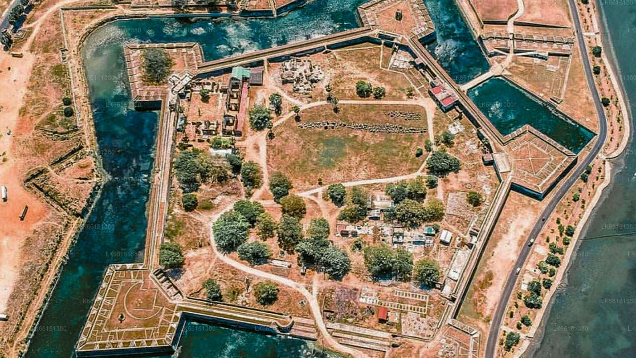
A visitor writing to the Colombo Journal in 1832 under the pen name "Penn" found the fort already in a state of ruin, referring to it as "Erie Fort" and recording a structure roughly 130 feet long with four cylindrical walls. A more systematic study by British author J. Pearson in 1926 clarified the plan: the fort is horseshoe-shaped rather than square, with two bastions facing the sea and the open curve of the horseshoe facing inland to the south.
Pearson's measurements place the fort at approximately 274 feet along the northern wall connecting the two bastions and 206 feet at its widest. The outer wall retains much of its original thickness, though vegetation and coastal erosion have taken a significant toll since the early twentieth century. Today, visitors can walk the perimeter, identify the outlines of the two sea-facing bastions, and observe the rough coral-block masonry that characterises Portuguese military construction in the Jaffna region.
How does Kayts Fort compare with other Portuguese forts in Jaffna?
The Portuguese built several defensive positions across the Jaffna Peninsula during the seventeenth century, each occupying a strategically important coastal or island location. Kayts Fort was notably different from the main Jaffna Fort in one key respect: it was never substantially upgraded by the Dutch, who invested heavily in Jaffna Fort and Hammenhiel Fort after expelling the Portuguese. This means Kayts retains a rawer, more fragmentary character — closer to original Portuguese construction — while Jaffna Fort bears the heavy imprint of Dutch and later British engineering.
| Feature | Kayts Fort | Jaffna Fort | Hammenhiel Fort |
|---|---|---|---|
| Built by | Portuguese (1629) | Portuguese (1618) | Portuguese, expanded by Dutch |
| Plan | Horseshoe, 4 bastions | Pentagonal | Rectangular, island site |
| Dutch restoration | None | Extensive | Moderate |
| Current condition | Partial ruin | Largely intact | Partly intact |
What is the significance of the Urundai harbour?
Long before the Portuguese arrived, the anchorage beside the fort was one of the most active ports in northern Sri Lanka. The Nagadeepa Tamil inscription confirms that Urathota was a designated port for Indian merchant ships during the reign of Parakramabahu I, underscoring an unbroken maritime tradition stretching back at least to the twelfth century. Horses — brought in from India for military use — and elephants exported outward were the principal cargoes, making this small island a node in a wider Indian Ocean trade network.
By the time the Portuguese arrived in the sixteenth century, the harbour was already well-established enough to be worth fortifying. The commercial port retained some activity even after the fort fell into disuse, though Kayts island today is a quiet fishing community rather than a trading hub.
How do I get to Kayts Fort from Jaffna?
Kayts island is connected to the Jaffna Peninsula by a causeway, making it accessible by road from Jaffna town in around 30 to 40 minutes under normal traffic conditions. From Jaffna, take the A32 road westward through Chavakachcheri and continue toward Kayts via the causeway over Kayts Lagoon. The fort sits on the northern shore of the island, close to the waterfront. A hired car or tuk-tuk from Jaffna is the most practical option, as public transport connections to the far end of the island can be infrequent. The journey across the causeway offers views of the lagoon and the flat, palm-fringed landscape that characterises this part of the Northern Province.
What should I know before visiting?
- There are no formal facilities — no ticketing booth, no visitor centre, and no on-site signage in English. Come prepared with water and sun protection.
- The ruins stand in an open coastal setting; the ground can be uneven and sections of wall are unstable. Exercise caution, particularly near the seaward face.
- The site is rarely crowded, which makes it appealing for travellers who prefer unmediated encounters with historical ruins.
- Kayts is also worth visiting for its fishing harbour atmosphere, the small Catholic church on the island, and the views across the lagoon toward Hammenhiel.
- The best light for photography is in the late afternoon, when low sun catches the textured coral-block walls.
Is Kayts Fort protected as a heritage site?
Kayts Fort is listed as an archaeological monument under Sri Lanka's Antiquities Ordinance, administered by the Central Cultural Fund and the Department of Archaeology. This designation formally prohibits excavation, alteration, or removal of material from the site, though active conservation work at the fort has historically been limited. The broader context of Portuguese-period fortifications in the Jaffna Peninsula has attracted increasing scholarly attention in recent years, and there are periodic calls for more systematic documentation and stabilisation of the remaining walls.