Stretching across the eastern coastline of Sri Lanka, Batticaloa Lagoon is one of the country's most ecologically rich and culturally layered coastal waterways. Enclosed by narrow barrier islands, mangrove forests, and traditional fishing villages, the lagoon forms a vast sheltered basin where the pace of life moves with the tide. For travellers venturing to the Eastern Province, it offers something genuinely rare: a living lagoon landscape where nature, history, and local culture occupy the same quiet frame.
What is the legend of the singing fish at Batticaloa?
Batticaloa is widely known as the "Land of the Singing Fish" — a title rooted in a well-documented local phenomenon. On calm nights, particularly around the full moon, residents and visitors have long reported hearing a faint musical humming rising from the lagoon's depths. The sound is attributed to certain species of fish producing vibrations, though the precise mechanism remains a subject of scientific curiosity. Holding a paddle or oar beneath the surface is said to amplify the effect.
The phenomenon has been noted by colonial-era writers and continues to draw researchers and curious travellers alike. Whether or not you witness it firsthand, the legend gives Batticaloa Lagoon an identity that few coastal destinations in Sri Lanka can claim.
What wildlife and ecosystems does the lagoon support?
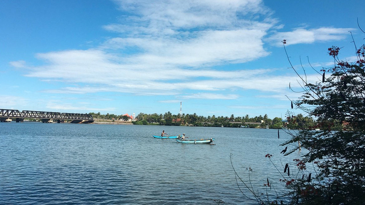
The lagoon system covers a substantial area and supports a diverse range of habitats. Dense mangrove corridors line much of the shoreline, providing nursery grounds for fish and shelter for water birds. Wading species — including egrets, herons, and kingfishers — are commonly sighted along the banks, particularly in the early morning. The lagoon also supports traditional small-scale fisheries, with communities depending on cast nets, basket traps, and catamaran-based fishing methods passed down across generations.
The surrounding wetlands connect to coconut groves and scrub vegetation that form an important buffer between the lagoon and the open sea. This layered ecosystem makes the area of interest not only to casual visitors but also to birdwatchers and those with an interest in coastal ecology. Visitors who have explored Madu Ganga on the southwest coast will recognise the mangrove character here, though Batticaloa's lagoon is considerably larger and set within a very different cultural context.
What can you do at Batticaloa Lagoon?
The lagoon rewards a slower kind of travel. Activities centre on the water and the shoreline rather than structured tourist infrastructure, which is part of the appeal.
- Boat rides and catamaran tours: Local fishermen offer informal boat tours across the lagoon, passing small islands and active fishing grounds. These are best arranged through guesthouses in Batticaloa town or via a local guide.
- Birdwatching: The mangrove edges and shallow mudflats attract a range of resident and migratory species. Early morning is the most productive time.
- Kayaking: The calm, sheltered waters make the lagoon well-suited to kayaking. This gives independent access to quieter channels and mangrove inlets that larger boats cannot reach.
- Photography: The low light of dawn and dusk transforms the lagoon into a striking subject — silhouetted catamarans, reflective water, and distant coconut palms create a distinctly eastern Sri Lankan composition.
- Exploring Kallady Bridge: The long causeway crossing near Kallady offers one of the best vantage points over the lagoon, with views across to Batticaloa Fort and the open sea beyond.
What is the Batticaloa Dutch Fort, and how does it connect to the lagoon?
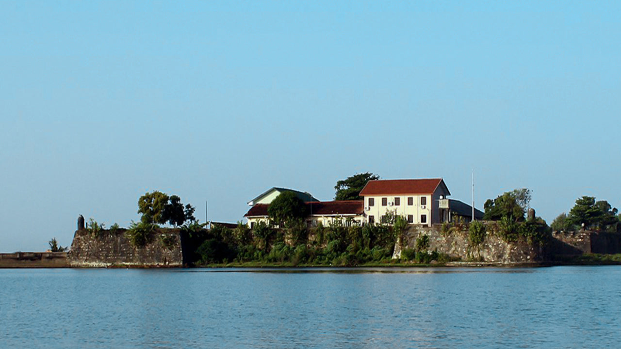
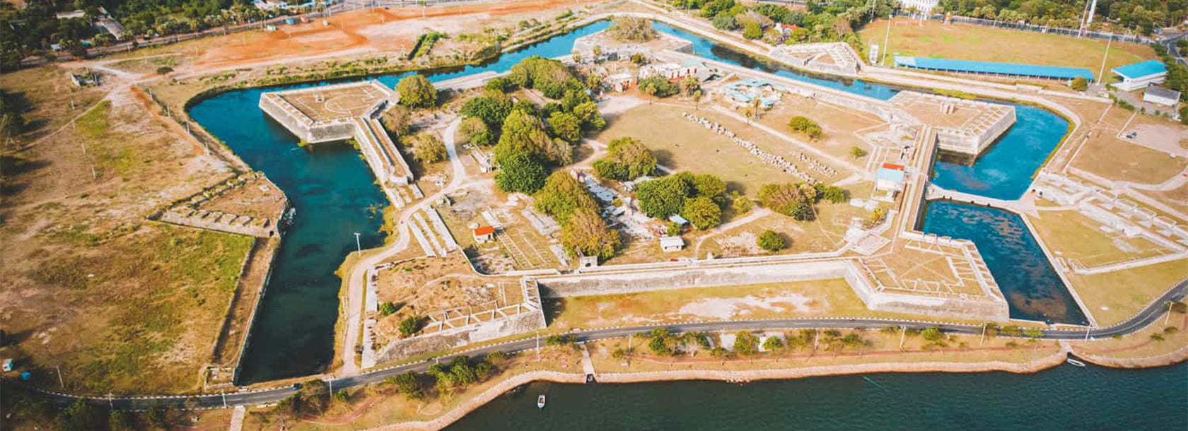
Sitting on a small island surrounded by the lagoon on three sides and the sea on the fourth, Batticaloa Fort is one of the oldest colonial structures in Sri Lanka's Eastern Province. Originally built by the Portuguese in the early 17th century and later expanded by the Dutch, the fort is a tangible reminder of the island's layered colonial past. The view from the fort across the lagoon — particularly at dusk — underlines how strategically and aesthetically significant this location was to those who chose to build here.
The fort currently houses government offices and is accessible to visitors. Combining a walk through the fort with a lagoon boat ride creates a coherent half-day itinerary that takes in both the built and natural heritage of Batticaloa.
When is the best time to visit Batticaloa Lagoon?
The Eastern Province operates on a different monsoon cycle from the west and south coasts. The dry season in this region runs roughly from April through to September, when the Inter-Tropical Convergence Zone brings clear skies and calm seas to the east while the west coast experiences its wetter months. This period offers the most reliable conditions for lagoon activities — flat water, good visibility, and minimal disruption from rain.
The northeast monsoon, which affects the region between October and January, brings heavier rainfall and can make boat travel less comfortable, though the lagoon itself remains accessible. Avoid planning water-based activities during peak storm periods in November and December without checking local conditions first.
How do you get to Batticaloa Lagoon from Colombo?
Batticaloa is located on the east coast, roughly 310 kilometres from Colombo by road. The most common overland route follows the A11 highway via Kandy and Mahiyanganaya, passing through the hill country before descending to the eastern plains — a journey of around six to seven hours depending on traffic and road conditions. An alternative route via Polonnaruwa is slightly more direct and allows a stop at the ancient city ruins en route.
InterCity Express trains connect Colombo Fort station to Batticaloa, with a journey time of approximately eight to nine hours. The train route cuts across the dry zone and offers views of the Cultural Triangle's plains, reservoirs, and scrub jungle. There is also a domestic air connection between Ratmalana Airport in Colombo and Batticaloa Airport, which cuts travel time significantly for those with limited time.
| Mode | Route | Approx. Duration |
|---|---|---|
| Private vehicle | Colombo – Kandy – Mahiyanganaya – Batticaloa | 6–7 hours |
| Train | Colombo Fort – Batticaloa (InterCity Express) | 8–9 hours |
| Domestic flight | Ratmalana (RML) – Batticaloa (BTC) | Around 1 hour |
What else can you visit near Batticaloa Lagoon?
Batticaloa's surrounding district holds several worthwhile stops that complement a lagoon visit.
- Pasikuda Beach: One of the east coast's most sheltered beaches, around 35 kilometres north of Batticaloa town, with exceptionally calm, shallow water.
- Kalkudah Beach: Adjacent to Pasikuda, and similarly calm, with a quieter atmosphere and fewer resort developments.
- Batticaloa Lighthouse: Located near the lagoon's southern end, the lighthouse is a modest but photogenic colonial-era structure.
- Pigeon Island: Further north near Nilaveli, this national park is one of Sri Lanka's best snorkelling sites and a feasible addition for those touring the east coast.
- Arugam Bay: For travellers continuing south, this well-known surf destination is around two hours from Batticaloa and anchors the southern end of an eastern coast circuit.
Where should you stay when visiting Batticaloa Lagoon?
Accommodation options in Batticaloa range from simple guesthouses in the town centre to more comfortable resort properties on the lagoon's edge. Staying on or near the water means early morning boat access without the need for additional transfers. Pasikuda, slightly further north, offers a wider range of resort accommodation for those who prefer a beach base from which to day-trip to the lagoon.
Local restaurants in Batticaloa town serve eastern Sri Lankan cuisine — expect rice and curry with a coastal emphasis: fresh fish, crab, prawn, and the characteristically spicier, coconut-rich style of the east. Street-side kadés near the waterfront are a reliable option for a quick meal after a morning on the water.