Centralprovinsen
-
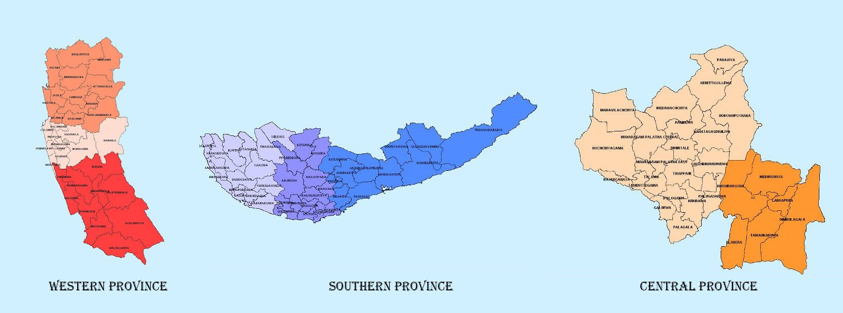
 Västra provinsen
Sri Lankas mest tätbefolkade provins, Western Province, som är 3 593 km2 stor, är hemvist för landets lagstiftande huvudstad Sri Jayewardenepura. Här ligger också landets kommersiella centrum, Colombo.
-
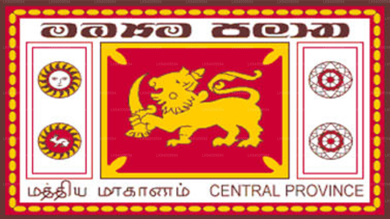 Centrala provinsen
Centralprovinsen ligger i Sri Lankas centrala berg och består av tre administrativa distrikt: Kandy, Matale och Nuwara-Eliya. Provinsens landyta är 5 575 km2, vilket motsvarar 8,6 % av Sri Lankas totala landyta.
-
 Södra provinsen
Sri Lankas södra provins är ett litet geografiskt område som består av tre distrikt: Galle, Matara och Hambantota. Jordbruk och fiske är de viktigaste inkomstkällorna för den stora majoriteten av människorna i denna region.
-
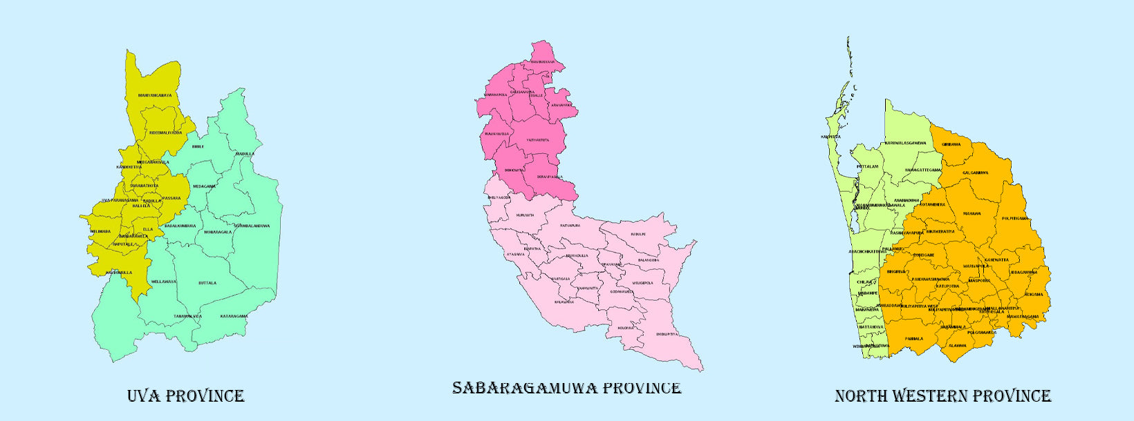
 Uva-provinsen
Uva-provinsen består av två distrikt: Badulla och Moneragala, medan provinsens huvudstad är Badulla. Uva gränsar till provinserna östra, södra och centrala.
-
 Sabaragamuwa-provinsen
Sabaragamuwa är ännu en provins i Sri Lanka, belägen i den södra centrala delen av ön och består av två administrativa distrikt: Ratnapura och Kegalle.
-
 Nordvästra provinsen
Nordvästra provinsen består av två administrativa distrikt, Kurunegala och Puttalam. Provinshuvudstaden är Kurunegala som har en befolkning på 28 571. Provinsen är välkänd för sina kokosnötsplantager.
-
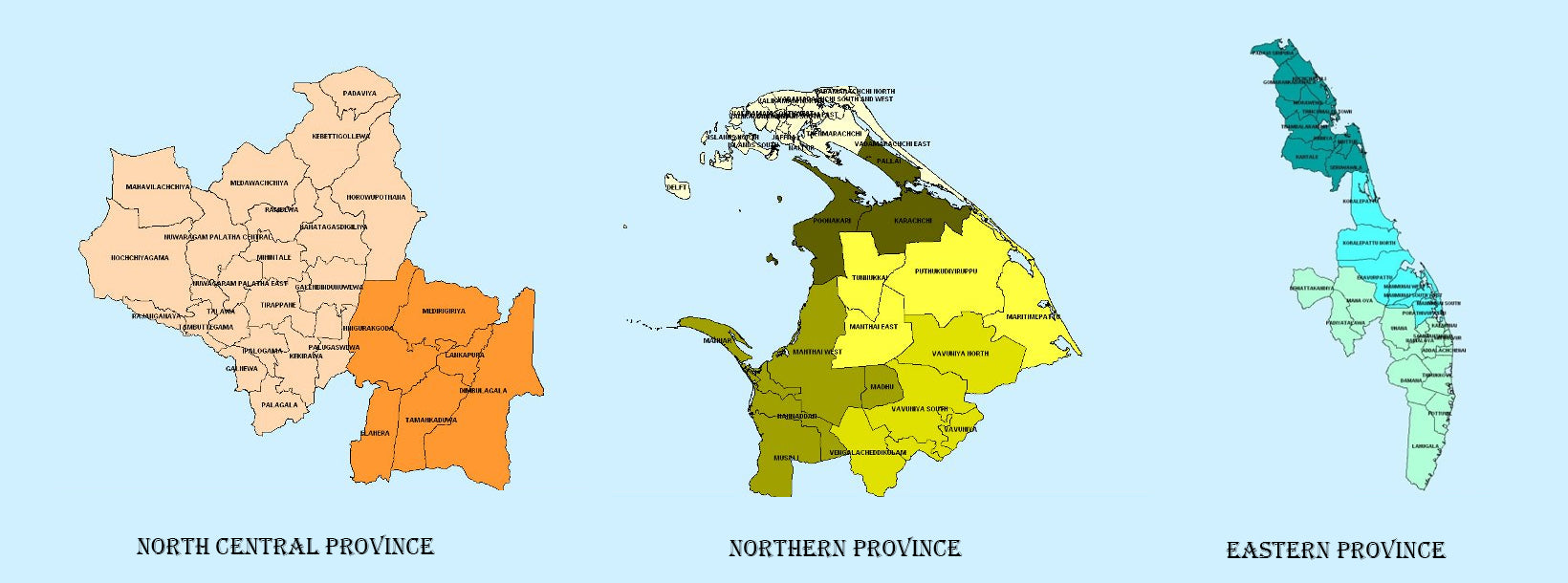
 North Central Province
Sri Lankas största provins, belägen i den torra zonen med en yta på 10 714 km2, är den norra centrala provinsen som består av två administrativa distrikt, nämligen Anuradhapura och Polonnaruwa.
-
 Norra provinsen
Norra provinsen ligger i norra Sri Lanka, bara 35 km från Indien. Den har en landyta på 8 884 km². Provinsen är omgiven av Mannarbukten och Palkbukten i väster, Palksundet i nordväst, Bengaliska viken i norr och öster samt de östra, norra centrala och nordvästra provinserna i söder.
-
 Östra provinsen
En annan provins i Sri Lanka som är mest känd för sina gyllene stränder och den naturliga hamnen, är den östra provinsen, som är 9 996 km2 stor och består av tre administrativa distrikt, nämligen Trincomalee, Batticaloa och Ampara.