
Monaragala is the largest town in Monaragala District, set in the southern reaches of Uva Province at around 151 metres above sea level. It sits on the Colombo–Batticaloa main road, roughly 57 kilometres southeast of Badulla, and serves as the natural base for exploring one of Sri Lanka's least-visited yet most rewarding regions. Dry-zone forest, ancient rock temples, vast reservoirs, and the edges of Yala and Gal Oya national parks all lie within reach.
What is Monaragala known for?
The town occupies a strategic crossroads between the wet highlands of the central mountains and the arid lowland plains that stretch toward the east coast. Historically part of the Wellassa region — a name meaning "one hundred thousand paddies" — Monaragala District retains a rural, unhurried character that contrasts sharply with the more heavily visited hill country to its north.
For travellers, the district's chief draw is its concentration of early medieval Buddhist heritage, particularly the monumental rock-carved statues at Maligawila and Buduruwagala, both reachable as day trips from the town.
What is the Maligawila Buddha Statue?
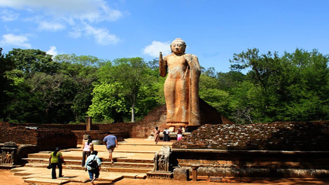
The Maligawila Buddha is the tallest free-standing ancient Buddha statue in Sri Lanka, carved from a single large limestone rock during the 7th century. Tradition attributes the work to a prince named Aggabodhi, and the statue depicts the Buddha in a standing posture on a lotus pedestal. When archaeologists first documented the site in 1951, the statue had collapsed and broken into several pieces; a careful restoration project in the late 20th century returned it to its upright form.
The site sits in a quiet forested clearing roughly 16 kilometres from Monaragala town, and a second statue — a seated Bodhisattva figure — stands nearby. The surrounding ruins of a monastic complex suggest this was once a significant centre of religious activity during the Anuradhapura and early Polonnaruwa periods.
What can I see at Buduruwagala?
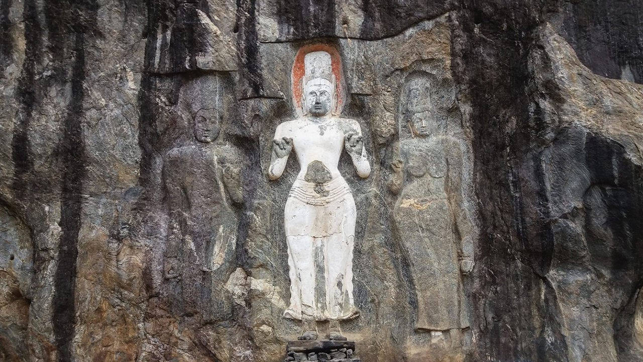
Buduruwagala, whose name translates loosely as "rock of Buddhist sculptures", is a rock-face sanctuary carved during the 9th to 10th centuries and associated with the Mahayana school of Buddhism — an unusual distinction in predominantly Theravada Sri Lanka. Seven large figures are hewn directly into a granite outcrop, arranged in two groups facing each other across a narrow clearing.
The central and largest figure is a standing Buddha that still retains traces of its original stucco robe, and a faint vertical streak of ochre paint suggests the image was once brightly coloured. To the Buddha's right stands a Bodhisattva identified as Avalokitesvara, flanked by a female consort figure rendered in the graceful thrice-bent posture characteristic of Mahayana iconography — believed to represent Tara. The group to the left includes a seated meditating figure and a rare image of Maitreya, the future Buddha.
The site is active as a place of worship, so visitors are expected to remove shoes and dress modestly before approaching the carvings. The forest path from the car park to the rock face takes around ten minutes on foot.
Which national parks are near Monaragala?
Monaragala District borders two of Sri Lanka's most significant protected areas, making it a practical base for wildlife-focused itineraries.
- Yala National Park — Sri Lanka's most celebrated wildlife reserve lies partly within Monaragala District, with the park's eastern sectors among the least visited and most rewarding for those seeking solitude. The park is best known for its high density of leopards, as well as elephants, sloth bears, crocodiles, and a wide range of waterbirds.
- Gal Oya National Park — spanning parts of Monaragala and Ampara districts, Gal Oya is built around the vast Senanayake Samudraya reservoir, the largest inland body of water in Sri Lanka. Boat safaris on the reservoir offer the unusual spectacle of elephants swimming between islands, and the park receives a fraction of the visitor numbers that Yala attracts.
Both parks operate seasonal access schedules and require entry through designated gates; conditions vary significantly between the dry season (roughly May to September in this zone) and the wetter months.
What rivers and waterways run through Monaragala District?
The district is drained by several rivers that are important both ecologically and historically. The Menik Ganga, which flows through the southern portion of the district toward the sea at Hambantota, passes close to Kataragama and is one of the most sacred rivers in Sri Lanka for Hindu and Buddhist pilgrims. The Gal Oya, Heda Oya, Wila Oya, and Kumbukkan Oya also rise or flow through the district, sustaining the dry-zone forests and filling the large irrigation tanks that punctuate the landscape.
How do I get to Monaragala from Colombo?
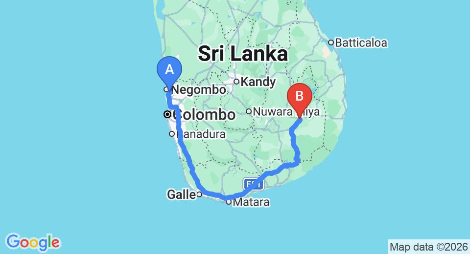
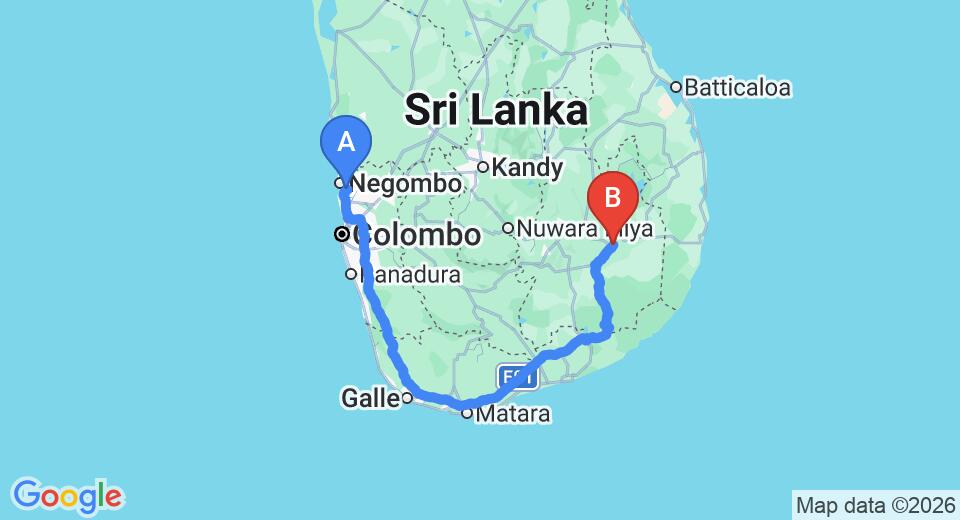
Monaragala is approximately 230 kilometres from Colombo by road. The most direct route follows the Southern Expressway to Hambantota and then the A2 and A4 highways northeast, typically taking around four to five hours depending on conditions. An alternative route runs via Ratnapura and Wellawaya through the hill country, which is slower but passes through striking mountain scenery.
Intercity bus services operate from Colombo's Bastian Mawatha bus station. No train line currently connects Colombo directly to Monaragala, though trains run as far as Badulla; from there, onward road transport covers the remaining distance.
When is the best time to visit Monaragala?
Monaragala lies in Sri Lanka's dry zone, meaning it receives less rainfall than the hill country or the south coast. The driest and most comfortable period for travel is typically from May to September, which coincides with the best conditions for safari drives in Yala and Gal Oya. The region can be hot during midday hours throughout the year, so morning and late-afternoon activities are advisable. The northeast monsoon brings some rain between October and January but rarely disrupts travel significantly.
What is Uva Province and how does Monaragala fit into it?
Uva Province comprises two administrative districts — Badulla in the north and Monaragala in the south — and was formally constituted in 1896 during the British colonial period. The provincial capital, Badulla, sits in the cooler highlands, while Monaragala occupies the warmer, drier lowland terrain. Together the two districts form one of Sri Lanka's least densely populated provinces, a fact that contributes to the preserved character of its forests and archaeological sites.
Major natural landmarks within the province include Dunhinda Falls, Diyaluma Falls, and Rawana Falls in the Badulla District, as well as the Mahaweli and Menik river systems and the Maduru Oya and Senanayake Samudraya reservoirs. Travellers combining a hill-country itinerary with a wildlife leg often route through Monaragala as a natural transition point between the two landscapes.